
CONQUEST MB1
Other Type
Current Position
| Longitude | 35.49135° |
|---|---|
| Latitude | 33.81888° |
| Status | Moored |
| Speed | 15.9 Knots |
| Course | 37° |
| Area | Mediterranean Sea - Eastern Basin |
| Station | T-AIS |
| Position Received | 1 m ago |
Info
Information
The current position of CONQUEST MB1 is in Mediterranean Sea - Eastern Basin with coordinates 33.81888° / 35.49135° as reported on 2024-06-01 23:59 by AIS to our vessel tracker app. The vessel's current speed is 15.9 Knots
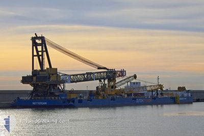
The vessel CONQUEST MB1 (MMSI: 244810178) is a Other Type It's sailing under the flag of [NL] Netherlands.
In this page you can find informations about the vessels current position, last detected port calls, and current voyage information. If the vessels is not in coverage by AIS you will find the latest position.
The current position of CONQUEST MB1 is detected by our AIS receivers and we are not responsible for the reliability of the data. The last position was recorded while the vessel was in Coverage by the Ais receivers of our vessel tracking app.
The current draught of CONQUEST MB1 as reported by AIS is 4.1 meters
Weather
| Temperature | 21.8°C / 71.24°F |
|---|---|
| Wind Speed | 6 knots |
| Direction | 21° NNE |
| Pressure | 1015.3 hPa |
| Humidity | 62.8 % |
| Cloud Coverage | --- |
Featured Company
Last Port Calls
| Port | Arrival | Departure | Time In Port |
|---|---|---|---|
| 2024-06-01 12:26 | |||
| 2024-06-01 02:34 | 2024-06-01 12:18 | 9 h | |
| 2024-05-31 18:57 | |||
| 2024-05-31 06:08 | 2024-05-31 18:54 | 12 h | |
| 2024-05-31 05:39 | 2024-05-31 05:40 | 0 m | |
| 2024-05-29 23:59 | 2024-05-31 05:39 | 1 d | |
| 2024-05-29 20:14 | 2024-05-29 23:59 | 3 h | |
| 2024-05-29 14:54 | 2024-05-29 15:04 | 9 m | |
| 2024-05-27 21:46 | 2024-05-29 14:44 | 1 d | |
| 2024-05-27 19:01 | 2024-05-27 21:27 | 2 h |
Most Visited Ports (Last year)
| Port | Arrivals | |
|---|---|---|
| 133 |
Last Trips
| Origin | Departure | Destination | Arrival | Distance | |
|---|---|---|---|---|---|
| 2024-06-01 15:18 | 2024-06-01 15:26 | 5.37 nm | |||
| 2024-06-01 15:18 | 2024-06-01 05:34 | 5.37 nm | |||
| 2024-05-31 21:54 | 2024-05-31 21:57 | 0.40 nm | |||
| 2024-05-31 08:40 | 2024-05-31 09:08 | 5.11 nm | |||
| 2024-05-31 08:40 | 2024-05-31 08:39 | 5.11 nm | |||
| 2024-05-30 02:59 | 2024-05-30 02:59 | 1.23 nm | |||
| 2024-05-29 18:04 | 2024-05-29 23:14 | 3.17 nm | |||
| 2024-05-29 17:44 | 2024-05-29 17:54 | 1.59 nm | |||
| 2024-05-28 00:27 | 2024-05-28 00:46 | 0.21 nm | |||
| 2024-05-27 21:59 | 2024-05-27 22:01 | 0.25 nm |
Events
| Time | Event | Details | Position / Dest | Info |
|---|---|---|---|---|
| 2024-06-01 23:56 | START Moving | 6.15 nm, South of BEIRUT |
33.81778 / 35.49187
LIMASSOL
|
Speed: 94.9 kn Course: 119° |
| 2024-06-01 23:55 | STOP Moving | 6.41 nm, South of BEIRUT |
33.81327 / 35.49153
LIMASSOL
|
Speed: Course: 511° |
| 2024-06-01 23:52 | START Moving | 6.25 nm, South of BEIRUT |
33.81640 / 35.49037
LIMASSOL
|
Speed: 38 kn Course: 189° |
| 2024-06-01 21:37 | STOP Moving | 6.14 nm, South of BEIRUT |
33.81828 / 35.49078
LIMASSOL
|
Speed: Course: 511° |
| 2024-06-01 21:34 | Change Sea Area | Lebanese part of the Mediterranean Sea - Eastern Basin Cypriote part of the Mediterranean Sea - Eastern Basin |
33.79287 / 35.47208
Mediterranean Sea - Eastern Basin
|
Speed: 44.2 kn Course: 31.5° |
| 2024-06-01 21:34 | START Moving | 7.9 nm, South West of BEIRUT |
33.79287 / 35.47208
LIMASSOL
|
Speed: 44.2 kn Course: 31.5° |
| 2024-06-01 20:02 | STOP Moving | 6.14 nm, South of BEIRUT |
33.81828 / 35.49082
LIMASSOL
|
Speed: 0.3 kn Course: 511° |
| 2024-06-01 20:02 | IN Coverage |
33.81817 / 35.49067
Mediterranean Sea - Eastern Basin
|
Speed: Course: 342° |
|
| 2024-06-01 18:53 | OUT of Coverage |
33.81827 / 35.49078
Mediterranean Sea - Eastern Basin
|
Speed: Course: 19° |
|
| 2024-06-01 16:53 | IN Coverage |
33.81860 / 35.49068
Mediterranean Sea - Eastern Basin
|
Speed: 7.1 kn Course: 346° |