
CONSTELLATION
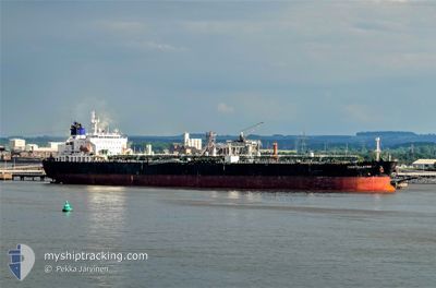
Crude Oil Tanker
Current Trip
| Time Travelled | 4 days |
|---|---|
| Remaining Time | 2 days |
| Distance Travelled | 435.97 nm |
| Remaining Distance | 891.62 nm |
| AVG Speed | 9.4 Knots |
| MAX Speed | 14.8 Knots |
| AVG Wind | 9.1 knots |
| MAX Wind | 18.9 knots |
| MIN Temp | 27.3°C / 81.14°F |
| MAX Temp | 29.3°C / 84.74°F |
| Draught | 8.8 m |
| Position Received | 7 h, 12 m ago |
Current Position
| Longitude | -79.95103° |
|---|---|
| Latitude | 24.57845° |
| Status | Under way using engine |
| Speed | 12.7 Knots |
| Course | 239° |
| Area | North Atlantic Ocean |
| Station | T-AIS |
| Position Received | 7 h, 12 m ago |
Info
Information
The current position of CONSTELLATION is in North Atlantic Ocean with coordinates 24.57845° / -79.95103° as reported on 2024-06-01 03:25 by AIS to our vessel tracker app. The vessel's current speed is 12.7 Knots and is heading at the port of HOUSTON. The estimated time of arrival as calculated by vessel tracking app is 2024-06-04 06:23 LT
The vessel CONSTELLATION (IMO: 9308091, MMSI: 538002090) is a Crude Oil Tanker that was built in 2006 ( 18 years old ). It's sailing under the flag of [MH] Marshall Is.
In this page you can find informations about the vessels current position, last detected port calls, and current voyage information. If the vessels is not in coverage by AIS you will find the latest position.
The current position of CONSTELLATION is detected by our AIS receivers and we are not responsible for the reliability of the data. The last position was recorded while the vessel was in Coverage by the Ais receivers of our vessel tracking app.
The current draught of CONSTELLATION as reported by AIS is 8.8 meters
Weather
| Temperature | 28.2°C / 82.76°F |
|---|---|
| Wind Speed | 17 knots |
| Direction | 81° E |
| Pressure | 1015.7 hPa |
| Humidity | 67 % |
| Cloud Coverage | 2 % |
Featured Company
Last Port Calls
| Port | Arrival | Departure | Time In Port |
|---|---|---|---|
| 2024-05-26 16:55 | 2024-05-27 23:08 | 1 d | |
| 2024-05-15 16:26 | 2024-05-21 16:46 | 6 d | |
| 2024-04-30 21:25 | 2024-05-03 01:24 | 2 d | |
| 2024-04-25 15:30 | 2024-04-28 00:02 | 2 d | |
| 2024-04-12 20:51 | 2024-04-16 08:42 | 3 d | |
| 2024-04-09 15:35 | 2024-04-11 02:42 | 1 d | |
| 2024-04-01 23:03 | 2024-04-04 03:59 | 2 d | |
| 2024-04-01 04:11 | 2024-04-01 06:47 | 2 h |
Most Visited Ports (Last year)
| Port | Arrivals | |
|---|---|---|
| 2 | ||
| 2 | ||
| 2 | ||
| 2 | ||
| 2 | ||
| 1 |
Last Trips
| Origin | Departure | Destination | Arrival | Distance | |
|---|---|---|---|---|---|
| 2024-05-21 11:46 | 2024-05-26 12:55 | 1323.32 nm | |||
| 2024-05-02 20:24 | 2024-05-15 11:26 | 1629.40 nm | |||
| 2024-04-27 19:02 | 2024-04-30 16:25 | 742.65 nm | |||
| 2024-04-16 04:42 | 2024-04-25 10:30 | 2156.34 nm | |||
| 2024-04-10 22:42 | 2024-04-12 16:51 | 48.42 nm | |||
| 2024-04-03 23:59 | 2024-04-09 11:35 | 1521.37 nm | |||
| 2024-04-01 02:47 | 2024-04-01 19:03 | 4.40 nm | |||
| 2024-03-07 14:47 | 2024-04-01 00:11 | 5127.95 nm |
Events
| Time | Event | Details | Position / Dest | Info |
|---|---|---|---|---|
| 2024-06-01 03:48 | Status Changed | Default Under way using engine |
24.53412 / -80.02898
HOUSTON
|
Speed: 12.7 kn Course: 239° |
| 2024-06-01 03:25 | OUT of Coverage |
24.57845 / -79.95103
North Atlantic Ocean
HOUSTON
|
Speed: 12.7 kn Course: 239° |
|
| 2024-06-01 02:58 | Status Changed | Under way using engine Default |
24.62828 / -79.85962
HOUSTON
|
Speed: 12.9 kn Course: 216° |
| 2024-06-01 02:58 | IN Coverage |
24.62760 / -79.86087
North Atlantic Ocean
HOUSTON
|
Speed: 12.9 kn Course: 238° |
|
| 2024-06-01 01:20 | Status Changed | Default Under way using engine |
24.90480 / -79.63220
HOUSTON
|
Speed: 12.8 kn Course: 198° |
| 2024-06-01 01:15 | OUT of Coverage |
24.92113 / -79.62633
North Atlantic Ocean
HOUSTON
|
Speed: 12.8 kn Course: 198° |
|
| 2024-06-01 00:59 | Status Changed | Under way using engine Default |
24.97468 / -79.60703
HOUSTON
|
Speed: 12.5 kn Course: 194° |
| 2024-06-01 00:43 | Status Changed | Default Under way using engine |
25.02873 / -79.58930
HOUSTON
|
Speed: 12.4 kn Course: 193° |
| 2024-05-31 23:01 | Status Changed | Under way using engine Default |
25.37376 / -79.53890
HOUSTON
|
Speed: 11.8 kn Course: 189° |
| 2024-05-31 22:53 | Status Changed | Default Under way using engine |
25.39720 / -79.53435
HOUSTON
|
Speed: 11.8 kn Course: 189° |