
CONTAINERSHIPS 6
Container Ship
Current Trip
| Time Travelled | 11 h, 4 mins |
|---|---|
| Remaining Time | 4 h, 37 mins |
| Distance Travelled | 150.38 nm |
| Remaining Distance | 65.35 nm |
| AVG Speed | 15 Knots |
| MAX Speed | 15.8 Knots |
| AVG Wind | 12.7 knots |
| MAX Wind | 31 knots |
| MIN Temp | 15.9°C / 60.62°F |
| MAX Temp | 17.7°C / 63.86°F |
| Draught | 8.3 m |
| Position Received | Now |
Current Position
| Longitude | -9.64783° |
|---|---|
| Latitude | 43.36033° |
| Status | Under way using engine |
| Speed | 12.8 Knots |
| Course | 81° |
| Area | North Atlantic Ocean |
| Station | T-AIS |
| Position Received | Now |
Info
Information
The current position of CONTAINERSHIPS 6 is in North Atlantic Ocean with coordinates 43.36033° / -9.64783° as reported on 2024-06-28 09:27 by AIS to our vessel tracker app. The vessel's current speed is 12.8 Knots and is heading at the port of EL FERROL. The estimated time of arrival as calculated by vessel tracking app is 2024-06-28 14:04 LT
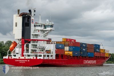
The vessel CONTAINERSHIPS 6 (IMO: 9188518, MMSI: 211315100) is a Container Ship that was built in 1999 ( 25 years old ). It's sailing under the flag of [DE] Germany.
In this page you can find informations about the vessels current position, last detected port calls, and current voyage information. If the vessels is not in coverage by AIS you will find the latest position.
The current position of CONTAINERSHIPS 6 is detected by our AIS receivers and we are not responsible for the reliability of the data. The last position was recorded while the vessel was in Coverage by the Ais receivers of our vessel tracking app.
The current draught of CONTAINERSHIPS 6 as reported by AIS is 8.3 meters
Weather
| Temperature | 15.9°C / 60.62°F |
|---|---|
| Wind Speed | 24 knots |
| Direction | 28° NNE |
| Pressure | 1018 hPa |
| Humidity | 85.3 % |
| Cloud Coverage | 100 % |
Featured Company
Last Port Calls
| Port | Arrival | Departure | Time In Port |
|---|---|---|---|
| 2024-06-27 10:08 | 2024-06-27 22:23 | 12 h | |
| 2024-06-25 12:05 | 2024-06-26 17:19 | 1 d | |
| 2024-06-20 19:02 | 2024-06-21 17:26 | 22 h | |
| 2024-06-19 19:53 | 2024-06-20 10:51 | 14 h | |
| 2024-06-19 12:54 | 2024-06-19 17:42 | 4 h | |
| 2024-06-18 17:24 | 2024-06-19 04:38 | 11 h | |
| 2024-06-17 18:59 | 2024-06-18 11:15 | 16 h | |
| 2024-06-13 22:15 | 2024-06-14 10:43 | 12 h | |
| 2024-06-11 22:37 | 2024-06-13 00:32 | 1 d | |
| 2024-06-08 05:34 | 2024-06-08 19:04 | 13 h |
Most Visited Ports (Last year)
| Port | Arrivals | |
|---|---|---|
| 26 | ||
| 17 | ||
| 15 | ||
| 14 | ||
| 10 | ||
| 9 |
Last Trips
| Origin | Departure | Destination | Arrival | Distance | |
|---|---|---|---|---|---|
| 2024-06-26 18:19 | 2024-06-27 11:08 | 222.97 nm | |||
| 2024-06-21 19:26 | 2024-06-25 13:05 | 1231.99 nm | |||
| 2024-06-20 12:51 | 2024-06-20 21:02 | 109.86 nm | |||
| 2024-06-19 19:42 | 2024-06-19 21:53 | 32.07 nm | |||
| 2024-06-19 06:38 | 2024-06-19 14:54 | 98.06 nm | |||
| 2024-06-18 12:15 | 2024-06-18 19:24 | 87.64 nm | |||
| 2024-06-14 11:43 | 2024-06-17 19:59 | 1002.84 nm | |||
| 2024-06-13 01:32 | 2024-06-13 23:15 | 221.98 nm | |||
| 2024-06-08 21:04 | 2024-06-11 23:37 | 1181.82 nm | |||
| 2024-06-07 12:53 | 2024-06-08 07:34 | 109.97 nm |
Events
| Time | Event | Details | Position / Dest | Info |
|---|---|---|---|---|
| 2024-06-28 09:10 | Status Changed | Under way using engine Default |
43.31267 / -9.70300
ESFRO
|
Speed: 13.8 kn Course: 28° |
| 2024-06-28 08:38 | Status Changed | Default Under way using engine |
43.20717 / -9.78100
ESFRO
|
Speed: 13.1 kn Course: 15° |
| 2024-06-28 08:29 | Status Changed | Under way using engine Default |
43.17617 / -9.78933
ESFRO
|
Speed: 13.6 kn Course: 358° |
| 2024-06-28 08:29 | IN Coverage |
43.17683 / -9.78933
North Atlantic Ocean
ESFRO
|
Speed: 13.7 kn Course: 359° |
|
| 2024-06-28 03:24 | Status Changed | Default Under way using engine |
42.07400 / -9.70533
ESFRO
|
Speed: 13.9 kn Course: 321° |
| 2024-06-28 03:18 | Detected in Sea | Spanish part of the North Atlantic Ocean |
42.05083 / -9.68033
North Atlantic Ocean
ESFRO
|
Speed: 13.9 kn Course: 321° |
| 2024-06-28 03:18 | Status Changed | Under way using engine Default |
42.05083 / -9.68033
ESFRO
|
Speed: 14.3 kn Course: 321° |
| 2024-06-28 03:18 | OUT of Coverage |
42.05083 / -9.68033
North Atlantic Ocean
ESFRO
|
Speed: 13.9 kn Course: 321° |
|
| 2024-06-28 03:02 | IN Coverage |
42.05083 / -9.68033
North Atlantic Ocean
ESFRO
|
Speed: 13.9 kn Course: 321° |
|
| 2024-06-28 00:34 | OUT of Coverage |
41.55717 / -9.14883
North Atlantic Ocean
ESFRO
|
Speed: 14.3 kn Course: 323° |