
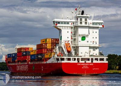
CONTAINERSHIPS NORD
Cargo A
Current Trip
| Time Travelled | 11 h, 13 mins |
|---|---|
| Remaining Time | 22 h, 43 mins |
| Distance Travelled | 126.48 nm |
| Remaining Distance | 248.35 nm |
| AVG Speed | 13.4 Knots |
| MAX Speed | 18 Knots |
| AVG Wind | 15 knots |
| MAX Wind | 20.9 knots |
| MIN Temp | 10.7°C / 51.26°F |
| MAX Temp | 14.7°C / 58.46°F |
| Draught | 7.9 m |
| Position Received | 1 m ago |
Current Position
| Longitude | 5.69915° |
|---|---|
| Latitude | 53.69053° |
| Status | Under way using engine |
| Speed | 9.3 Knots |
| Course | 250.8° |
| Area | North Sea |
| Station | T-AIS |
| Position Received | 1 m ago |
Info
Information
The current position of CONTAINERSHIPS NORD is in North Sea with coordinates 53.69053° / 5.69915° as reported on 2024-05-29 09:04 by AIS to our vessel tracker app. The vessel's current speed is 9.3 Knots and is heading at the port of TILBURY. The estimated time of arrival as calculated by vessel tracking app is 2024-05-30 07:49 LT
The vessel CONTAINERSHIPS NORD (IMO: 9813993, MMSI: 232046824) is a Cargo A It's sailing under the flag of [GB] United Kingdom.
In this page you can find informations about the vessels current position, last detected port calls, and current voyage information. If the vessels is not in coverage by AIS you will find the latest position.
The current position of CONTAINERSHIPS NORD is detected by our AIS receivers and we are not responsible for the reliability of the data. The last position was recorded while the vessel was in Coverage by the Ais receivers of our vessel tracking app.
The current draught of CONTAINERSHIPS NORD as reported by AIS is 7.9 meters
Weather
| Temperature | 13.9°C / 57.02°F |
|---|---|
| Wind Speed | 17 knots |
| Direction | 240° WSW |
| Pressure | 1005.5 hPa |
| Humidity | 87.5 % |
| Cloud Coverage | 100 % |
Featured Company
Last Port Calls
| Port | Arrival | Departure | Time In Port |
|---|---|---|---|
| 2024-05-28 19:50 | 2024-05-28 21:53 | 2 h | |
| 2024-05-28 10:28 | 2024-05-28 11:26 | 58 m | |
| 2024-05-26 19:38 | 2024-05-27 08:31 | 12 h | |
| 2024-05-25 18:22 | 2024-05-26 10:57 | 16 h | |
| 2024-05-24 14:45 | 2024-05-24 14:50 | 5 m | |
| 2024-05-22 21:50 | 2024-05-23 09:55 | 12 h | |
| 2024-05-22 21:40 | |||
| 2024-05-20 15:15 | |||
| 2024-05-19 05:58 | 2024-05-19 22:06 | 16 h | |
| 2024-05-18 02:10 | 2024-05-18 05:18 | 3 h |
Last Trips
| Origin | Departure | Destination | Arrival | Distance | |
|---|---|---|---|---|---|
| 2024-05-28 13:26 | 2024-05-28 21:50 | 50.41 nm | |||
| 2024-05-27 10:31 | 2024-05-28 12:28 | 361.77 nm | |||
| 2024-05-26 13:57 | 2024-05-26 21:38 | 121.15 nm | |||
| 2024-05-24 16:50 | 2024-05-25 21:22 | 410.71 nm | |||
| 2024-05-23 11:55 | 2024-05-24 16:45 | 330.63 nm | |||
| 2024-05-19 23:06 | 2024-05-22 23:50 | 271.33 nm | |||
| 2024-05-19 23:06 | 2024-05-22 23:40 | 271.10 nm | |||
| 2024-05-19 23:06 | 2024-05-20 17:15 | 270.57 nm | |||
| 2024-05-18 07:18 | 2024-05-19 06:58 | 377.21 nm | |||
| 2024-05-16 19:21 | 2024-05-18 04:10 | 412.72 nm |
Events
| Time | Event | Details | Position / Dest | Info |
|---|---|---|---|---|
| 2024-05-29 07:40 | Detected in Sea | Dutch part of the North Sea |
53.76266 / 6.06227
North Sea
GBTIL VIA NOK
|
Speed: 10.1 kn Course: 252.2° |
| 2024-05-29 07:39 | Status Changed | Under way using engine Default |
53.76309 / 6.06455
GBTIL VIA NOK
|
Speed: 10.5 kn Course: 254° |
| 2024-05-29 07:22 | IN Coverage |
53.76266 / 6.06227
North Sea
GBTIL VIA NOK
|
Speed: 10.1 kn Course: 252.2° |
|
| 2024-05-29 05:22 | Status Changed | Default Under way using engine |
53.88023 / 6.78237
GBTIL VIA NOK
|
Speed: 11.7 kn Course: 255.8° |
| 2024-05-29 05:19 | OUT of Coverage |
53.88209 / 6.79495
North Sea
GBTIL VIA NOK
|
Speed: 11.7 kn Course: 255.8° |
|
| 2024-05-29 03:02 | Status Changed | Under way using engine Default |
53.98120 / 7.48902
GBTIL VIA NOK
|
Speed: 10.3 kn Course: 254° |
| 2024-05-29 02:41 | Status Changed | Default Under way using engine |
53.99833 / 7.58500
GBTIL VIA NOK
|
Speed: 10.3 kn Course: 251.6° |
| 2024-05-29 02:37 | Status Changed | Under way using engine Default |
54.00258 / 7.60376
GBTIL VIA NOK
|
Speed: 10.3 kn Course: 252° |
| 2024-05-29 02:27 | Status Changed | Default Under way using engine |
54.01248 / 7.65598
GBTIL VIA NOK
|
Speed: 10.3 kn Course: 252.7° |
| 2024-05-28 22:39 | ETA Changed | 2024/05/30 05:00 2024/05/30 01:00 |
53.83974 / 8.82921
GBTIL VIA NOK
|
Speed: 17 kn Course: 271.2° |