
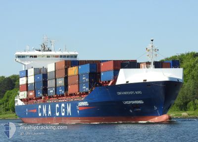
CONTAINERSHIPS NORD
Cargo
Current Trip
| Time Travelled | 4 h, 9 mins |
|---|---|
| Remaining Time | 3 h, 35 mins |
| Distance Travelled | 59.33 nm |
| Remaining Distance | 59.76 nm |
| AVG Speed | 15.3 Knots |
| MAX Speed | 16.2 Knots |
| AVG Wind | 8.2 knots |
| MAX Wind | 9 knots |
| MIN Temp | 16.8°C / 62.24°F |
| MAX Temp | 17.5°C / 63.5°F |
| Draught | 8.6 m |
| Position Received | 12 m ago |
Current Position
| Longitude | 19.54801° |
|---|---|
| Latitude | 55.26041° |
| Status | Under way using engine |
| Speed | 15.9 Knots |
| Course | 209.1° |
| Area | Baltic Sea |
| Station | T-AIS |
| Position Received | 12 m ago |
Info
Information
The current position of CONTAINERSHIPS NORD is in Baltic Sea with coordinates 55.26041° / 19.54801° as reported on 2024-06-26 01:55 by AIS to our vessel tracker app. The vessel's current speed is 15.9 Knots and is heading at the port of GDANSK. The estimated time of arrival as calculated by vessel tracking app is 2024-06-26 05:42 LT
The vessel CONTAINERSHIPS NORD (IMO: 9813993, MMSI: 232046824) is a Cargo It's sailing under the flag of [GB] United Kingdom.
In this page you can find informations about the vessels current position, last detected port calls, and current voyage information. If the vessels is not in coverage by AIS you will find the latest position.
The current position of CONTAINERSHIPS NORD is detected by our AIS receivers and we are not responsible for the reliability of the data. The last position was recorded while the vessel was in Coverage by the Ais receivers of our vessel tracking app.
The current draught of CONTAINERSHIPS NORD as reported by AIS is 8.6 meters
Weather
| Temperature | 16.8°C / 62.24°F |
|---|---|
| Wind Speed | 7 knots |
| Direction | 99° E |
| Pressure | 1019.8 hPa |
| Humidity | 86.2 % |
| Cloud Coverage | --- |
Featured Company
Last Port Calls
| Port | Arrival | Departure | Time In Port |
|---|---|---|---|
| 2024-06-25 01:40 | 2024-06-25 21:58 | 20 h | |
| 2024-06-20 18:40 | 2024-06-21 19:03 | 1 d | |
| 2024-06-18 12:34 | 2024-06-19 01:06 | 12 h | |
| 2024-06-14 19:07 | 2024-06-15 15:25 | 20 h | |
| 2024-06-13 21:21 | 2024-06-14 09:00 | 11 h | |
| 2024-06-11 06:34 | 2024-06-11 17:21 | 10 h | |
| 2024-06-10 16:16 | 2024-06-11 04:22 | 12 h | |
| 2024-06-08 18:48 | 2024-06-09 02:52 | 8 h | |
| 2024-06-07 14:10 | 2024-06-08 10:11 | 20 h | |
| 2024-06-05 15:53 | 2024-06-07 07:17 | 1 d |
Last Trips
| Origin | Departure | Destination | Arrival | Distance | |
|---|---|---|---|---|---|
| 2024-06-21 20:03 | 2024-06-25 04:40 | 853.28 nm | |||
| 2024-06-19 02:06 | 2024-06-20 19:40 | 290.38 nm | |||
| 2024-06-15 17:25 | 2024-06-18 13:34 | 997.57 nm | |||
| 2024-06-14 12:00 | 2024-06-14 21:07 | 121.85 nm | |||
| 2024-06-11 19:21 | 2024-06-14 00:21 | 340.48 nm | |||
| 2024-06-11 06:22 | 2024-06-11 08:34 | 27.64 nm | |||
| 2024-06-09 04:52 | 2024-06-10 18:16 | 587.87 nm | |||
| 2024-06-08 12:11 | 2024-06-08 20:48 | 104.71 nm | |||
| 2024-06-07 09:17 | 2024-06-07 16:10 | 96.68 nm | |||
| 2024-06-04 08:15 | 2024-06-05 17:53 | 105.13 nm |
Events
| Time | Event | Details | Position / Dest | Info |
|---|---|---|---|---|
| 2024-06-26 01:17 | Detected in Sea | Russian part of the Baltic Sea |
55.35095 / 19.78757
Baltic Sea
PLGDN
|
Speed: 16.2 kn Course: 244.8° |
| 2024-06-26 01:17 | Status Changed | Under way using engine Default |
55.35095 / 19.78757
PLGDN
|
Speed: 15.9 kn Course: 243° |
| 2024-06-26 01:17 | IN Coverage |
55.35095 / 19.78757
Baltic Sea
PLGDN
|
Speed: 16.2 kn Course: 244.8° |
|
| 2024-06-25 23:21 | Status Changed | Default Under way using engine |
55.59124 / 20.57163
PLGDN
|
Speed: 15.7 kn Course: 240.4° |
| 2024-06-25 23:14 | Status Changed | Under way using engine Default |
55.60719 / 20.62028
PLGDN
|
Speed: 15.8 kn Course: 240° |
| 2024-06-25 23:14 | OUT of Coverage |
55.60719 / 20.62028
Baltic Sea
PLGDN
|
Speed: 15.7 kn Course: 240.4° |
|
| 2024-06-25 23:04 | Status Changed | Default Under way using engine |
55.62800 / 20.68470
PLGDN
|
Speed: 15.7 kn Course: 240.2° |
| 2024-06-25 21:58 | PORT DEPARTURE |
|
55.72566 / 21.09048
PLGDN
|
Speed: 8.2 kn Course: 295° |
| 2024-06-25 21:16 | START Moving |
55.64926 / 21.15762
[LT] KLAIPEDA
|
Speed: 4.3 kn Course: 335° |
|
| 2024-06-25 21:06 | ETA Changed | 2024/06/26 06:00 2024/06/26 04:00 |
55.64731 / 21.15894
[LT] KLAIPEDA
|
Speed: Course: 323° |