
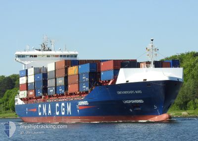
CONTAINERSHIPS NORD
Cargo A
Current Trip
| Time Travelled | 23 h, 30 mins |
|---|---|
| Remaining Time | 1 day |
| Distance Travelled | 340.43 nm |
| Remaining Distance | 652.08 nm |
| AVG Speed | 14.7 Knots |
| MAX Speed | 16 Knots |
| AVG Wind | 7.9 knots |
| MAX Wind | 14.8 knots |
| MIN Temp | 15°C / 59°F |
| MAX Temp | 18.4°C / 65.12°F |
| Draught | 8.3 m |
| Position Received | 1 m ago |
Current Position
| Longitude | 10.83774° |
|---|---|
| Latitude | 54.84204° |
| Status | Under way using engine |
| Speed | 16.3 Knots |
| Course | 2.8° |
| Area | Baltic Sea |
| Station | T-AIS |
| Position Received | 1 m ago |
Info
Information
The current position of CONTAINERSHIPS NORD is in Baltic Sea with coordinates 54.84204° / 10.83774° as reported on 2024-06-16 14:54 by AIS to our vessel tracker app. The vessel's current speed is 16.3 Knots and is heading at the port of TEES. The estimated time of arrival as calculated by vessel tracking app is 2024-06-18 09:37 LT
The vessel CONTAINERSHIPS NORD (IMO: 9813993, MMSI: 232046824) is a Cargo A It's sailing under the flag of [GB] United Kingdom.
In this page you can find informations about the vessels current position, last detected port calls, and current voyage information. If the vessels is not in coverage by AIS you will find the latest position.
The current position of CONTAINERSHIPS NORD is detected by our AIS receivers and we are not responsible for the reliability of the data. The last position was recorded while the vessel was in Coverage by the Ais receivers of our vessel tracking app.
The current draught of CONTAINERSHIPS NORD as reported by AIS is 8.3 meters
Weather
| Temperature | 16°C / 60.8°F |
|---|---|
| Wind Speed | 12 knots |
| Direction | 187° S |
| Pressure | 1007 hPa |
| Humidity | 78.3 % |
| Cloud Coverage | 70 % |
Featured Company
Last Port Calls
| Port | Arrival | Departure | Time In Port |
|---|---|---|---|
| 2024-06-14 19:07 | 2024-06-15 15:25 | 20 h | |
| 2024-06-13 21:21 | 2024-06-14 09:00 | 11 h | |
| 2024-06-11 06:34 | 2024-06-11 17:21 | 10 h | |
| 2024-06-10 16:16 | 2024-06-11 04:22 | 12 h | |
| 2024-06-08 18:48 | 2024-06-09 02:52 | 8 h | |
| 2024-06-07 14:10 | 2024-06-08 10:11 | 20 h | |
| 2024-06-05 15:53 | 2024-06-07 07:17 | 1 d | |
| 2024-06-03 01:44 | 2024-06-04 06:15 | 1 d | |
| 2024-05-31 19:51 | 2024-06-02 00:06 | 1 d | |
| 2024-05-30 09:10 | 2024-05-30 20:35 | 11 h |
Last Trips
| Origin | Departure | Destination | Arrival | Distance | |
|---|---|---|---|---|---|
| 2024-06-14 12:00 | 2024-06-14 21:07 | 121.85 nm | |||
| 2024-06-11 19:21 | 2024-06-14 00:21 | 340.48 nm | |||
| 2024-06-11 06:22 | 2024-06-11 08:34 | 27.64 nm | |||
| 2024-06-09 04:52 | 2024-06-10 18:16 | 587.87 nm | |||
| 2024-06-08 12:11 | 2024-06-08 20:48 | 104.71 nm | |||
| 2024-06-07 09:17 | 2024-06-07 16:10 | 96.68 nm | |||
| 2024-06-04 08:15 | 2024-06-05 17:53 | 105.13 nm | |||
| 2024-06-02 01:06 | 2024-06-03 03:44 | 276.22 nm | |||
| 2024-05-30 21:35 | 2024-05-31 20:51 | 287.29 nm | |||
| 2024-05-28 23:53 | 2024-05-30 10:10 | 387.10 nm |
Events
| Time | Event | Details | Position / Dest | Info |
|---|---|---|---|---|
| 2024-06-16 14:29 | Change Sea Area | Danish part of the Kattegat Danish part of the Baltic Sea |
54.73824 / 10.78891
Kattegat
GBTEE
|
Speed: 15.3 kn Course: 10.2° |
| 2024-06-16 13:59 | Change Sea Area | Danish part of the Baltic Sea German part of the Baltic Sea |
54.64316 / 10.88726
Baltic Sea
GBTEE
|
Speed: 15.2 kn Course: 300.2° |
| 2024-06-16 12:53 | Change Sea Area | German part of the Baltic Sea Danish part of the Baltic Sea |
54.55471 / 11.33999
Baltic Sea
GBTEE
|
Speed: 15.4 kn Course: 297.3° |
| 2024-06-16 10:56 | Change Sea Area | Danish part of the Baltic Sea German part of the Baltic Sea |
54.44643 / 12.13617
Baltic Sea
GBTEE
|
Speed: 14.7 kn Course: 267.7° |
| 2024-06-16 10:41 | Change Sea Area | German part of the Baltic Sea Danish part of the Baltic Sea |
54.48199 / 12.20692
Baltic Sea
GBTEE
|
Speed: 15.3 kn Course: 196.9° |
| 2024-06-16 09:56 | Change Sea Area | Danish part of the Baltic Sea German part of the Baltic Sea |
54.63722 / 12.37491
Baltic Sea
GBTEE
|
Speed: 15 kn Course: 233.5° |
| 2024-06-16 09:32 | Change Sea Area | German part of the Baltic Sea Danish part of the Baltic Sea |
54.70083 / 12.50746
Baltic Sea
GBTEE
|
Speed: 14.8 kn Course: 228° |
| 2024-06-16 08:44 | Change Sea Area | Danish part of the Baltic Sea German part of the Baltic Sea |
54.78910 / 12.80562
Baltic Sea
GBTEE
|
Speed: 14.7 kn Course: 269.5° |
| 2024-06-16 04:47 | Change Sea Area | German part of the Baltic Sea Danish part of the Kattegat |
54.63555 / 14.45537
Baltic Sea
GBTEE
|
Speed: 14.6 kn Course: 262.3° |
| 2024-06-16 03:35 | Change Sea Area | Danish part of the Kattegat Polish part of the Baltic Sea |
54.67871 / 14.94946
Kattegat
GBTEE
|
Speed: 14.6 kn Course: 261.1° |