
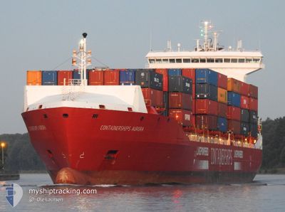
CONTAINERSHIPSAURORA
Cargo
Current Trip
| Time Travelled | 2 days |
|---|---|
| Remaining Time | 12 h, 53 mins |
| Distance Travelled | 834.91 nm |
| Remaining Distance | 168.08 nm |
| AVG Speed | 12 Knots |
| MAX Speed | 13.7 Knots |
| AVG Wind | 16.2 knots |
| MAX Wind | 26.9 knots |
| MIN Temp | 11.2°C / 52.16°F |
| MAX Temp | 17.6°C / 63.68°F |
| Draught | 7.9 m |
| Position Received | 6 m ago |
Current Position
| Longitude | 3.22736° |
|---|---|
| Latitude | 55.87436° |
| Status | Under way using engine |
| Speed | 13.2 Knots |
| Course | 244.2° |
| Area | North Sea |
| Station | T-AIS |
| Position Received | 6 m ago |
Info
Information
The current position of CONTAINERSHIPSAURORA is in North Sea with coordinates 55.87436° / 3.22736° as reported on 2024-06-04 21:45 by AIS to our vessel tracker app. The vessel's current speed is 13.2 Knots and is heading at the port of TEES. The estimated time of arrival as calculated by vessel tracking app is 2024-06-05 10:45 LT
The vessel CONTAINERSHIPSAURORA (IMO: 9814014, MMSI: 209659000) is a Cargo It's sailing under the flag of [CY] Cyprus.
In this page you can find informations about the vessels current position, last detected port calls, and current voyage information. If the vessels is not in coverage by AIS you will find the latest position.
The current position of CONTAINERSHIPSAURORA is detected by our AIS receivers and we are not responsible for the reliability of the data. The last position was recorded while the vessel was in Coverage by the Ais receivers of our vessel tracking app.
The current draught of CONTAINERSHIPSAURORA as reported by AIS is 7.9 meters
Weather
| Temperature | 12.3°C / 54.14°F |
|---|---|
| Wind Speed | 20 knots |
| Direction | 274° W |
| Pressure | 1000.7 hPa |
| Humidity | 75.1 % |
| Cloud Coverage | 100 % |
Featured Company
Last Port Calls
| Port | Arrival | Departure | Time In Port |
|---|---|---|---|
| 2024-06-01 11:34 | 2024-06-02 02:32 | 14 h | |
| 2024-05-31 16:28 | 2024-06-01 02:50 | 10 h | |
| 2024-05-27 13:44 | 2024-05-28 05:00 | 15 h | |
| 2024-05-26 03:22 | 2024-05-26 14:38 | 11 h | |
| 2024-05-22 12:26 | 2024-05-23 13:52 | 1 d | |
| 2024-05-21 11:34 | 2024-05-22 04:39 | 17 h | |
| 2024-05-17 12:58 | 2024-05-18 21:21 | 1 d | |
| 2024-05-15 19:52 | 2024-05-16 14:48 | 18 h | |
| 2024-05-12 06:35 | 2024-05-12 22:25 | 15 h | |
| 2024-05-11 05:31 | 2024-05-11 22:26 | 16 h |
Last Trips
| Origin | Departure | Destination | Arrival | Distance | |
|---|---|---|---|---|---|
| 2024-06-01 05:50 | 2024-06-01 13:34 | 125.23 nm | |||
| 2024-05-28 07:00 | 2024-05-31 19:28 | 745.69 nm | |||
| 2024-05-26 15:38 | 2024-05-27 15:44 | 290.60 nm | |||
| 2024-05-23 15:52 | 2024-05-26 04:22 | 790.04 nm | |||
| 2024-05-22 07:39 | 2024-05-22 14:26 | 118.73 nm | |||
| 2024-05-18 22:21 | 2024-05-21 14:34 | 845.68 nm | |||
| 2024-05-16 15:48 | 2024-05-17 13:58 | 287.43 nm | |||
| 2024-05-13 00:25 | 2024-05-15 20:52 | 1001.62 nm | |||
| 2024-05-12 01:26 | 2024-05-12 08:35 | 119.03 nm | |||
| 2024-05-09 02:03 | 2024-05-11 08:31 | 738.77 nm |
Events
| Time | Event | Details | Position / Dest | Info |
|---|---|---|---|---|
| 2024-06-04 21:25 | Detected in Sea | United Kingdom part of the North Sea |
55.90611 / 3.34499
North Sea
GBTEE
|
Speed: 13.2 kn Course: 245° |
| 2024-06-04 21:22 | Detected in Sea | German part of the North Sea |
55.91088 / 3.36265
North Sea
GBTEE
|
Speed: 13 kn Course: 244° |
| 2024-06-04 14:45 | Status Changed | Under way using engine Default |
56.58498 / 5.62450
GBTEE
|
Speed: 13 kn Course: 240° |
| 2024-06-04 14:34 | Status Changed | Default Under way using engine |
56.60333 / 5.68833
GBTEE
|
Speed: 13.1 kn Course: 241.9° |
| 2024-06-04 14:26 | Status Changed | Under way using engine Default |
56.61913 / 5.73610
GBTEE
|
Speed: 13.3 kn Course: 239° |
| 2024-06-04 14:26 | IN Coverage |
56.61641 / 5.72714
North Sea
GBTEE
|
Speed: 13.3 kn Course: 240.7° |
|
| 2024-06-04 12:16 | Status Changed | Default Under way using engine |
56.85333 / 6.48667
GBTEE
|
Speed: 12.9 kn Course: 242.3° |
| 2024-06-04 12:14 | OUT of Coverage |
56.85857 / 6.49954
North Sea
GBTEE
|
Speed: 12.9 kn Course: 242.3° |
|
| 2024-06-04 07:29 | Change Sea Area | Danish part of the North Sea Danish part of the Skaggerak |
57.36758 / 8.14720
North Sea
GBTEE
|
Speed: 12.8 kn Course: 240.6° |
| 2024-06-03 23:44 | Change Sea Area | Danish part of the Skaggerak Danish part of the Kattegat |
57.79884 / 10.93315
Skaggerak
GBTEE
|
Speed: 11.9 kn Course: 316.7° |