
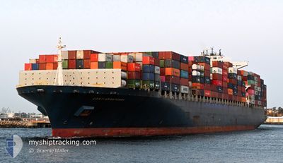
CONTI ANNAPURNA
Container Ship
Current Trip
| Time Travelled | 1 day |
|---|---|
| Remaining Time | 1 day |
| Distance Travelled | 515.71 nm |
| Remaining Distance | 427.14 nm |
| AVG Speed | 11.5 Knots |
| MAX Speed | 16.2 Knots |
| AVG Wind | 13.7 knots |
| MAX Wind | 23 knots |
| MIN Temp | 11.9°C / 53.42°F |
| MAX Temp | 19.6°C / 67.28°F |
| Draught | 13.1 m |
| Position Received | 3 h, 40 m ago |
Current Position
| Longitude | 145.41371° |
|---|---|
| Latitude | -39.16002° |
| Status | Under way using engine |
| Speed | 11.2 Knots |
| Course | 274° |
| Area | Bass Strait |
| Station | T-AIS |
| Position Received | 3 h, 40 m ago |
Info
Information
The current position of CONTI ANNAPURNA is in Bass Strait with coordinates -39.16002° / 145.41371° as reported on 2024-06-02 08:02 by AIS to our vessel tracker app. The vessel's current speed is 11.2 Knots and is heading at the port of ADELAIDE. The estimated time of arrival as calculated by vessel tracking app is 2024-06-04 00:29 LT
The vessel CONTI ANNAPURNA (IMO: 9286255, MMSI: 636092883) is a Container Ship that was built in 2004 ( 20 years old ). It's sailing under the flag of [LR] Liberia.
In this page you can find informations about the vessels current position, last detected port calls, and current voyage information. If the vessels is not in coverage by AIS you will find the latest position.
The current position of CONTI ANNAPURNA is detected by our AIS receivers and we are not responsible for the reliability of the data. The last position was recorded while the vessel was in Coverage by the Ais receivers of our vessel tracking app.
The current draught of CONTI ANNAPURNA as reported by AIS is 13.1 meters
Weather
| Temperature | 12.5°C / 54.5°F |
|---|---|
| Wind Speed | 13 knots |
| Direction | 168° SSE |
| Pressure | 1022.6 hPa |
| Humidity | 61.1 % |
| Cloud Coverage | 82 % |
Featured Company
Last Port Calls
| Port | Arrival | Departure | Time In Port |
|---|---|---|---|
| 2024-05-29 16:12 | 2024-05-31 14:20 | 1 d | |
| 2024-05-23 08:39 | 2024-05-26 16:27 | 3 d | |
| 2024-05-09 21:37 | 2024-05-11 23:33 | 2 d | |
| 2024-05-05 05:58 | 2024-05-06 06:56 | 1 d | |
| 2024-05-02 05:17 | 2024-05-03 02:12 | 20 h | |
| 2024-04-22 10:22 | 2024-04-24 02:30 | 1 d | |
| 2024-04-15 17:45 | 2024-04-17 18:11 | 2 d | |
| 2024-04-11 07:05 | 2024-04-13 08:47 | 2 d | |
| 2024-04-06 02:49 | 2024-04-09 07:30 | 3 d |
Most Visited Ports (Last year)
| Port | Arrivals | |
|---|---|---|
| 13 | ||
| 8 | ||
| 8 | ||
| 7 | ||
| 7 | ||
| 7 |
Last Trips
| Origin | Departure | Destination | Arrival | Distance | |
|---|---|---|---|---|---|
| 2024-05-27 02:27 | 2024-05-30 02:12 | 712.16 nm | |||
| 2024-05-12 07:33 | 2024-05-23 18:39 | 3956.37 nm | |||
| 2024-05-06 14:56 | 2024-05-10 05:37 | 224.18 nm | |||
| 2024-05-03 10:12 | 2024-05-05 13:58 | 229.60 nm | |||
| 2024-04-24 10:30 | 2024-05-02 13:17 | 2502.65 nm | |||
| 2024-04-18 03:41 | 2024-04-22 18:22 | 1395.51 nm | |||
| 2024-04-13 18:47 | 2024-04-16 03:15 | 973.34 nm | |||
| 2024-04-09 17:30 | 2024-04-11 17:05 | 627.34 nm | |||
| 2024-03-28 07:02 | 2024-04-06 13:49 | 3954.71 nm |
Events
| Time | Event | Details | Position / Dest | Info |
|---|---|---|---|---|
| 2024-06-02 08:09 | Status Changed | Default Under way using engine |
-39.15828 / 145.38597
AUSYD => AUADL
|
Speed: 11.2 kn Course: 274° |
| 2024-06-02 08:02 | OUT of Coverage |
-39.16002 / 145.41371
Bass Strait
AUSYD => AUADL
|
Speed: 11.2 kn Course: 274° |
|
| 2024-06-02 07:42 | Status Changed | Under way using engine Default |
-39.16480 / 145.49152
AUSYD => AUADL
|
Speed: 11.2 kn Course: 274° |
| 2024-06-02 07:41 | Status Changed | Default Under way using engine |
-39.16508 / 145.49622
AUSYD => AUADL
|
Speed: 11 kn Course: 274.5° |
| 2024-06-02 04:07 | ETA Changed | 2024/06/04 17:30 2024/06/03 19:00 |
-39.18599 / 146.37013
AUSYD => AUADL
|
Speed: 11.9 kn Course: 251° |
| 2024-06-02 03:53 | Status Changed | Under way using engine Default |
-39.17174 / 146.42672
AUSYD => AUADL
|
Speed: 11.9 kn Course: 252° |
| 2024-06-02 03:41 | IN Coverage |
-39.17192 / 146.42595
Bass Strait
AUSYD => AUADL
|
Speed: 11.9 kn Course: 252.9° |
|
| 2024-06-02 01:05 | Status Changed | Default Under way using engine |
-38.99692 / 147.07088
AUSYD => AUADL
|
Speed: 10.8 kn Course: 252° |
| 2024-06-02 00:58 | Detected in Sea | Australian part of the Bass Strait |
-38.98946 / 147.10013
Bass Strait
AUSYD => AUADL
|
Speed: 10.8 kn Course: 252° |
| 2024-06-02 00:58 | OUT of Coverage |
-38.98946 / 147.10013
Bass Strait
AUSYD => AUADL
|
Speed: 10.8 kn Course: 252° |