
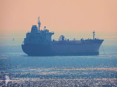
CONTI BENGUELA
Oil/Chemical Tanker
Current Trip
NL RTM>PT PDL
| Time Travelled | 3 days |
|---|---|
| Remaining Time | --- |
| Distance Travelled | 1117.88 nm |
| Remaining Distance | --- |
| AVG Speed | 12.3 Knots |
| MAX Speed | 14.5 Knots |
| AVG Wind | 11.8 knots |
| MAX Wind | 23 knots |
| MIN Temp | 11.9°C / 53.42°F |
| MAX Temp | 15.3°C / 59.54°F |
| Draught | 10.5 m |
| Position Received | 2 d ago |
Current Position
| Longitude | -5.89996° |
|---|---|
| Latitude | 49.05995° |
| Status | Under way using engine |
| Speed | 13.9 Knots |
| Course | 232.4° |
| Area | Celtic Sea |
| Station | T-AIS |
| Position Received | 2 d ago |
Info
Information
The current position of CONTI BENGUELA is in Celtic Sea with coordinates 49.05995° / -5.89996° as reported on 2024-05-21 08:45 by AIS to our vessel tracker app. The vessel's current speed is 13.9 Knots
The vessel CONTI BENGUELA (IMO: 9391373, MMSI: 636091569) is a Oil/Chemical Tanker that was built in 2008 ( 16 years old ). It's sailing under the flag of [LR] Liberia.
In this page you can find informations about the vessels current position, last detected port calls, and current voyage information. If the vessels is not in coverage by AIS you will find the latest position.
The current position of CONTI BENGUELA is detected by our AIS receivers and we are not responsible for the reliability of the data. The last position was recorded while the vessel was in Coverage by the Ais receivers of our vessel tracking app.
The current draught of CONTI BENGUELA as reported by AIS is 10.5 meters
Weather
| Temperature | 14.4°C / 57.92°F |
|---|---|
| Wind Speed | 14 knots |
| Direction | 163° SSE |
| Pressure | 1023.6 hPa |
| Humidity | 70.1 % |
| Cloud Coverage | 12 % |
Featured Company
Last Port Calls
| Port | Arrival | Departure | Time In Port |
|---|---|---|---|
| 2024-05-17 00:56 | 2024-05-19 21:24 | 2 d | |
| 2024-05-10 04:37 | 2024-05-12 11:58 | 2 d | |
| 2024-05-01 09:57 | 2024-05-04 22:08 | 3 d | |
| 2024-04-27 08:12 | 2024-04-28 16:49 | 1 d | |
| 2024-04-19 05:03 | 2024-04-20 10:25 | 1 d | |
| 2024-04-14 15:17 | 2024-04-19 02:45 | 4 d | |
| 2024-03-28 02:06 | 2024-03-30 16:32 | 2 d | |
| 2024-03-23 05:22 | 2024-03-25 03:16 | 1 d | |
| 2024-03-16 15:47 | 2024-03-19 10:15 | 2 d | |
| 2024-03-09 10:58 | 2024-03-11 06:23 | 1 d |
Most Visited Ports (Last year)
| Port | Arrivals | |
|---|---|---|
| 3 | ||
| 3 | ||
| 2 | ||
| 2 | ||
| 2 | ||
| 2 |
Last Trips
| Origin | Departure | Destination | Arrival | Distance | |
|---|---|---|---|---|---|
| 2024-05-12 13:58 | 2024-05-17 02:56 | 80.53 nm | |||
| 2024-05-04 23:08 | 2024-05-10 06:37 | 281.80 nm | |||
| 2024-04-28 18:49 | 2024-05-01 10:57 | 255.92 nm | |||
| 2024-04-20 12:25 | 2024-04-27 10:12 | 129.72 nm | |||
| 2024-04-19 04:45 | 2024-04-19 07:03 | 20.73 nm | |||
| 2024-03-30 16:32 | 2024-04-14 17:17 | 1329.14 nm | |||
| 2024-03-25 03:16 | 2024-03-28 02:06 | 258.78 nm | |||
| 2024-03-19 10:15 | 2024-03-23 05:22 | 275.85 nm | |||
| 2024-03-11 06:23 | 2024-03-16 15:47 | 385.96 nm | |||
| 2024-02-26 00:40 | 2024-03-09 10:58 | 919.08 nm |
Events
| Time | Event | Details | Position / Dest | Info |
|---|---|---|---|---|
| 2024-05-21 08:51 | Status Changed | Default Under way using engine |
49.04666 / -5.92500
NL RTM>PT PDL
|
Speed: 13.9 kn Course: 232.4° |
| 2024-05-21 08:45 | OUT of Coverage |
49.05995 / -5.89996
Celtic Sea
NL RTM>PT PDL
|
Speed: 13.9 kn Course: 232.4° |
|
| 2024-05-21 08:42 | Status Changed | Under way using engine Default |
49.06728 / -5.88461
NL RTM>PT PDL
|
Speed: 14 kn Course: 242° |
| 2024-05-21 08:22 | Status Changed | Default Under way using engine |
49.10345 / -5.77969
NL RTM>PT PDL
|
Speed: 13.9 kn Course: 242.9° |
| 2024-05-21 08:15 | Status Changed | Under way using engine Default |
49.11669 / -5.73980
NL RTM>PT PDL
|
Speed: 14 kn Course: 242° |
| 2024-05-21 08:06 | Status Changed | Default Under way using engine |
49.13152 / -5.69665
NL RTM>PT PDL
|
Speed: 14 kn Course: 242.1° |
| 2024-05-21 07:26 | Detected in Sea | French part of the Celtic Sea |
49.20678 / -5.48764
Celtic Sea
NL RTM>PT PDL
|
Speed: 13.9 kn Course: 239.7° |
| 2024-05-21 06:14 | Change Sea Area | United Kingdom part of the Celtic Sea United Kingdom part of the English Channel |
49.33405 / -5.13664
Celtic Sea
NL RTM>PT PDL
|
Speed: 12.9 kn Course: 236.9° |
| 2024-05-21 00:04 | Change Sea Area | United Kingdom part of the English Channel Guernsey part of the English Channel |
49.86087 / -3.34884
English Channel
NL RTM>PT PDL
|
Speed: 14 kn Course: 243.7° |
| 2024-05-21 00:04 | Status Changed | Under way using engine Default |
49.86227 / -3.34451
NL RTM>PT PDL
|
Speed: 13.9 kn Course: 243° |