
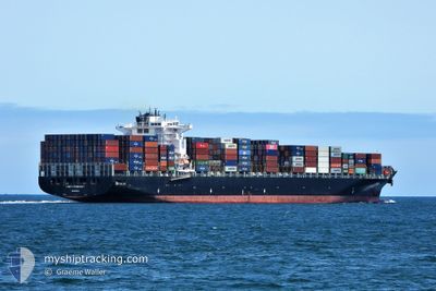
CONTI CONQUEST
Container Ship
Current Trip
| Time Travelled | 13 h, 33 mins |
|---|---|
| Remaining Time | --- |
| Distance Travelled | 187.04 nm |
| Remaining Distance | --- |
| AVG Speed | 12.8 Knots |
| MAX Speed | 17.8 Knots |
| AVG Wind | 20 knots |
| MAX Wind | 28.9 knots |
| MIN Temp | 9.9°C / 49.82°F |
| MAX Temp | 20.2°C / 68.36°F |
| Draught | 10.3 m |
| Position Received | 11 m ago |
Current Position
| Longitude | -125.66602° |
|---|---|
| Latitude | 38.76952° |
| Status | Under way using engine |
| Speed | 15.4 Knots |
| Course | 303.8° |
| Area | North Pacific Ocean |
| Station | T-AIS |
| Position Received | 11 m ago |
Info
Information
The current position of CONTI CONQUEST is in North Pacific Ocean with coordinates 38.76952° / -125.66602° as reported on 2024-06-18 11:00 by AIS to our vessel tracker app. The vessel's current speed is 15.4 Knots and is heading at the port of BUSAN. The estimated time of arrival as calculated by vessel tracking app is 2024-06-30 10:00 LT
The vessel CONTI CONQUEST (IMO: 9293818, MMSI: 636093041) is a Container Ship that was built in 2006 ( 18 years old ). It's sailing under the flag of [LR] Liberia.
In this page you can find informations about the vessels current position, last detected port calls, and current voyage information. If the vessels is not in coverage by AIS you will find the latest position.
The current position of CONTI CONQUEST is detected by our AIS receivers and we are not responsible for the reliability of the data. The last position was recorded while the vessel was in Coverage by the Ais receivers of our vessel tracking app.
The current draught of CONTI CONQUEST as reported by AIS is 10.3 meters
Weather
| Temperature | 13.5°C / 56.3°F |
|---|---|
| Wind Speed | 22 knots |
| Direction | 350° N |
| Pressure | 1015.4 hPa |
| Humidity | 80.2 % |
| Cloud Coverage | 11 % |
Featured Company
Last Port Calls
| Port | Arrival | Departure | Time In Port |
|---|---|---|---|
| 2024-06-16 12:14 | 2024-06-17 21:39 | 1 d | |
| 2024-06-07 13:13 | 2024-06-12 13:38 | 5 d | |
| 2024-05-21 14:59 | 2024-05-22 16:04 | 1 d | |
| 2024-05-15 17:52 | 2024-05-16 20:13 | 1 d | |
| 2024-05-12 09:08 | 2024-05-13 21:57 | 1 d | |
| 2024-05-07 17:37 | 2024-05-08 12:44 | 19 h | |
| 2024-05-01 16:36 | 2024-05-02 06:12 | 13 h | |
| 2024-04-26 04:57 | 2024-04-27 04:16 | 23 h | |
| 2024-04-23 17:12 | 2024-04-25 06:16 | 1 d | |
| 2024-04-15 12:06 | 2024-04-16 18:22 | 1 d |
Most Visited Ports (Last year)
| Port | Arrivals | |
|---|---|---|
| 6 | ||
| 5 | ||
| 5 | ||
| 5 | ||
| 4 | ||
| 4 |
Last Trips
| Origin | Departure | Destination | Arrival | Distance | |
|---|---|---|---|---|---|
| 2024-06-12 06:38 | 2024-06-16 05:14 | 647.34 nm | |||
| 2024-05-23 00:04 | 2024-06-07 06:13 | 6430.85 nm | |||
| 2024-05-17 03:13 | 2024-05-21 22:59 | 1350.64 nm | |||
| 2024-05-14 05:57 | 2024-05-16 00:52 | 637.24 nm | |||
| 2024-05-08 20:44 | 2024-05-12 17:08 | 239.95 nm | |||
| 2024-05-02 11:42 | 2024-05-08 01:37 | 1422.71 nm | |||
| 2024-04-27 09:46 | 2024-05-01 22:06 | 1047.81 nm | |||
| 2024-04-25 11:46 | 2024-04-26 10:27 | 200.88 nm | |||
| 2024-04-17 02:22 | 2024-04-23 22:42 | 2470.44 nm | |||
| 2024-04-12 02:11 | 2024-04-15 20:06 | 1477.92 nm |
Events
| Time | Event | Details | Position / Dest | Info |
|---|---|---|---|---|
| 2024-06-18 11:06 | Status Changed | Default Under way using engine |
38.78333 / -125.69167
KRPUS
|
Speed: 15.4 kn Course: 303.8° |
| 2024-06-18 10:37 | IN Coverage |
38.71249 / -125.56779
North Pacific Ocean
KRPUS
|
Speed: 15.2 kn Course: 307.6° |
|
| 2024-06-18 10:35 | Status Changed | Under way using engine Default |
38.70473 / -125.55488
KRPUS
|
Speed: 15.2 kn Course: 306° |
| 2024-06-18 08:19 | Status Changed | Default Under way using engine |
38.37617 / -124.94617
KRPUS
|
Speed: 15.3 kn Course: 305.2° |
| 2024-06-18 08:13 | OUT of Coverage |
38.36073 / -124.91740
North Pacific Ocean
KRPUS
|
Speed: 15.3 kn Course: 305.2° |
|
| 2024-06-18 07:53 | Status Changed | Under way using engine Default |
38.31365 / -124.83286
KRPUS
|
Speed: 15 kn Course: 305° |
| 2024-06-18 07:51 | Status Changed | Default Under way using engine |
38.30833 / -124.82333
KRPUS
|
Speed: 14.5 kn Course: 303.5° |
| 2024-06-18 06:06 | Status Changed | Under way using engine Default |
38.07071 / -124.37890
KRPUS
|
Speed: 14 kn Course: 307° |
| 2024-06-18 05:29 | Status Changed | Default Under way using engine |
37.98167 / -124.22334
KRPUS
|
Speed: 14.8 kn Course: 301.8° |
| 2024-06-18 04:57 | Status Changed | Under way using engine Default |
37.91038 / -124.08438
KRPUS
|
Speed: 14.9 kn Course: 305° |