
CONTSHIP MED
General Cargo
Current Trip
| Time Travelled | 21 days |
|---|---|
| Remaining Time | 3 days |
| Distance Travelled | 2856.09 nm |
| Remaining Distance | 1191.27 nm |
| AVG Speed | 9.5 Knots |
| MAX Speed | 16.6 Knots |
| AVG Wind | 10.1 knots |
| MAX Wind | 26.8 knots |
| MIN Temp | 12°C / 53.6°F |
| MAX Temp | 24.5°C / 76.1°F |
| Draught | 8.9 m |
| Position Received | 1 d ago |
Current Position
| Longitude | -7.11312° |
|---|---|
| Latitude | 35.02879° |
| Status | Under way using engine |
| Speed | 13.4 Knots |
| Course | 227.2° |
| Area | North Atlantic Ocean |
| Station | T-AIS |
| Position Received | 1 d ago |
Info
Information
The current position of CONTSHIP MED is in North Atlantic Ocean with coordinates 35.02879° / -7.11312° as reported on 2024-05-14 03:43 by AIS to our vessel tracker app. The vessel's current speed is 13.4 Knots and is heading at the port of BANJUL. The estimated time of arrival as calculated by vessel tracking app is 2024-05-18 21:13 LT
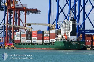
The vessel CONTSHIP MED (IMO: 9306249, MMSI: 636019746) is a General Cargo that was built in 2004 ( 20 years old ). It's sailing under the flag of [LR] Liberia.
In this page you can find informations about the vessels current position, last detected port calls, and current voyage information. If the vessels is not in coverage by AIS you will find the latest position.
The current position of CONTSHIP MED is detected by our AIS receivers and we are not responsible for the reliability of the data. The last position was recorded while the vessel was in Coverage by the Ais receivers of our vessel tracking app.
The current draught of CONTSHIP MED as reported by AIS is 8.9 meters
Weather
| Temperature | 18°C / 64.4°F |
|---|---|
| Wind Speed | 25 knots |
| Direction | 19° NNE |
| Pressure | 1012.1 hPa |
| Humidity | 72.8 % |
| Cloud Coverage | 34 % |
Featured Company
Last Port Calls
| Port | Arrival | Departure | Time In Port |
|---|---|---|---|
| 2024-04-22 10:00 | 2024-04-23 06:54 | 20 h | |
| 2024-04-19 12:57 | 2024-04-21 13:18 | 2 d | |
| 2024-04-19 11:59 | 2024-04-19 12:26 | 26 m | |
| 2024-04-16 18:51 | 2024-04-17 16:21 | 21 h | |
| 2024-03-26 13:37 | 2024-03-29 12:40 | 2 d | |
| 2024-03-24 14:27 | 2024-03-25 12:51 | 22 h | |
| 2024-03-14 12:48 | 2024-03-14 23:50 | 11 h | |
| 2024-03-06 01:10 | 2024-03-06 11:41 | 10 h | |
| 2024-02-29 23:46 |
Most Visited Ports (Last year)
| Port | Arrivals | |
|---|---|---|
| 14 | ||
| 8 | ||
| 5 | ||
| 5 | ||
| 2 | ||
| 1 |
Last Trips
| Origin | Departure | Destination | Arrival | Distance | |
|---|---|---|---|---|---|
| 2024-04-21 13:18 | 2024-04-22 10:00 | 213.04 nm | |||
| 2024-04-19 12:26 | 2024-04-19 12:57 | 0.64 nm | |||
| 2024-04-17 16:21 | 2024-04-19 11:59 | 215.99 nm | |||
| 2024-03-29 12:40 | 2024-04-16 18:51 | 2929.95 nm | |||
| 2024-03-25 12:51 | 2024-03-26 13:37 | 219.17 nm | |||
| 2024-03-14 23:50 | 2024-03-24 14:27 | 15.09 nm | |||
| 2024-03-06 12:41 | 2024-03-14 12:48 | 1466.29 nm | |||
| 2024-02-29 23:46 | 2024-03-06 02:10 | 1342.70 nm |
Events
| Time | Event | Details | Position / Dest | Info |
|---|---|---|---|---|
| 2024-05-14 03:44 | Status Changed | Default Under way using engine |
35.02634 / -7.11649
BANJUL
|
Speed: 13.4 kn Course: 227.2° |
| 2024-05-14 03:43 | Status Changed | Under way using engine Default |
35.02879 / -7.11312
BANJUL
|
Speed: 13.6 kn Course: 228° |
| 2024-05-14 03:43 | OUT of Coverage |
35.02879 / -7.11312
North Atlantic Ocean
BANJUL
|
Speed: 13.4 kn Course: 227.2° |
|
| 2024-05-14 03:29 | Status Changed | Default Under way using engine |
35.06271 / -7.06648
BANJUL
|
Speed: 13.9 kn Course: 226.9° |
| 2024-05-14 02:31 | Status Changed | Under way using engine Default |
35.21456 / -6.86643
BANJUL
|
Speed: 13.4 kn Course: 227° |
| 2024-05-14 01:48 | Status Changed | Default Under way using engine |
35.32193 / -6.71845
BANJUL
|
Speed: 13.6 kn Course: 228.4° |
| 2024-05-14 01:39 | Status Changed | Under way using engine Default |
35.34329 / -6.68874
BANJUL
|
Speed: 13.1 kn Course: 234° |
| 2024-05-14 01:39 | IN Coverage |
35.33999 / -6.69328
North Atlantic Ocean
BANJUL
|
Speed: 13.5 kn Course: 228° |
|
| 2024-05-13 22:34 | Status Changed | Default Under way using engine |
35.79599 / -6.09154
BANJUL
|
Speed: 13.2 kn Course: 201.4° |
| 2024-05-13 22:28 | OUT of Coverage |
35.81571 / -6.08069
North Atlantic Ocean
BANJUL
|
Speed: 13.2 kn Course: 201.4° |