
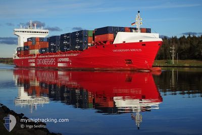
CONTSHIPS BOREALIS
Cargo A
Current Trip
| Time Travelled | 14 h, 54 mins |
|---|---|
| Remaining Time | 2 h, 6 mins |
| Distance Travelled | 243.96 nm |
| Remaining Distance | 43.69 nm |
| AVG Speed | 16.7 Knots |
| MAX Speed | 19 Knots |
| AVG Wind | 7.3 knots |
| MAX Wind | 12.9 knots |
| MIN Temp | 11.2°C / 52.16°F |
| MAX Temp | 14.8°C / 58.64°F |
| Draught | 8.7 m |
| Position Received | 1 m ago |
Current Position
| Longitude | 2.64394° |
|---|---|
| Latitude | 51.68678° |
| Status | Under way using engine |
| Speed | 18.4 Knots |
| Course | 172.5° |
| Area | North Sea |
| Station | T-AIS |
| Position Received | 1 m ago |
Info
Information
The current position of CONTSHIPS BOREALIS is in North Sea with coordinates 51.68678° / 2.64394° as reported on 2024-06-03 17:23 by AIS to our vessel tracker app. The vessel's current speed is 18.4 Knots and is heading at the port of ZEEBRUGGE. The estimated time of arrival as calculated by vessel tracking app is 2024-06-03 19:30 LT
The vessel CONTSHIPS BOREALIS (IMO: 9866249, MMSI: 210028000) is a Cargo A It's sailing under the flag of [CY] Cyprus.
In this page you can find informations about the vessels current position, last detected port calls, and current voyage information. If the vessels is not in coverage by AIS you will find the latest position.
The current position of CONTSHIPS BOREALIS is detected by our AIS receivers and we are not responsible for the reliability of the data. The last position was recorded while the vessel was in Coverage by the Ais receivers of our vessel tracking app.
The current draught of CONTSHIPS BOREALIS as reported by AIS is 8.7 meters
Weather
| Temperature | 14.8°C / 58.64°F |
|---|---|
| Wind Speed | 3 knots |
| Direction | 257° WSW |
| Pressure | 1019.2 hPa |
| Humidity | 84.5 % |
| Cloud Coverage | 100 % |
Featured Company
Last Port Calls
| Port | Arrival | Departure | Time In Port |
|---|---|---|---|
| 2024-06-02 11:40 | 2024-06-03 02:30 | 14 h | |
| 2024-05-28 03:39 | 2024-05-28 13:24 | 9 h | |
| 2024-05-27 03:31 | 2024-05-28 00:20 | 20 h | |
| 2024-05-25 09:26 | 2024-05-25 09:29 | 2 m | |
| 2024-05-23 06:06 | 2024-05-24 04:20 | 22 h | |
| 2024-05-21 09:36 | 2024-05-22 09:05 | 23 h | |
| 2024-05-19 22:47 | 2024-05-20 15:26 | 16 h | |
| 2024-05-14 06:26 | 2024-05-14 15:59 | 9 h | |
| 2024-05-13 02:53 | 2024-05-14 02:12 | 23 h | |
| 2024-05-11 01:01 | 2024-05-11 01:04 | 3 m |
Most Visited Ports (Last year)
| Port | Arrivals | |
|---|---|---|
| 16 | ||
| 14 | ||
| 12 | ||
| 12 | ||
| 12 | ||
| 11 |
Last Trips
| Origin | Departure | Destination | Arrival | Distance | |
|---|---|---|---|---|---|
| 2024-05-28 16:24 | 2024-06-02 12:40 | 1495.74 nm | |||
| 2024-05-28 03:20 | 2024-05-28 06:39 | 46.22 nm | |||
| 2024-05-25 11:29 | 2024-05-27 06:31 | 648.80 nm | |||
| 2024-05-24 06:20 | 2024-05-25 11:26 | 330.53 nm | |||
| 2024-05-22 11:05 | 2024-05-23 08:06 | 115.67 nm | |||
| 2024-05-20 16:26 | 2024-05-21 11:36 | 291.05 nm | |||
| 2024-05-14 18:59 | 2024-05-19 23:47 | 1498.46 nm | |||
| 2024-05-14 05:12 | 2024-05-14 09:26 | 46.86 nm | |||
| 2024-05-11 03:04 | 2024-05-13 05:53 | 648.74 nm | |||
| 2024-05-09 22:55 | 2024-05-11 03:01 | 328.59 nm |
Events
| Time | Event | Details | Position / Dest | Info |
|---|---|---|---|---|
| 2024-06-03 16:59 | Change Sea Area | Belgian part of the North Sea Dutch part of the North Sea |
51.80955 / 2.62847
North Sea
BEZEE
|
Speed: 19 kn Course: 177.9° |
| 2024-06-03 16:29 | Change Sea Area | Dutch part of the North Sea United Kingdom part of the North Sea |
51.96302 / 2.62369
North Sea
BEZEE
|
Speed: 18.8 kn Course: 180.9° |
| 2024-06-03 15:44 | Status Changed | Under way using engine Default |
52.19382 / 2.62895
BEZEE
|
Speed: 18 kn Course: 180° |
| 2024-06-03 15:31 | IN Coverage |
52.19332 / 2.62894
North Sea
BEZEE
|
Speed: 18.2 kn Course: 180.3° |
|
| 2024-06-03 10:37 | Status Changed | Default Under way using engine |
53.46167 / 1.81833
BEZEE
|
Speed: 16.3 kn Course: 142.6° |
| 2024-06-03 10:31 | OUT of Coverage |
53.48409 / 1.79169
North Sea
BEZEE
|
Speed: 16.3 kn Course: 142.6° |
|
| 2024-06-03 10:03 | ETA Changed | 2024/06/03 19:00 2024/06/04 02:00 |
53.58738 / 1.65529
BEZEE
|
Speed: 16.6 kn Course: 137° |
| 2024-06-03 07:18 | Status Changed | Under way using engine Default |
54.08978 / .69642
BEZEE
|
Speed: 16 kn Course: 125° |
| 2024-06-03 07:04 | Status Changed | Default Under way using engine |
54.12333 / .60833
BEZEE
|
Speed: 15.6 kn Course: 122.2° |
| 2024-06-03 06:47 | Status Changed | Under way using engine Default |
54.16304 / .50364
BEZEE
|
Speed: 15.2 kn Course: 123° |