
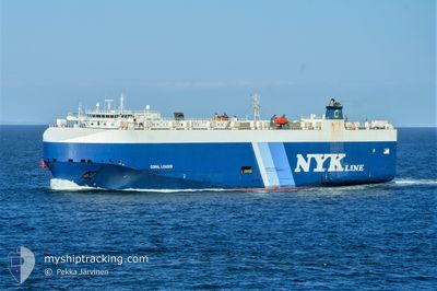
CORAL LEADER
Vehicles Carrier
Current Trip
TRAUT>ESVGO
| Time Travelled | 1 day |
|---|---|
| Remaining Time | --- |
| Distance Travelled | 629.37 nm |
| Remaining Distance | --- |
| AVG Speed | 14.7 Knots |
| MAX Speed | 18.2 Knots |
| AVG Wind | 4.7 knots |
| MAX Wind | 13.9 knots |
| MIN Temp | 20.1°C / 68.18°F |
| MAX Temp | 32.4°C / 90.32°F |
| Draught | 8.4 m |
| Position Received | 57 m ago |
Current Position
| Longitude | 19.60962° |
|---|---|
| Latitude | 36.39124° |
| Status | Under way using engine |
| Speed | 14.6 Knots |
| Course | 269.7° |
| Area | Mediterranean Sea - Eastern Basin |
| Station | T-AIS |
| Position Received | 57 m ago |
Info
Information
The current position of CORAL LEADER is in Mediterranean Sea - Eastern Basin with coordinates 36.39124° / 19.60962° as reported on 2024-06-03 16:42 by AIS to our vessel tracker app. The vessel's current speed is 14.6 Knots
The vessel CORAL LEADER (IMO: 9318486, MMSI: 308038000) is a Vehicles Carrier that was built in 2006 ( 18 years old ). It's sailing under the flag of [BS] Bahamas.
In this page you can find informations about the vessels current position, last detected port calls, and current voyage information. If the vessels is not in coverage by AIS you will find the latest position.
The current position of CORAL LEADER is detected by our AIS receivers and we are not responsible for the reliability of the data. The last position was recorded while the vessel was in Coverage by the Ais receivers of our vessel tracking app.
The current draught of CORAL LEADER as reported by AIS is 8.4 meters
Weather
| Temperature | 22.5°C / 72.5°F |
|---|---|
| Wind Speed | 4 knots |
| Direction | 202° SSW |
| Pressure | 1012.8 hPa |
| Humidity | 86.6 % |
| Cloud Coverage | 15 % |
Featured Company
Last Port Calls
| Port | Arrival | Departure | Time In Port |
|---|---|---|---|
| 2024-06-01 05:19 | 2024-06-01 21:58 | 16 h | |
| 2024-05-29 05:26 | 2024-05-30 19:14 | 1 d | |
| 2024-05-21 20:14 | 2024-05-22 19:17 | 23 h | |
| 2024-05-18 10:08 | 2024-05-19 16:13 | 1 d | |
| 2024-05-15 08:11 | 2024-05-16 00:42 | 16 h | |
| 2024-05-11 08:11 | 2024-05-12 18:56 | 1 d | |
| 2024-05-08 01:45 | 2024-05-09 15:31 | 1 d | |
| 2024-05-07 08:18 | 2024-05-07 23:49 | 15 h | |
| 2024-04-27 08:05 | 2024-04-28 19:02 | 1 d | |
| 2024-04-23 13:27 | 2024-04-26 03:58 | 2 d |
Last Trips
| Origin | Departure | Destination | Arrival | Distance | |
|---|---|---|---|---|---|
| 2024-05-30 22:14 | 2024-06-01 08:19 | 404.48 nm | |||
| 2024-05-22 21:17 | 2024-05-29 08:26 | 1149.43 nm | |||
| 2024-05-19 18:13 | 2024-05-21 22:14 | 534.38 nm | |||
| 2024-05-16 02:42 | 2024-05-18 12:08 | 969.32 nm | |||
| 2024-05-12 19:56 | 2024-05-15 10:11 | 730.93 nm | |||
| 2024-05-09 17:31 | 2024-05-11 09:11 | 557.38 nm | |||
| 2024-05-08 01:49 | 2024-05-08 03:45 | 21.65 nm | |||
| 2024-04-28 22:02 | 2024-05-07 10:18 | 3215.43 nm | |||
| 2024-04-26 06:58 | 2024-04-27 11:05 | 404.15 nm | |||
| 2024-04-20 18:43 | 2024-04-23 16:27 | 997.40 nm |
Events
| Time | Event | Details | Position / Dest | Info |
|---|---|---|---|---|
| 2024-06-03 16:47 | Status Changed | Default Under way using engine |
36.39123 / 19.58489
TRAUT>ESVGO
|
Speed: 14.6 kn Course: 269.7° |
| 2024-06-03 16:38 | Status Changed | Under way using engine Default |
36.39127 / 19.62874
TRAUT>ESVGO
|
Speed: 14.6 kn Course: 270° |
| 2024-06-03 16:31 | Status Changed | Default Under way using engine |
36.39124 / 19.66349
TRAUT>ESVGO
|
Speed: 14.6 kn Course: 270° |
| 2024-06-03 15:15 | Status Changed | Under way using engine Default |
36.38445 / 20.04813
TRAUT>ESVGO
|
Speed: 14.6 kn Course: 272° |
| 2024-06-03 15:01 | Status Changed | Default Under way using engine |
36.38250 / 20.12258
TRAUT>ESVGO
|
Speed: 14.6 kn Course: 277° |
| 2024-06-03 10:25 | Change Sea Area | Greek part of the Mediterranean Sea - Eastern Basin Greek part of the Aegean Sea |
36.35900 / 21.55436
Mediterranean Sea - Eastern Basin
|
Speed: 14.8 kn Course: 269° |
| 2024-06-03 10:25 | Status Changed | Under way using engine Default |
36.35900 / 21.55436
TRAUT>ESVGO
|
Speed: 15.2 kn Course: 268° |
| 2024-06-03 10:10 | IN Coverage |
36.35900 / 21.55436
Mediterranean Sea - Eastern Basin
|
Speed: 14.8 kn Course: 269° |
|
| 2024-06-03 05:00 | Status Changed | Default Under way using engine |
36.41442 / 23.21619
TRAUT>ESVGO
|
Speed: 15.1 kn Course: 227.7° |
| 2024-06-03 04:55 | OUT of Coverage |
36.42365 / 23.23694
Aegean Sea
|
Speed: 15.1 kn Course: 227.7° |