
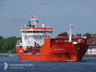
CORAL LOPHELIA
Lpg Tanker
Current Trip
| Time Travelled | 1 day |
|---|---|
| Remaining Time | 4 h, 18 mins |
| Distance Travelled | 677.47 nm |
| Remaining Distance | 70.67 nm |
| AVG Speed | 14.8 Knots |
| MAX Speed | 17.1 Knots |
| AVG Wind | 9 knots |
| MAX Wind | 20.3 knots |
| MIN Temp | 10.3°C / 50.54°F |
| MAX Temp | 22.6°C / 72.68°F |
| Draught | 5.6 m |
| Position Received | Now |
Current Position
| Longitude | 24.10078° |
|---|---|
| Latitude | 59.67451° |
| Status | Under way using engine |
| Speed | 15.7 Knots |
| Course | 73° |
| Area | Gulf of Finland |
| Station | T-AIS |
| Position Received | Now |
Info
Information
The current position of CORAL LOPHELIA is in Gulf of Finland with coordinates 59.67451° / 24.10078° as reported on 2024-06-03 09:16 by AIS to our vessel tracker app. The vessel's current speed is 15.7 Knots and is heading at the port of PORVOO. The estimated time of arrival as calculated by vessel tracking app is 2024-06-03 13:34 LT
The vessel CORAL LOPHELIA (IMO: 9350886, MMSI: 636016683) is a Lpg Tanker that was built in 2006 ( 18 years old ). It's sailing under the flag of [LR] Liberia.
In this page you can find informations about the vessels current position, last detected port calls, and current voyage information. If the vessels is not in coverage by AIS you will find the latest position.
The current position of CORAL LOPHELIA is detected by our AIS receivers and we are not responsible for the reliability of the data. The last position was recorded while the vessel was in Coverage by the Ais receivers of our vessel tracking app.
The current draught of CORAL LOPHELIA as reported by AIS is 5.6 meters
Weather
| Temperature | 10.5°C / 50.9°F |
|---|---|
| Wind Speed | 12 knots |
| Direction | 232° SW |
| Pressure | 1005.3 hPa |
| Humidity | 98.8 % |
| Cloud Coverage | 100 % |
Featured Company
Last Port Calls
| Port | Arrival | Departure | Time In Port |
|---|---|---|---|
| 2024-05-31 14:06 | 2024-06-01 13:04 | 22 h | |
| 2024-05-29 14:45 | 2024-05-30 08:42 | 17 h | |
| 2024-05-25 05:59 | 2024-05-26 03:02 | 21 h | |
| 2024-05-23 14:04 | 2024-05-24 05:41 | 15 h | |
| 2024-05-22 08:06 | 2024-05-23 04:37 | 20 h | |
| 2024-05-19 03:15 | 2024-05-20 09:10 | 1 d | |
| 2024-05-16 17:51 | 2024-05-18 10:12 | 1 d | |
| 2024-05-09 13:21 | 2024-05-10 12:31 | 23 h | |
| 2024-05-05 14:26 | 2024-05-06 16:11 | 1 d | |
| 2024-04-30 18:17 | 2024-05-02 18:37 | 2 d |
Most Visited Ports (Last year)
| Port | Arrivals | |
|---|---|---|
| 13 | ||
| 12 | ||
| 5 | ||
| 5 | ||
| 4 | ||
| 4 |
Last Trips
| Origin | Departure | Destination | Arrival | Distance | |
|---|---|---|---|---|---|
| 2024-05-30 10:42 | 2024-05-31 16:06 | 117.34 nm | |||
| 2024-05-26 05:02 | 2024-05-29 16:45 | 173.38 nm | |||
| 2024-05-24 07:41 | 2024-05-25 07:59 | 118.07 nm | |||
| 2024-05-23 06:37 | 2024-05-23 16:04 | 117.01 nm | |||
| 2024-05-20 11:10 | 2024-05-22 10:06 | 608.48 nm | |||
| 2024-05-18 12:12 | 2024-05-19 05:15 | 180.42 nm | |||
| 2024-05-10 14:31 | 2024-05-16 19:51 | 1771.13 nm | |||
| 2024-05-06 18:11 | 2024-05-09 15:21 | 612.81 nm | |||
| 2024-05-02 20:37 | 2024-05-05 16:26 | 158.68 nm | |||
| 2024-04-29 02:10 | 2024-04-30 20:17 | 595.81 nm |
Events
| Time | Event | Details | Position / Dest | Info |
|---|---|---|---|---|
| 2024-06-03 07:32 | Detected in Sea | Finnish part of the Gulf of Finland |
59.53147 / 23.23338
Gulf of Finland
FI PRV
|
Speed: 15.9 kn Course: 73° |
| 2024-06-03 07:25 | Change Sea Area | Estonian part of the Gulf of Finland Estonian part of the Baltic Sea |
59.52307 / 23.18044
Gulf of Finland
FI PRV
|
Speed: 15.9 kn Course: 72° |
| 2024-06-03 07:20 | Detected in Sea | Estonian part of the Baltic Sea |
59.51545 / 23.13328
Baltic Sea
FI PRV
|
Speed: 16 kn Course: 72° |
| 2024-06-03 06:31 | Change Sea Area | Finnish part of the Baltic Sea Estonian part of the Baltic Sea |
59.43870 / 22.74080
Baltic Sea
FI PRV
|
Speed: 15.7 kn Course: 66° |
| 2024-06-03 06:31 | Status Changed | Under way using engine Default |
59.43870 / 22.74080
FI PRV
|
Speed: 15.9 kn Course: 66° |
| 2024-06-03 05:51 | Status Changed | Default Under way using engine |
59.35767 / 22.44744
FI PRV
|
Speed: 15.7 kn Course: 55° |
| 2024-06-03 04:34 | Status Changed | Under way using engine Default |
59.15702 / 21.91328
FI PRV
|
Speed: 15.7 kn Course: 51° |
| 2024-06-03 04:01 | Status Changed | Default Under way using engine |
59.06738 / 21.70062
FI PRV
|
Speed: 15.6 kn Course: 49° |
| 2024-06-03 03:57 | Status Changed | Under way using engine Default |
59.05504 / 21.67583
FI PRV
|
Speed: 15.7 kn Course: 41° |
| 2024-06-03 03:50 | IN Coverage |
59.05691 / 21.67937
Baltic Sea
FI PRV
|
Speed: 15.7 kn Course: 44° |