
COSCO ENGLAND
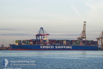
Container Ship
Current Trip
| Time Travelled | 6 days |
|---|---|
| Remaining Time | 8 days |
| Distance Travelled | 2887.18 nm |
| Remaining Distance | 3821.78 nm |
| AVG Speed | 18.8 Knots |
| MAX Speed | 21.9 Knots |
| AVG Wind | 10.6 knots |
| MAX Wind | 23.6 knots |
| MIN Temp | 7.1°C / 44.78°F |
| MAX Temp | 27.9°C / 82.22°F |
| Draught | 13.9 m |
| Position Received | 3 d ago |
Current Position
| Longitude | 141.36002° |
|---|---|
| Latitude | 35.42460° |
| Status | Under way using engine |
| Speed | 21.2 Knots |
| Course | 58.9° |
| Area | North Pacific Ocean |
| Station | T-AIS |
| Position Received | 3 d ago |
Info
Information
The current position of COSCO ENGLAND is in North Pacific Ocean with coordinates 35.42460° / 141.36002° as reported on 2024-06-10 18:39 by AIS to our vessel tracker app. The vessel's current speed is 21.2 Knots and is heading at the port of LOS ANGELES. The estimated time of arrival as calculated by vessel tracking app is 2024-06-22 11:41 LT
The vessel COSCO ENGLAND (IMO: 9516428, MMSI: 477652300) is a Container Ship that was built in 2013 ( 11 years old ). It's sailing under the flag of [HK] Hong Kong.
In this page you can find informations about the vessels current position, last detected port calls, and current voyage information. If the vessels is not in coverage by AIS you will find the latest position.
The current position of COSCO ENGLAND is detected by our AIS receivers and we are not responsible for the reliability of the data. The last position was recorded while the vessel was in Coverage by the Ais receivers of our vessel tracking app.
The current draught of COSCO ENGLAND as reported by AIS is 13.9 meters
Weather
| Temperature | 7.1°C / 44.78°F |
|---|---|
| Wind Speed | 20 knots |
| Direction | 306° NW |
| Pressure | 1009.5 hPa |
| Humidity | 95 % |
| Cloud Coverage | 100 % |
Featured Company
Last Port Calls
| Port | Arrival | Departure | Time In Port |
|---|---|---|---|
| 2024-06-06 19:28 | 2024-06-07 17:00 | 21 h | |
| 2024-06-04 07:11 | 2024-06-05 15:03 | 1 d | |
| 2024-06-03 06:11 | 2024-06-03 23:49 | 17 h | |
| 2024-06-02 00:42 | 2024-06-02 20:10 | 19 h | |
| 2024-05-25 23:02 | 2024-05-26 13:27 | 14 h | |
| 2024-05-03 09:44 | 2024-05-08 13:10 | 5 d | |
| 2024-04-18 04:20 | 2024-04-19 05:38 | 1 d | |
| 2024-04-16 05:22 | 2024-04-17 08:19 | 1 d | |
| 2024-04-15 05:06 | 2024-04-15 23:42 | 18 h | |
| 2024-04-13 14:02 | 2024-04-14 01:25 | 11 h |
Last Trips
| Origin | Departure | Destination | Arrival | Distance | |
|---|---|---|---|---|---|
| 2024-06-05 23:03 | 2024-06-07 03:28 | 340.33 nm | |||
| 2024-06-04 07:49 | 2024-06-04 15:11 | 62.52 nm | |||
| 2024-06-03 04:10 | 2024-06-03 14:11 | 112.41 nm | |||
| 2024-05-26 21:27 | 2024-06-02 08:42 | 2008.21 nm | |||
| 2024-05-08 06:10 | 2024-05-26 07:02 | 6249.50 nm | |||
| 2024-04-19 13:38 | 2024-05-03 02:44 | 6181.43 nm | |||
| 2024-04-17 16:19 | 2024-04-18 12:20 | 342.21 nm | |||
| 2024-04-16 07:42 | 2024-04-16 13:22 | 58.28 nm | |||
| 2024-04-14 09:25 | 2024-04-15 13:06 | 114.77 nm | |||
| 2024-04-05 09:45 | 2024-04-13 22:02 | 2650.63 nm |
Events
| Time | Event | Details | Position / Dest | Info |
|---|---|---|---|---|
| 2024-06-10 18:45 | Status Changed | Default Under way using engine |
35.44415 / 141.40054
US LGB
|
Speed: 21.2 kn Course: 58.9° |
| 2024-06-10 18:39 | OUT of Coverage |
35.42460 / 141.36002
North Pacific Ocean
US LGB
|
Speed: 21.2 kn Course: 58.9° |
|
| 2024-06-10 15:03 | Destination Changed | US LGB LGB |
34.80380 / 140.10100
US LGB
|
Speed: 18.3 kn Course: 59.6° |
| 2024-06-10 15:00 | Status Changed | Under way using engine Default |
34.79707 / 140.08712
LGB
|
Speed: 18.5 kn Course: 60° |
| 2024-06-10 14:45 | IN Coverage |
34.79885 / 140.09079
North Pacific Ocean
LGB
|
Speed: 18.3 kn Course: 59.4° |
|
| 2024-06-10 13:57 | Status Changed | Default Under way using engine |
34.67593 / 139.70418
LGB
|
Speed: 20.1 kn Course: 73.7° |
| 2024-06-10 13:50 | Change Sea Area | Japanese part of the North Pacific Ocean Japanese part of the Philippine Sea |
34.66409 / 139.65457
North Pacific Ocean
LGB
|
Speed: 20.1 kn Course: 73.7° |
| 2024-06-10 13:50 | OUT of Coverage |
34.66409 / 139.65457
North Pacific Ocean
LGB
|
Speed: 20.1 kn Course: 73.7° |
|
| 2024-06-10 13:47 | Change Sea Area | Japanese part of the Philippine Sea Taiwanese part of the Eastern China Sea |
34.65944 / 139.63391
Philippine Sea
LGB
|
Speed: 20.7 kn Course: 75.3° |
| 2024-06-10 13:45 | Status Changed | Under way using engine Default |
34.65721 / 139.62374
LGB
|
Speed: 21.2 kn Course: 76° |