
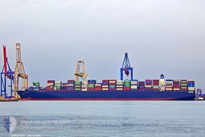
COSCO FAITH
Container Ship
Current Trip
PANAMA CANAL
| Time Travelled | 2 days |
|---|---|
| Remaining Time | --- |
| Distance Travelled | 1000.09 nm |
| Remaining Distance | --- |
| AVG Speed | 14.8 Knots |
| MAX Speed | 19.9 Knots |
| AVG Wind | 9.4 knots |
| MAX Wind | 21 knots |
| MIN Temp | 24.5°C / 76.1°F |
| MAX Temp | 29.4°C / 84.92°F |
| Draught | 12.9 m |
| Position Received | 1 d ago |
Current Position
| Longitude | -77.63373° |
|---|---|
| Latitude | 28.09076° |
| Status | Under way using engine |
| Speed | 17 Knots |
| Course | 146.9° |
| Area | North Atlantic Ocean |
| Station | T-AIS |
| Position Received | 1 d ago |
Info
Information
The current position of COSCO FAITH is in North Atlantic Ocean with coordinates 28.09076° / -77.63373° as reported on 2024-06-25 02:17 by AIS to our vessel tracker app. The vessel's current speed is 17 Knots
The vessel COSCO FAITH (IMO: 9472141, MMSI: 477108100) is a Container Ship that was built in 2012 ( 12 years old ). It's sailing under the flag of [HK] Hong Kong.
In this page you can find informations about the vessels current position, last detected port calls, and current voyage information. If the vessels is not in coverage by AIS you will find the latest position.
The current position of COSCO FAITH is detected by our AIS receivers and we are not responsible for the reliability of the data. The last position was recorded while the vessel was in Coverage by the Ais receivers of our vessel tracking app.
The current draught of COSCO FAITH as reported by AIS is 12.9 meters
Weather
| Temperature | 29°C / 84.2°F |
|---|---|
| Wind Speed | 21 knots |
| Direction | 93° E |
| Pressure | 1014 hPa |
| Humidity | 79.7 % |
| Cloud Coverage | 34 % |
Featured Company
Last Port Calls
| Port | Arrival | Departure | Time In Port |
|---|---|---|---|
| 2024-06-22 10:00 | 2024-06-24 07:22 | 1 d | |
| 2024-06-17 20:16 | 2024-06-19 05:03 | 1 d | |
| 2024-06-13 05:40 | 2024-06-16 10:21 | 3 d | |
| 2024-05-18 05:08 | 2024-05-19 06:27 | 1 d | |
| 2024-05-14 11:24 | 2024-05-15 13:44 | 1 d | |
| 2024-05-09 22:31 | 2024-05-10 19:24 | 20 h | |
| 2024-05-03 07:09 | 2024-05-04 12:03 | 1 d | |
| 2024-04-06 04:06 | 2024-04-07 08:36 | 1 d | |
| 2024-04-02 10:29 | 2024-04-04 04:13 | 1 d | |
| 2024-04-01 05:46 |
Last Trips
| Origin | Departure | Destination | Arrival | Distance | |
|---|---|---|---|---|---|
| 2024-06-19 01:03 | 2024-06-22 06:00 | 561.80 nm | |||
| 2024-06-16 06:21 | 2024-06-17 16:16 | 324.94 nm | |||
| 2024-05-19 15:27 | 2024-06-13 01:40 | 10189.86 nm | |||
| 2024-05-15 21:44 | 2024-05-18 14:08 | 487.60 nm | |||
| 2024-05-11 03:24 | 2024-05-14 19:24 | 701.92 nm | |||
| 2024-05-04 20:03 | 2024-05-10 06:31 | 2520.39 nm | |||
| 2024-04-07 10:36 | 2024-05-03 15:09 | 11157.44 nm | |||
| 2024-04-04 06:13 | 2024-04-06 06:06 | 354.05 nm | |||
| 2024-04-01 07:46 | 2024-04-02 12:29 | 277.78 nm |
Events
| Time | Event | Details | Position / Dest | Info |
|---|---|---|---|---|
| 2024-06-25 02:28 | Status Changed | Default Under way using engine |
28.04904 / -77.60326
PANAMA CANAL
|
Speed: 17 kn Course: 146.9° |
| 2024-06-25 02:17 | Change Sea Area | Bahamas part of the North Atlantic Ocean United States part of the North Atlantic Ocean |
28.09076 / -77.63373
North Atlantic Ocean
PANAMA CANAL
|
Speed: 17 kn Course: 146.9° |
| 2024-06-25 02:17 | Status Changed | Under way using engine Default |
28.09076 / -77.63373
PANAMA CANAL
|
Speed: 16.9 kn Course: 147° |
| 2024-06-25 02:17 | OUT of Coverage |
28.09076 / -77.63373
North Atlantic Ocean
PANAMA CANAL
|
Speed: 17 kn Course: 146.9° |
|
| 2024-06-25 02:05 | IN Coverage |
28.09076 / -77.63373
North Atlantic Ocean
PANAMA CANAL
|
Speed: 17 kn Course: 146.9° |
|
| 2024-06-24 15:00 | Status Changed | Default Under way using engine |
30.89244 / -79.64812
PANAMA CANAL
|
Speed: 15.3 kn Course: 146° |
| 2024-06-24 14:53 | OUT of Coverage |
30.91665 / -79.66692
North Atlantic Ocean
PANAMA CANAL
|
Speed: 15.3 kn Course: 146° |
|
| 2024-06-24 14:46 | Status Changed | Under way using engine Default |
30.94057 / -79.68488
PANAMA CANAL
|
Speed: 15.8 kn Course: 148° |
| 2024-06-24 14:23 | Status Changed | Default Under way using engine |
31.02456 / -79.74642
PANAMA CANAL
|
Speed: 15.3 kn Course: 148° |
| 2024-06-24 14:21 | Status Changed | Under way using engine Default |
31.03457 / -79.75394
PANAMA CANAL
|
Speed: 15.5 kn Course: 149° |