
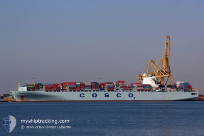
COSCO HELLAS
Container Ship
Current Trip
| Time Travelled | 10 days |
|---|---|
| Remaining Time | --- |
| Distance Travelled | 2085.25 nm |
| Remaining Distance | 6115.23 nm |
| AVG Speed | 17.6 Knots |
| MAX Speed | 21.6 Knots |
| AVG Wind | 12 knots |
| MAX Wind | 20.8 knots |
| MIN Temp | 6.3°C / 43.34°F |
| MAX Temp | 22.5°C / 72.5°F |
| Draught | 14 m |
| Position Received | 8 d ago |
Current Position
| Longitude | 141.62708° |
|---|---|
| Latitude | 41.65635° |
| Status | Under way using engine |
| Speed | 19.5 Knots |
| Course | 94° |
| Area | North Pacific Ocean |
| Station | T-AIS |
| Position Received | 8 d ago |
Info
Information
The current position of COSCO HELLAS is in North Pacific Ocean with coordinates 41.65635° / 141.62708° as reported on 2024-06-17 09:33 by AIS to our vessel tracker app. The vessel's current speed is 19.5 Knots and is heading at the port of BALBOA. The estimated time of arrival as calculated by vessel tracking app is 2024-07-05 08:00 LT
The vessel COSCO HELLAS (IMO: 9308510, MMSI: 256932000) is a Container Ship that was built in 2006 ( 18 years old ). It's sailing under the flag of [MT] Malta.
In this page you can find informations about the vessels current position, last detected port calls, and current voyage information. If the vessels is not in coverage by AIS you will find the latest position.
The current position of COSCO HELLAS is detected by our AIS receivers and we are not responsible for the reliability of the data. The last position was recorded while the vessel was in Coverage by the Ais receivers of our vessel tracking app.
The current draught of COSCO HELLAS as reported by AIS is 14 meters
Weather
| Temperature | 6.7°C / 44.06°F |
|---|---|
| Wind Speed | 12 knots |
| Direction | 87° E |
| Pressure | 1012 hPa |
| Humidity | 92.2 % |
| Cloud Coverage | 100 % |
Featured Company
Last Port Calls
| Port | Arrival | Departure | Time In Port |
|---|---|---|---|
| 2024-06-14 18:05 | 2024-06-15 15:46 | 21 h | |
| 2024-06-10 18:33 | 2024-06-11 11:10 | 16 h | |
| 2024-06-08 09:48 | 2024-06-09 07:13 | 21 h | |
| 2024-05-31 11:39 | 2024-06-01 05:46 | 18 h | |
| 2024-05-24 16:34 | 2024-05-25 20:49 | 1 d | |
| 2024-04-22 12:42 | 2024-04-24 07:42 | 1 d | |
| 2024-04-18 10:51 | 2024-04-20 14:41 | 2 d | |
| 2024-04-16 16:56 | 2024-04-17 09:18 | 16 h | |
| 2024-04-13 23:57 | 2024-04-15 10:55 | 1 d | |
| 2024-04-12 09:09 | 2024-04-13 09:50 | 1 d |
Most Visited Ports (Last year)
| Port | Arrivals | |
|---|---|---|
| 5 | ||
| 4 | ||
| 4 | ||
| 4 | ||
| 4 | ||
| 4 |
Last Trips
| Origin | Departure | Destination | Arrival | Distance | |
|---|---|---|---|---|---|
| 2024-06-11 19:10 | 2024-06-15 03:05 | 610.17 nm | |||
| 2024-06-09 15:13 | 2024-06-11 02:33 | 475.27 nm | |||
| 2024-06-01 13:46 | 2024-06-08 17:48 | 962.94 nm | |||
| 2024-05-26 04:49 | 2024-05-31 19:39 | 1573.37 nm | |||
| 2024-04-24 03:42 | 2024-05-25 00:34 | 11695.65 nm | |||
| 2024-04-20 09:41 | 2024-04-22 08:42 | 458.64 nm | |||
| 2024-04-17 04:18 | 2024-04-18 05:51 | 476.62 nm | |||
| 2024-04-15 05:55 | 2024-04-16 11:56 | 298.48 nm | |||
| 2024-04-13 04:50 | 2024-04-13 18:57 | 50.20 nm | |||
| 2024-04-07 04:26 | 2024-04-12 04:09 | 1774.92 nm |
Events
| Time | Event | Details | Position / Dest | Info |
|---|---|---|---|---|
| 2024-06-17 09:37 | Status Changed | Default Under way using engine |
41.65435 / 141.66179
PABLB
|
Speed: 19.5 kn Course: 94° |
| 2024-06-17 09:33 | OUT of Coverage |
41.65635 / 141.62708
North Pacific Ocean
PABLB
|
Speed: 19.5 kn Course: 94° |
|
| 2024-06-17 09:22 | Status Changed | Under way using engine Default |
41.66002 / 141.55033
PABLB
|
Speed: 20.7 kn Course: 91° |
| 2024-06-17 09:09 | Status Changed | Default Under way using engine |
41.66167 / 141.45344
PABLB
|
Speed: 21 kn Course: 90° |
| 2024-06-17 08:47 | Change Sea Area | Japanese part of the North Pacific Ocean Japanese part of the Japan Sea |
41.65528 / 141.28585
North Pacific Ocean
PABLB
|
Speed: 19.4 kn Course: 78° |
| 2024-06-17 08:22 | Status Changed | Under way using engine Default |
41.63807 / 141.11085
PABLB
|
Speed: 20.9 kn Course: 86° |
| 2024-06-17 08:16 | Status Changed | Default Under way using engine |
41.63635 / 141.06769
PABLB
|
Speed: 21.1 kn Course: 83° |
| 2024-06-17 08:09 | Status Changed | Under way using engine Default |
41.63273 / 141.01302
PABLB
|
Speed: 21.1 kn Course: 82° |
| 2024-06-17 07:37 | Status Changed | Default Under way using engine |
41.59395 / 140.77586
PABLB
|
Speed: 19.9 kn Course: 74° |
| 2024-06-17 07:18 | Status Changed | Under way using engine Default |
41.54988 / 140.64327
PABLB
|
Speed: 19.2 kn Course: 52° |