
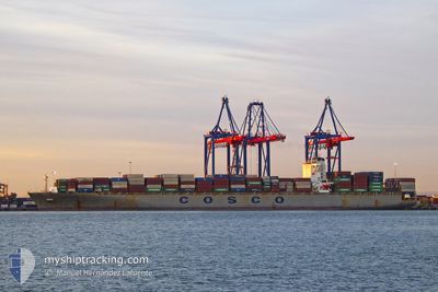
COSCO MALAYSIA
Container Ship
Current Trip
| Time Travelled | 13 days |
|---|---|
| Remaining Time | --- |
| Distance Travelled | 5905.26 nm |
| Remaining Distance | 517.50 nm |
| AVG Speed | 18 Knots |
| MAX Speed | 21.8 Knots |
| AVG Wind | 10.8 knots |
| MAX Wind | 23.9 knots |
| MIN Temp | 7.9°C / 46.22°F |
| MAX Temp | 26.2°C / 79.16°F |
| Draught | 12.5 m |
| Position Received | 9 d ago |
Current Position
| Longitude | 141.81961° |
|---|---|
| Latitude | 35.42920° |
| Status | Under way using engine |
| Speed | 18.2 Knots |
| Course | 60.1° |
| Area | North Pacific Ocean |
| Station | T-AIS |
| Position Received | 9 d ago |
Info
Information
The current position of COSCO MALAYSIA is in North Pacific Ocean with coordinates 35.42920° / 141.81961° as reported on 2024-05-21 20:44 by AIS to our vessel tracker app. The vessel's current speed is 18.2 Knots and is heading at the port of LOS ANGELES. The estimated time of arrival as calculated by vessel tracking app is 2024-06-02 13:00 LT
The vessel COSCO MALAYSIA (IMO: 9448774, MMSI: 477770700) is a Container Ship that was built in 2010 ( 14 years old ). It's sailing under the flag of [HK] Hong Kong.
In this page you can find informations about the vessels current position, last detected port calls, and current voyage information. If the vessels is not in coverage by AIS you will find the latest position.
The current position of COSCO MALAYSIA is detected by our AIS receivers and we are not responsible for the reliability of the data. The last position was recorded while the vessel was in Coverage by the Ais receivers of our vessel tracking app.
The current draught of COSCO MALAYSIA as reported by AIS is 12.5 meters
Weather
| Temperature | 14.4°C / 57.92°F |
|---|---|
| Wind Speed | 20 knots |
| Direction | 336° NNW |
| Pressure | 1022.1 hPa |
| Humidity | 86.9 % |
| Cloud Coverage | --- |
Featured Company
Last Port Calls
| Port | Arrival | Departure | Time In Port |
|---|---|---|---|
| 2024-05-17 07:39 | 2024-05-18 01:59 | 18 h | |
| 2024-05-11 17:11 | 2024-05-12 18:44 | 1 d | |
| 2024-04-08 02:56 | 2024-04-09 12:30 | 1 d | |
| 2024-04-06 09:51 | 2024-04-07 02:03 | 16 h | |
| 2024-03-31 13:21 | 2024-04-02 21:31 | 2 d | |
| 2024-03-01 11:16 | 2024-03-02 01:12 | 13 h |
Last Trips
| Origin | Departure | Destination | Arrival | Distance | |
|---|---|---|---|---|---|
| 2024-05-13 02:44 | 2024-05-17 15:39 | 1075.13 nm | |||
| 2024-04-09 08:30 | 2024-05-12 01:11 | 10067.39 nm | |||
| 2024-04-06 21:03 | 2024-04-07 22:56 | 391.35 nm | |||
| 2024-04-02 16:31 | 2024-04-06 04:51 | 656.28 nm | |||
| 2024-03-02 09:12 | 2024-03-31 08:21 | 11047.58 nm | |||
| 2024-02-26 14:23 | 2024-03-01 19:16 | 1027.76 nm |
Events
| Time | Event | Details | Position / Dest | Info |
|---|---|---|---|---|
| 2024-05-21 20:47 | Status Changed | Default Under way using engine |
35.43814 / 141.83896
LONG BEACH
|
Speed: 18.2 kn Course: 60.1° |
| 2024-05-21 20:44 | Status Changed | Under way using engine Default |
35.42920 / 141.81961
LONG BEACH
|
Speed: 18.7 kn Course: 60° |
| 2024-05-21 20:44 | OUT of Coverage |
35.42920 / 141.81961
North Pacific Ocean
LONG BEACH
|
Speed: 18.2 kn Course: 60.1° |
|
| 2024-05-21 20:20 | Status Changed | Default Under way using engine |
35.36738 / 141.68715
LONG BEACH
|
Speed: 19 kn Course: 60° |
| 2024-05-21 19:58 | Status Changed | Under way using engine Default |
35.30924 / 141.56445
LONG BEACH
|
Speed: 19 kn Course: 60° |
| 2024-05-21 19:52 | Status Changed | Default Under way using engine |
35.29533 / 141.53545
LONG BEACH
|
Speed: 19 kn Course: 62.7° |