
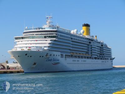
COSTA DELIZIOSA
Passengers Ship
Current Trip
| Time Travelled | 6 h, 17 mins |
|---|---|
| Remaining Time | 1 day |
| Distance Travelled | 108.41 nm |
| Remaining Distance | 460.02 nm |
| AVG Speed | 17.6 Knots |
| MAX Speed | 18 Knots |
| AVG Wind | 11.6 knots |
| MAX Wind | 14.4 knots |
| MIN Temp | 22.8°C / 73.04°F |
| MAX Temp | 29.5°C / 85.1°F |
| Draught | 8.1 m |
| Position Received | Now |
Current Position
| Longitude | 18.73667° |
|---|---|
| Latitude | 40.17683° |
| Status | Under way using engine |
| Speed | 17.1 Knots |
| Course | 144° |
| Area | Adriatic Sea |
| Station | T-AIS |
| Position Received | Now |
Info
Information
The current position of COSTA DELIZIOSA is in Adriatic Sea with coordinates 40.17683° / 18.73667° as reported on 2024-06-10 00:42 by AIS to our vessel tracker app. The vessel's current speed is 17.1 Knots and is heading at the port of MYKONOS. The estimated time of arrival as calculated by vessel tracking app is 2024-06-11 02:37 LT
The vessel COSTA DELIZIOSA (IMO: 9398917, MMSI: 247282900) is a Passengers Ship that was built in 2010 ( 14 years old ). It's sailing under the flag of [IT] Italy.
In this page you can find informations about the vessels current position, last detected port calls, and current voyage information. If the vessels is not in coverage by AIS you will find the latest position.
The current position of COSTA DELIZIOSA is detected by our AIS receivers and we are not responsible for the reliability of the data. The last position was recorded while the vessel was in Coverage by the Ais receivers of our vessel tracking app.
The current draught of COSTA DELIZIOSA as reported by AIS is 8.1 meters
Weather
| Temperature | 22.8°C / 73.04°F |
|---|---|
| Wind Speed | 14 knots |
| Direction | 156° SSE |
| Pressure | 1009.6 hPa |
| Humidity | 82.5 % |
| Cloud Coverage | 82 % |
Featured Company
Last Port Calls
| Port | Arrival | Departure | Time In Port |
|---|---|---|---|
| 2024-06-09 11:12 | 2024-06-09 18:25 | 7 h | |
| 2024-06-08 04:42 | 2024-06-08 15:58 | 11 h | |
| 2024-06-06 08:18 | 2024-06-06 15:31 | 7 h | |
| 2024-06-05 03:39 | 2024-06-05 15:41 | 12 h | |
| 2024-06-02 11:21 | 2024-06-02 18:18 | 6 h | |
| 2024-06-01 04:33 | 2024-06-01 15:58 | 11 h | |
| 2024-05-30 08:01 | 2024-05-30 15:20 | 7 h | |
| 2024-05-29 03:30 | 2024-05-29 15:31 | 12 h | |
| 2024-05-26 11:15 | 2024-05-26 18:28 | 7 h | |
| 2024-05-25 05:19 | 2024-05-25 15:53 | 10 h |
Last Trips
| Origin | Departure | Destination | Arrival | Distance | |
|---|---|---|---|---|---|
| 2024-06-08 17:58 | 2024-06-09 13:12 | 332.95 nm | |||
| 2024-06-06 18:31 | 2024-06-08 06:42 | 636.63 nm | |||
| 2024-06-05 18:41 | 2024-06-06 11:18 | 235.18 nm | |||
| 2024-06-02 20:18 | 2024-06-05 06:39 | 709.95 nm | |||
| 2024-06-01 17:58 | 2024-06-02 13:21 | 333.29 nm | |||
| 2024-05-30 18:20 | 2024-06-01 06:33 | 641.45 nm | |||
| 2024-05-29 18:31 | 2024-05-30 11:01 | 248.99 nm | |||
| 2024-05-26 20:28 | 2024-05-29 06:30 | 706.59 nm | |||
| 2024-05-25 17:53 | 2024-05-26 13:15 | 333.21 nm | |||
| 2024-05-24 13:12 | 2024-05-25 07:19 | 337.08 nm |
Events
| Time | Event | Details | Position / Dest | Info |
|---|---|---|---|---|
| 2024-06-09 19:30 | ETA Changed | 2024/06/11 03:42 2024/06/11 06:42 |
41.10109 / 17.20055
GRJMK - MYKONOS
|
Speed: 17.5 kn Course: 115° |
| 2024-06-09 19:26 | Status Changed | Under way using engine Default |
41.10833 / 17.18014
GRJMK - MYKONOS
|
Speed: 17.5 kn Course: 115° |
| 2024-06-09 19:18 | Status Changed | Default Under way using engine |
41.12426 / 17.13534
GRJMK - MYKONOS
|
Speed: 17.5 kn Course: 114.7° |
| 2024-06-09 19:16 | Status Changed | Under way using engine Default |
41.12996 / 17.11911
GRJMK - MYKONOS
|
Speed: 17.4 kn Course: 115° |
| 2024-06-09 19:01 | Status Changed | Default Under way using engine |
41.15565 / 17.03175
GRJMK - MYKONOS
|
Speed: 17.4 kn Course: 109.9° |
| 2024-06-09 18:57 | Status Changed | Under way using engine Default |
41.16156 / 17.01015
GRJMK - MYKONOS
|
Speed: 17.3 kn Course: 110° |
| 2024-06-09 18:45 | Status Changed | Default Under way using engine |
41.18247 / 16.93438
GRJMK - MYKONOS
|
Speed: 16.5 kn Course: 92.1° |
| 2024-06-09 18:33 | Status Changed | Under way using engine Default |
41.17777 / 16.86682
GRJMK - MYKONOS
|
Speed: 11 kn Course: 16° |
| 2024-06-09 18:25 | PORT DEPARTURE |
|
41.15463 / 16.84528
GRJMK - MYKONOS
|
Speed: 10.1 kn Course: 307° |
| 2024-06-09 18:21 | Status Changed | Default Under way using engine |
41.14496 / 16.84945
[IT] BARI
|
Speed: 3.5 kn Course: 280° |