
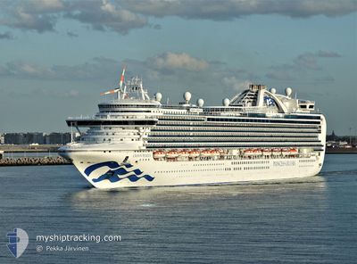
CROWN PRINCESS
Passengers Ship
Current Trip
| Time Travelled | 2 days |
|---|---|
| Remaining Time | 3 h, 56 mins |
| Distance Travelled | 1108.08 nm |
| Remaining Distance | 86.52 nm |
| AVG Speed | 17.9 Knots |
| MAX Speed | 22 Knots |
| AVG Wind | 14.5 knots |
| MAX Wind | 29.8 knots |
| MIN Temp | 6.8°C / 44.24°F |
| MAX Temp | 14.6°C / 58.28°F |
| Draught | 8.8 m |
| Position Received | Now |
Current Position
| Longitude | -131.06477° |
|---|---|
| Latitude | 54.13696° |
| Status | Under way using engine |
| Speed | 20.4 Knots |
| Course | 358.4° |
| Area | The Coastal Waters of Southeast Alaska and British Columbia |
| Station | T-AIS |
| Position Received | Now |
Info
Information
The current position of CROWN PRINCESS is in The Coastal Waters of Southeast Alaska and British Columbia with coordinates 54.13696° / -131.06477° as reported on 2024-05-18 08:30 by AIS to our vessel tracker app. The vessel's current speed is 20.4 Knots and is heading at the port of KETCHIKAN. The estimated time of arrival as calculated by vessel tracking app is 2024-05-18 12:27 LT
The vessel CROWN PRINCESS (IMO: 9293399, MMSI: 310500000) is a Passengers Ship that was built in 2006 ( 18 years old ). It's sailing under the flag of [BM] Bermuda.
In this page you can find informations about the vessels current position, last detected port calls, and current voyage information. If the vessels is not in coverage by AIS you will find the latest position.
The current position of CROWN PRINCESS is detected by our AIS receivers and we are not responsible for the reliability of the data. The last position was recorded while the vessel was in Coverage by the Ais receivers of our vessel tracking app.
The current draught of CROWN PRINCESS as reported by AIS is 8.8 meters
Weather
| Temperature | 7.6°C / 45.68°F |
|---|---|
| Wind Speed | 6 knots |
| Direction | 290° WNW |
| Pressure | 1019.9 hPa |
| Humidity | 69.4 % |
| Cloud Coverage | 100 % |
Featured Company
Last Port Calls
| Port | Arrival | Departure | Time In Port |
|---|---|---|---|
| 2024-05-15 13:08 | 2024-05-15 23:38 | 10 h | |
| 2024-05-12 20:14 | 2024-05-13 05:10 | 8 h | |
| 2024-05-09 16:26 | 2024-05-10 01:38 | 9 h | |
| 2024-05-08 16:26 | 2024-05-09 08:18 | 15 h | |
| 2024-05-07 13:22 | 2024-05-07 23:02 | 9 h | |
| 2024-05-04 13:40 | 2024-05-04 23:25 | 9 h | |
| 2024-05-01 14:30 | 2024-05-02 05:43 | 15 h | |
| 2024-04-30 15:30 | 2024-05-01 03:32 | 12 h | |
| 2024-04-29 12:44 | 2024-04-29 22:51 | 10 h | |
| 2024-04-27 13:39 | 2024-04-27 23:24 | 9 h |
Last Trips
| Origin | Departure | Destination | Arrival | Distance | |
|---|---|---|---|---|---|
| 2024-05-12 22:10 | 2024-05-15 06:08 | 827.13 nm | |||
| 2024-05-09 17:38 | 2024-05-12 13:14 | 1136.31 nm | |||
| 2024-05-09 00:18 | 2024-05-09 08:26 | 86.23 nm | |||
| 2024-05-07 15:02 | 2024-05-08 08:26 | 296.25 nm | |||
| 2024-05-04 16:25 | 2024-05-07 05:22 | 1196.06 nm | |||
| 2024-05-01 22:43 | 2024-05-04 06:40 | 906.53 nm | |||
| 2024-04-30 20:32 | 2024-05-01 07:30 | 165.74 nm | |||
| 2024-04-29 15:51 | 2024-04-30 08:30 | 308.19 nm | |||
| 2024-04-27 16:24 | 2024-04-29 05:44 | 611.05 nm | |||
| 2024-04-25 18:19 | 2024-04-27 06:39 | 532.56 nm |
Events
| Time | Event | Details | Position / Dest | Info |
|---|---|---|---|---|
| 2024-05-18 06:47 | Status Changed | Under way using engine Default |
53.54760 / -131.04734
USKTN
|
Speed: 20.7 kn Course: 358° |
| 2024-05-18 06:42 | Status Changed | Default Under way using engine |
53.52066 / -131.04625
USKTN
|
Speed: 20.7 kn Course: 358.9° |
| 2024-05-18 06:23 | Change Sea Area | Canadian part of the The Coastal Waters of Southeast Alaska and British Columbia United States part of the North Pacific Ocean |
53.41393 / -131.04486
The Coastal Waters of Southeast Alaska and British Columbia
USKTN
|
Speed: 20.8 kn Course: 359.9° |
| 2024-05-18 06:23 | Status Changed | Under way using engine Default |
53.41393 / -131.04486
USKTN
|
Speed: 21 kn Course: 358° |
| 2024-05-18 06:23 | IN Coverage |
53.41393 / -131.04486
The Coastal Waters of Southeast Alaska and British Columbia
USKTN
|
Speed: 20.8 kn Course: 359.9° |
|
| 2024-05-16 10:02 | Status Changed | Default Under way using engine |
39.11333 / -124.45167
USKTN
|
Speed: 20.6 kn Course: 339.5° |
| 2024-05-16 09:57 | OUT of Coverage |
39.08960 / -124.44024
North Pacific Ocean
USKTN
|
Speed: 20.6 kn Course: 339.5° |
|
| 2024-05-16 09:50 | Status Changed | Under way using engine Default |
39.04816 / -124.42042
USKTN
|
Speed: 20.7 kn Course: 340° |
| 2024-05-16 09:41 | IN Coverage |
39.06089 / -124.42645
North Pacific Ocean
USKTN
|
Speed: 20.2 kn Course: 339.8° |
|
| 2024-05-16 08:10 | OUT of Coverage |
38.51322 / -124.16561
North Pacific Ocean
USKTN
|
Speed: 20.6 kn Course: 339.7° |