
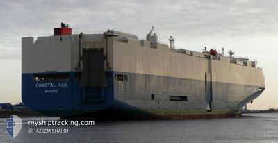
CRYSTAL ACE
Vehicles Carrier
Current Trip
BRVIT
| Time Travelled | 3 days |
|---|---|
| Remaining Time | --- |
| Distance Travelled | 1394.06 nm |
| Remaining Distance | --- |
| AVG Speed | 16.5 Knots |
| MAX Speed | 19.3 Knots |
| AVG Wind | 13 knots |
| MAX Wind | 22.2 knots |
| MIN Temp | 27°C / 80.6°F |
| MAX Temp | 29°C / 84.2°F |
| Draught | 9.2 m |
| Position Received | 2 d ago |
Current Position
| Longitude | -69.19655° |
|---|---|
| Latitude | 13.19548° |
| Status | Under way using engine |
| Speed | 17.6 Knots |
| Course | 91.6° |
| Area | Caribbean Sea |
| Station | T-AIS |
| Position Received | 2 d ago |
Info
Information
The current position of CRYSTAL ACE is in Caribbean Sea with coordinates 13.19548° / -69.19655° as reported on 2024-05-17 01:23 by AIS to our vessel tracker app. The vessel's current speed is 17.6 Knots
The vessel CRYSTAL ACE (IMO: 9539224, MMSI: 538004619) is a Vehicles Carrier that was built in 2012 ( 12 years old ). It's sailing under the flag of [MH] Marshall Is.
In this page you can find informations about the vessels current position, last detected port calls, and current voyage information. If the vessels is not in coverage by AIS you will find the latest position.
The current position of CRYSTAL ACE is detected by our AIS receivers and we are not responsible for the reliability of the data. The last position was recorded while the vessel was in Coverage by the Ais receivers of our vessel tracking app.
The current draught of CRYSTAL ACE as reported by AIS is 9.2 meters
Weather
| Temperature | 27.5°C / 81.5°F |
|---|---|
| Wind Speed | 16 knots |
| Direction | 80° E |
| Pressure | 1012.4 hPa |
| Humidity | 78.4 % |
| Cloud Coverage | 100 % |
Featured Company
Last Port Calls
| Port | Arrival | Departure | Time In Port |
|---|---|---|---|
| 2024-05-15 09:49 | 2024-05-15 23:06 | 13 h | |
| 2024-05-10 11:26 | 2024-05-11 22:56 | 1 d | |
| 2024-05-07 00:46 | 2024-05-07 17:42 | 16 h | |
| 2024-05-04 00:10 | 2024-05-04 22:24 | 22 h | |
| 2024-05-02 06:56 | 2024-05-02 21:03 | 14 h | |
| 2024-04-24 15:10 | 2024-04-26 09:18 | 1 d | |
| 2024-04-22 10:06 | 2024-04-22 18:39 | 8 h | |
| 2024-03-30 05:26 | 2024-03-31 16:02 | 1 d | |
| 2024-03-27 21:49 | 2024-03-28 21:23 | 23 h | |
| 2024-03-26 21:05 | 2024-03-27 14:25 | 17 h |
Most Visited Ports (Last year)
| Port | Arrivals | |
|---|---|---|
| 3 | ||
| 3 | ||
| 3 | ||
| 3 | ||
| 2 | ||
| 2 |
Last Trips
| Origin | Departure | Destination | Arrival | Distance | |
|---|---|---|---|---|---|
| 2024-05-11 18:56 | 2024-05-15 04:49 | 1433.70 nm | |||
| 2024-05-07 13:42 | 2024-05-10 07:26 | 305.01 nm | |||
| 2024-05-04 18:24 | 2024-05-06 20:46 | 636.59 nm | |||
| 2024-05-02 17:03 | 2024-05-03 20:10 | 280.12 nm | |||
| 2024-04-26 04:18 | 2024-05-02 02:56 | 1768.70 nm | |||
| 2024-04-22 14:39 | 2024-04-24 10:10 | 475.91 nm | |||
| 2024-04-01 01:02 | 2024-04-22 06:06 | 8606.16 nm | |||
| 2024-03-29 06:23 | 2024-03-30 14:26 | 534.11 nm | |||
| 2024-03-27 23:25 | 2024-03-28 06:49 | 95.27 nm | |||
| 2024-03-26 16:26 | 2024-03-27 06:05 | 174.77 nm |
Events
| Time | Event | Details | Position / Dest | Info |
|---|---|---|---|---|
| 2024-05-17 01:27 | Status Changed | Default Under way using engine |
13.19493 / -69.17693
BRVIT
|
Speed: 17.6 kn Course: 91.6° |
| 2024-05-17 01:23 | Change Sea Area | Cura�aoan part of the Caribbean Sea Colombian part of the Caribbean Sea |
13.19548 / -69.19655
Caribbean Sea
BRVIT
|
Speed: 17.6 kn Course: 91.6° |
| 2024-05-17 01:23 | OUT of Coverage |
13.19548 / -69.19655
Caribbean Sea
BRVIT
|
Speed: 17.6 kn Course: 91.6° |
|
| 2024-05-17 01:22 | Status Changed | Under way using engine Default |
13.19561 / -69.20147
BRVIT
|
Speed: 17.6 kn Course: 92° |
| 2024-05-17 01:22 | IN Coverage |
13.19548 / -69.19655
Caribbean Sea
BRVIT
|
Speed: 17.6 kn Course: 91.6° |
|
| 2024-05-16 05:53 | Status Changed | Default Under way using engine |
11.53455 / -74.60023
BRVIT
|
Speed: 18.2 kn Course: 61.9° |
| 2024-05-16 05:49 | OUT of Coverage |
11.52371 / -74.62074
Caribbean Sea
BRVIT
|
Speed: 18.2 kn Course: 61.9° |
|
| 2024-05-16 03:06 | Status Changed | Under way using engine Default |
11.06060 / -75.32678
BRVIT
|
Speed: 19 kn Course: 62° |
| 2024-05-16 02:56 | Status Changed | Default Under way using engine |
11.03571 / -75.37108
BRVIT
|
Speed: 19.1 kn Course: 62.5° |
| 2024-05-16 00:03 | ETA Changed | 2024/05/25 01:00 2024/05/24 21:00 |
10.32768 / -75.64892
BRVIT
|
Speed: 10.2 kn Course: 286.1° |