
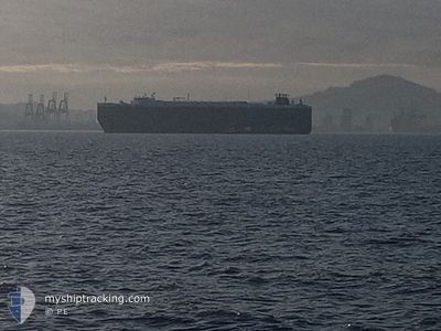
CRYSTAL RAY
Ro-Ro/Passenger Ship
Current Trip
| Time Travelled | 2 days |
|---|---|
| Remaining Time | --- |
| Distance Travelled | 465.46 nm |
| Remaining Distance | --- |
| AVG Speed | 12.1 Knots |
| MAX Speed | 19.2 Knots |
| AVG Wind | 17 knots |
| MAX Wind | 27 knots |
| MIN Temp | 12.2°C / 53.96°F |
| MAX Temp | 15.9°C / 60.62°F |
| Draught | 9.2 m |
| Position Received | Now |
Current Position
| Longitude | 2.23293° |
|---|---|
| Latitude | 51.59672° |
| Status | Under way using engine |
| Speed | 13.5 Knots |
| Course | 222.4° |
| Area | North Sea |
| Station | T-AIS |
| Position Received | Now |
Info
Information
The current position of CRYSTAL RAY is in North Sea with coordinates 51.59672° / 2.23293° as reported on 2024-06-18 13:22 by AIS to our vessel tracker app. The vessel's current speed is 13.5 Knots and is heading at the port of CRISTOBAL. The estimated time of arrival as calculated by vessel tracking app is 2024-07-02 23:00 LT
The vessel CRYSTAL RAY (IMO: 9210440, MMSI: 311039000) is a Ro-Ro/Passenger Ship that was built in 2000 ( 24 years old ). It's sailing under the flag of [BS] Bahamas.
In this page you can find informations about the vessels current position, last detected port calls, and current voyage information. If the vessels is not in coverage by AIS you will find the latest position.
The current position of CRYSTAL RAY is detected by our AIS receivers and we are not responsible for the reliability of the data. The last position was recorded while the vessel was in Coverage by the Ais receivers of our vessel tracking app.
The current draught of CRYSTAL RAY as reported by AIS is 9.2 meters
Weather
| Temperature | 15.2°C / 59.36°F |
|---|---|
| Wind Speed | 6 knots |
| Direction | 41° NE |
| Pressure | 1013.6 hPa |
| Humidity | 85.1 % |
| Cloud Coverage | 100 % |
Featured Company
Last Port Calls
| Port | Arrival | Departure | Time In Port |
|---|---|---|---|
| 2024-06-15 03:30 | 2024-06-15 17:26 | 13 h | |
| 2024-06-15 02:09 | 2024-06-15 03:05 | 55 m | |
| 2024-06-13 18:31 | 2024-06-14 17:52 | 23 h | |
| 2024-06-12 02:09 | 2024-06-12 15:09 | 12 h | |
| 2024-06-08 20:40 | 2024-06-10 23:34 | 2 d | |
| 2024-06-07 15:40 | 2024-06-08 16:08 | 1 d | |
| 2024-05-20 21:55 | 2024-06-06 12:02 | 16 d | |
| 2024-05-09 05:02 | 2024-05-12 10:40 | 3 d | |
| 2024-05-05 14:30 | 2024-05-05 21:47 | 7 h | |
| 2024-05-01 19:28 | 2024-05-04 13:48 | 2 d |
Most Visited Ports (Last year)
| Port | Arrivals | |
|---|---|---|
| 3 | ||
| 3 | ||
| 2 | ||
| 2 | ||
| 2 | ||
| 2 |
Last Trips
| Origin | Departure | Destination | Arrival | Distance | |
|---|---|---|---|---|---|
| 2024-06-15 05:05 | 2024-06-15 05:30 | 0.94 nm | |||
| 2024-06-14 19:52 | 2024-06-15 04:09 | 96.50 nm | |||
| 2024-06-12 17:09 | 2024-06-13 20:31 | 354.91 nm | |||
| 2024-06-11 01:34 | 2024-06-12 04:09 | 144.56 nm | |||
| 2024-06-08 18:08 | 2024-06-08 22:40 | 67.06 nm | |||
| 2024-06-06 13:02 | 2024-06-07 17:40 | 374.60 nm | |||
| 2024-05-12 13:40 | 2024-05-20 22:55 | 3238.39 nm | |||
| 2024-05-05 23:47 | 2024-05-09 08:02 | 1149.31 nm | |||
| 2024-05-04 15:48 | 2024-05-05 16:30 | 351.19 nm | |||
| 2024-04-02 16:55 | 2024-05-01 21:28 | 10350.00 nm |
Events
| Time | Event | Details | Position / Dest | Info |
|---|---|---|---|---|
| 2024-06-18 13:20 | Detected in Sea | United Kingdom part of the North Sea |
51.60222 / 2.24108
North Sea
PA CTB
|
Speed: 13.4 kn Course: 222.7° |
| 2024-06-18 11:56 | Change Sea Area | Belgian part of the North Sea Dutch part of the North Sea |
51.84265 / 2.56704
North Sea
PA CTB
|
Speed: 13.2 kn Course: 215.6° |
| 2024-06-18 08:26 | Status Changed | Under way using engine Default |
52.48117 / 3.31555
PA CTB
|
Speed: 15 kn Course: 215° |
| 2024-06-18 08:10 | Status Changed | Default Under way using engine |
52.53545 / 3.37730
PA CTB
|
Speed: 15.1 kn Course: 214.9° |
| 2024-06-18 08:08 | Status Changed | Under way using engine Default |
52.54157 / 3.38434
PA CTB
|
Speed: 15 kn Course: 215° |
| 2024-06-18 07:46 | Status Changed | Default Under way using engine |
52.61764 / 3.47327
PA CTB
|
Speed: 15.2 kn Course: 215.8° |
| 2024-06-18 07:38 | Status Changed | Under way using engine Default |
52.64384 / 3.50420
PA CTB
|
Speed: 15.2 kn Course: 218° |
| 2024-06-18 07:38 | IN Coverage |
52.64384 / 3.50420
North Sea
PA CTB
|
Speed: 15.2 kn Course: 215.9° |
|
| 2024-06-18 06:07 | Status Changed | Default Under way using engine |
52.94438 / 3.90839
PA CTB
|
Speed: 15.2 kn Course: 222.5° |
| 2024-06-18 06:06 | OUT of Coverage |
52.94967 / 3.91651
North Sea
PA CTB
|
Speed: 15.2 kn Course: 222.5° |