
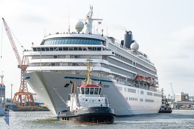
CRYSTAL SYMPHONY
Passengers Ship
Current Trip
ITPTF
| Time Travelled | 6 h, 23 mins |
|---|---|
| Remaining Time | --- |
| Distance Travelled | 85.47 nm |
| Remaining Distance | --- |
| AVG Speed | 14.3 Knots |
| MAX Speed | 16.5 Knots |
| AVG Wind | 9.3 knots |
| MAX Wind | 15.4 knots |
| MIN Temp | 18.8°C / 65.84°F |
| MAX Temp | 19.8°C / 67.64°F |
| Draught | 8 m |
| Position Received | Now |
Current Position
| Longitude | 9.06520° |
|---|---|
| Latitude | 44.12089° |
| Status | Moored |
| Speed | 13.3 Knots |
| Course | 47.7° |
| Area | Ligurian Sea |
| Station | T-AIS |
| Position Received | Now |
Info
Information
The current position of CRYSTAL SYMPHONY is in Ligurian Sea with coordinates 44.12089° / 9.06520° as reported on 2024-06-01 03:43 by AIS to our vessel tracker app. The vessel's current speed is 13.3 Knots
The vessel CRYSTAL SYMPHONY (IMO: 9066667, MMSI: 309168000) is a Passengers Ship that was built in 1995 ( 29 years old ). It's sailing under the flag of [BS] Bahamas.
In this page you can find informations about the vessels current position, last detected port calls, and current voyage information. If the vessels is not in coverage by AIS you will find the latest position.
The current position of CRYSTAL SYMPHONY is detected by our AIS receivers and we are not responsible for the reliability of the data. The last position was recorded while the vessel was in Coverage by the Ais receivers of our vessel tracking app.
The current draught of CRYSTAL SYMPHONY as reported by AIS is 8 meters
Weather
| Temperature | 19°C / 66.2°F |
|---|---|
| Wind Speed | 13 knots |
| Direction | 198° SSW |
| Pressure | 1009.4 hPa |
| Humidity | 79.5 % |
| Cloud Coverage | --- |
Featured Company
Last Port Calls
| Port | Arrival | Departure | Time In Port |
|---|---|---|---|
| 2024-05-30 17:45 | 2024-05-31 21:21 | 1 d | |
| 2024-05-28 05:17 | 2024-05-28 14:16 | 8 h | |
| 2024-05-27 03:36 | 2024-05-27 19:03 | 15 h | |
| 2024-05-26 06:09 | 2024-05-26 17:19 | 11 h | |
| 2024-05-25 04:43 | 2024-05-25 17:02 | 12 h | |
| 2024-05-24 05:11 | 2024-05-24 16:10 | 10 h | |
| 2024-05-22 05:13 | 2024-05-22 21:52 | 16 h | |
| 2024-05-21 08:50 | 2024-05-21 16:16 | 7 h | |
| 2024-05-20 04:53 | 2024-05-20 16:04 | 11 h | |
| 2024-05-18 05:05 | 2024-05-18 22:01 | 16 h |
Last Trips
| Origin | Departure | Destination | Arrival | Distance | |
|---|---|---|---|---|---|
| 2024-05-28 16:16 | 2024-05-30 19:45 | 423.38 nm | |||
| 2024-05-27 21:03 | 2024-05-28 07:17 | 146.83 nm | |||
| 2024-05-26 19:19 | 2024-05-27 05:36 | 137.04 nm | |||
| 2024-05-25 19:02 | 2024-05-26 08:09 | 142.07 nm | |||
| 2024-05-24 18:10 | 2024-05-25 06:43 | 173.29 nm | |||
| 2024-05-22 22:52 | 2024-05-24 07:11 | 447.42 nm | |||
| 2024-05-21 18:16 | 2024-05-22 06:13 | 193.05 nm | |||
| 2024-05-20 17:04 | 2024-05-21 10:50 | 289.82 nm | |||
| 2024-05-18 23:01 | 2024-05-20 05:53 | 345.72 nm | |||
| 2024-05-17 17:18 | 2024-05-18 06:05 | 207.16 nm |
Events
| Time | Event | Details | Position / Dest | Info |
|---|---|---|---|---|
| 2024-05-31 23:38 | Change Sea Area | Italian part of the Ligurian Sea Italian part of the Mediterranean Sea - Western Basin |
43.59100 / 8.01438
Ligurian Sea
ITPTF
|
Speed: 16.1 kn Course: 77.5° |
| 2024-05-31 22:32 | Change Sea Area | Italian part of the Mediterranean Sea - Western Basin French part of the Mediterranean Sea - Western Basin |
43.57929 / 7.63812
Mediterranean Sea - Western Basin
ITPTF
|
Speed: 15.5 kn Course: 135.4° |
| 2024-05-31 21:34 | Change Sea Area | French part of the Mediterranean Sea - Western Basin Mon�gasque part of the Mediterranean Sea - Western Basin |
43.72359 / 7.46120
Mediterranean Sea - Western Basin
ITPTF
|
Speed: 6.7 kn Course: 142° |
| 2024-05-31 21:25 | ETA Changed | 2024/06/01 05:00 2024/06/01 07:00 |
43.73552 / 7.44205
ITPTF
|
Speed: 7 kn Course: 116.8° |
| 2024-05-31 21:21 | START Moving | 0.79 nm, North East of MONACO |
43.73718 / 7.43584
ITPTF
|
Speed: 3.6 kn Course: 104° |
| 2024-05-31 21:21 | PORT DEPARTURE |
|
43.73718 / 7.43584
ITPTF
|
Speed: 1.8 kn Course: 58° |
| 2024-05-31 21:15 | Status Changed | Moored Default |
43.73663 / 7.43140
[MC] MONACO
|
Speed: Course: 39° |
| 2024-05-31 21:09 | Status Changed | Default Moored |
43.73631 / 7.43123
[MC] MONACO
|
Speed: Course: 39° |
| 2024-05-31 21:00 | Status Changed | Moored Default |
43.73630 / 7.43123
[MC] MONACO
|
Speed: Course: 39° |
| 2024-05-31 20:57 | Status Changed | Default Moored |
43.73630 / 7.43124
[MC] MONACO
|
Speed: Course: 39° |