
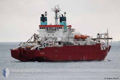
CS SOVEREIGN
Cable Layer
Current Trip
| Trip Time | 21 h, 11 mins |
|---|---|
| Trip Distance | 214.12 nm |
| AVG Speed | 9.3 Knots |
| MAX Speed | 12.9 Knots |
| Draught | 5.8 m |
| AVG Wind | 14 knots |
| MAX Wind | 18.8 knots |
| MIN Temp | 13.1°C / 55.58°F |
| MAX Temp | 15.7°C / 60.26°F |
| Position Received | 1 m ago |
Current Position
| Longitude | -2.43468° |
|---|---|
| Latitude | 50.56989° |
| Status | Moored |
| Speed | |
| Course | 269° |
| Area | English Channel |
| Station | T-AIS |
| Position Received | 1 m ago |
Info
Information
The current position of CS SOVEREIGN is in English Channel with coordinates 50.56989° / -2.43468° as reported on 2024-06-01 03:05 by AIS to our vessel tracker app. The vessel's current speed is 0 Knots and is currently inside the port of PORTLAND UK.
The vessel CS SOVEREIGN (IMO: 8918629, MMSI: 232892000) is a Cable Layer that was built in 1991 ( 33 years old ). It's sailing under the flag of [GB] United Kingdom.
In this page you can find informations about the vessels current position, last detected port calls, and current voyage information. If the vessels is not in coverage by AIS you will find the latest position.
The current position of CS SOVEREIGN is detected by our AIS receivers and we are not responsible for the reliability of the data. The last position was recorded while the vessel was in Coverage by the Ais receivers of our vessel tracking app.
The current draught of CS SOVEREIGN as reported by AIS is 5.8 meters
Weather
| Temperature | 11.3°C / 52.34°F |
|---|---|
| Wind Speed | 12 knots |
| Direction | 8° N |
| Pressure | 1024.3 hPa |
| Humidity | 81.7 % |
| Cloud Coverage | --- |
Featured Company
Last Port Calls
| Port | Arrival | Departure | Time In Port |
|---|---|---|---|
| 2024-05-26 08:38 | |||
| 2024-05-21 06:26 | 2024-05-25 11:27 | 4 d | |
| 2024-04-01 05:38 |
Most Visited Ports (Last year)
| Port | Arrivals | |
|---|---|---|
| 8 | ||
| 3 | ||
| 1 | ||
| 1 |
Last Trips
| Origin | Departure | Destination | Arrival | Distance | |
|---|---|---|---|---|---|
| 2024-05-25 13:27 | 2024-05-26 09:38 | 214.12 nm | |||
| 2024-04-01 06:38 | 2024-05-21 08:26 | 2292.84 nm |
Events
| Time | Event | Details | Position / Dest | Info |
|---|---|---|---|---|
| 2024-06-01 00:05 | ETA Changed | 2025/05/26 07:30 2024/05/26 07:30 |
50.56987 / -2.43476
[GB] PORTLAND UK
|
Speed: Course: 269° |
| 2024-05-26 09:49 | Status Changed | Moored Under way using engine |
50.57010 / -2.43467
[GB] PORTLAND UK
|
Speed: Course: 268° |
| 2024-05-26 09:06 | STOP Moving |
50.57001 / -2.43450
[GB] PORTLAND UK
|
Speed: 0.3 kn Course: 269° |
|
| 2024-05-26 08:38 | PORT ARRIVAL |
|
50.58680 / -2.41547
[GB] PORTLAND UK
|
Speed: 6.6 kn Course: 206° |
| 2024-05-26 04:58 | ETA Changed | 2024/05/26 07:30 2024/05/26 08:00 |
50.19898 / -2.86977
PORTLAND DORSET UK
|
Speed: 11.8 kn Course: 53° |
| 2024-05-26 04:19 | IN Coverage |
50.12357 / -3.02063
English Channel
PORTLAND DORSET UK
|
Speed: 11 kn Course: 54° |
|
| 2024-05-26 03:04 | OUT of Coverage |
49.99192 / -3.31026
English Channel
PORTLAND DORSET UK
|
Speed: 10.6 kn Course: 55° |
|
| 2024-05-25 23:30 | Change Sea Area | United Kingdom part of the English Channel French part of the Celtic Sea |
49.56296 / -4.10128
English Channel
PORTLAND DORSET UK
|
Speed: 11.8 kn Course: 41° |
| 2024-05-25 23:29 | IN Coverage |
49.56296 / -4.10128
English Channel
PORTLAND DORSET UK
|
Speed: 11.8 kn Course: 41° |
|
| 2024-05-25 14:10 | OUT of Coverage |
48.28474 / -5.18872
Celtic Sea
PORTLAND DORSET UK
|
Speed: 13.1 kn Course: 302° |