
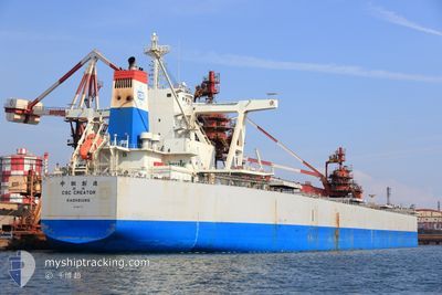
CSC CREATOR
Cargo
Current Trip
RZH CN
| Time Travelled | 32 days |
|---|---|
| Remaining Time | --- |
| Distance Travelled | 7550.10 nm |
| Remaining Distance | --- |
| AVG Speed | 12.3 Knots |
| MAX Speed | 17.1 Knots |
| AVG Wind | 10.4 knots |
| MAX Wind | 27.8 knots |
| MIN Temp | 4.6°C / 40.28°F |
| MAX Temp | 34.2°C / 93.56°F |
| Draught | 17.7 m |
| Position Received | 3 d ago |
Current Position
| Longitude | 122.32156° |
|---|---|
| Latitude | 24.78450° |
| Status | Under way using engine |
| Speed | 12.5 Knots |
| Course | 34.4° |
| Area | Philippine Sea |
| Station | T-AIS |
| Position Received | 3 d ago |
Info
Information
The current position of CSC CREATOR is in Philippine Sea with coordinates 24.78450° / 122.32156° as reported on 2024-04-29 19:39 by AIS to our vessel tracker app. The vessel's current speed is 12.5 Knots
The vessel CSC CREATOR (IMO: 9861770, MMSI: 416050000) is a Cargo It's sailing under the flag of [TW] Taiwan.
In this page you can find informations about the vessels current position, last detected port calls, and current voyage information. If the vessels is not in coverage by AIS you will find the latest position.
The current position of CSC CREATOR is detected by our AIS receivers and we are not responsible for the reliability of the data. The last position was recorded while the vessel was in Coverage by the Ais receivers of our vessel tracking app.
The current draught of CSC CREATOR as reported by AIS is 17.7 meters
Weather
| Temperature | 14.4°C / 57.92°F |
|---|---|
| Wind Speed | 12 knots |
| Direction | 121° ESE |
| Pressure | 1017.7 hPa |
| Humidity | 79.1 % |
| Cloud Coverage | 58 % |
Featured Company
Most Visited Ports (Last year)
| Port | Arrivals | |
|---|---|---|
| 7 | ||
| 5 | ||
| 4 | ||
| 2 | ||
| 1 | ||
| 1 |
Events
| Time | Event | Details | Position / Dest | Info |
|---|---|---|---|---|
| 2024-05-02 15:14 | STOP Moving | 15.69 nm, East of RIZHAO |
35.26857 / 119.84814
RZH CN
|
Speed: 0.2 kn Course: 51° |
| 2024-04-29 19:44 | Status Changed | Default Under way using engine |
24.80114 / 122.33360
RZH CN
|
Speed: 12.5 kn Course: 34.4° |
| 2024-04-29 19:39 | Status Changed | Under way using engine Default |
24.78450 / 122.32156
RZH CN
|
Speed: 12.6 kn Course: 33° |
| 2024-04-29 19:39 | OUT of Coverage |
24.78450 / 122.32156
Philippine Sea
RZH CN
|
Speed: 12.5 kn Course: 34.4° |
|
| 2024-04-29 19:28 | Status Changed | Default Under way using engine |
24.75434 / 122.30000
RZH CN
|
Speed: 13 kn Course: 33.2° |
| 2024-04-29 19:23 | Change Sea Area | Taiwanese part of the Philippine Sea Taiwanese part of the South China Sea |
24.73708 / 122.28749
Philippine Sea
RZH CN
|
Speed: 13 kn Course: 33.2° |
| 2024-04-29 19:22 | Status Changed | Under way using engine Default |
24.73555 / 122.28638
RZH CN
|
Speed: 13.4 kn Course: 19° |
| 2024-04-29 19:08 | IN Coverage |
24.73708 / 122.28749
Philippine Sea
RZH CN
|
Speed: 13 kn Course: 33.2° |
|
| 2024-04-29 03:16 | Status Changed | Default Under way using engine |
21.11892 / 121.00702
RZH CN
|
Speed: 13.7 kn Course: 25.4° |
| 2024-04-29 03:11 | OUT of Coverage |
21.10021 / 120.99807
South China Sea
RZH CN
|
Speed: 13.7 kn Course: 25.4° |