
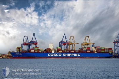
CSCL URANUS
Container Ship
Current Trip
| Time Travelled | 7 days |
|---|---|
| Remaining Time | --- |
| Distance Travelled | 2729.57 nm |
| Remaining Distance | 753.37 nm |
| AVG Speed | 15.3 Knots |
| MAX Speed | 19.3 Knots |
| AVG Wind | 7.8 knots |
| MAX Wind | 20.8 knots |
| MIN Temp | 26.6°C / 79.88°F |
| MAX Temp | 30.5°C / 86.9°F |
| Draught | 15.6 m |
| Position Received | 3 d ago |
Current Position
| Longitude | 76.34674° |
|---|---|
| Latitude | 8.44300° |
| Status | Under way using engine |
| Speed | 16.9 Knots |
| Course | 308.5° |
| Area | Laccadive Sea |
| Station | T-AIS |
| Position Received | 3 d ago |
Info
Information
The current position of CSCL URANUS is in Laccadive Sea with coordinates 8.44300° / 76.34674° as reported on 2024-05-15 05:13 by AIS to our vessel tracker app. The vessel's current speed is 16.9 Knots and is heading at the port of JEBEL ALI. The estimated time of arrival as calculated by vessel tracking app is 2024-05-19 09:00 LT
The vessel CSCL URANUS (IMO: 9467304, MMSI: 477423800) is a Container Ship that was built in 2012 ( 12 years old ). It's sailing under the flag of [HK] Hong Kong.
In this page you can find informations about the vessels current position, last detected port calls, and current voyage information. If the vessels is not in coverage by AIS you will find the latest position.
The current position of CSCL URANUS is detected by our AIS receivers and we are not responsible for the reliability of the data. The last position was recorded while the vessel was in Coverage by the Ais receivers of our vessel tracking app.
The current draught of CSCL URANUS as reported by AIS is 15.6 meters
Weather
| Temperature | 29°C / 84.2°F |
|---|---|
| Wind Speed | 12 knots |
| Direction | 281° W |
| Pressure | 1009.7 hPa |
| Humidity | 72.1 % |
| Cloud Coverage | --- |
Featured Company
Last Port Calls
| Port | Arrival | Departure | Time In Port |
|---|---|---|---|
| 2024-05-09 20:46 | 2024-05-10 18:48 | 22 h | |
| 2024-05-05 02:42 | 2024-05-06 02:10 | 23 h | |
| 2024-04-26 04:52 | 2024-04-27 16:56 | 1 d | |
| 2024-04-18 03:17 | |||
| 2024-04-08 19:40 | 2024-04-09 15:54 | 20 h | |
| 2024-04-04 05:47 | 2024-04-07 20:20 | 3 d | |
| 2024-03-30 21:37 | 2024-03-31 23:01 | 1 d | |
| 2024-03-28 15:55 | 2024-03-30 17:08 | 2 d | |
| 2024-03-17 07:08 | 2024-03-18 06:19 | 23 h | |
| 2024-03-13 00:22 | 2024-03-13 10:44 | 10 h |
Last Trips
| Origin | Departure | Destination | Arrival | Distance | |
|---|---|---|---|---|---|
| 2024-05-06 10:10 | 2024-05-10 04:46 | 1469.97 nm | |||
| 2024-04-28 00:56 | 2024-05-05 10:42 | 1470.64 nm | |||
| 2024-04-09 19:54 | 2024-04-18 11:17 | 3351.90 nm | |||
| 2024-04-07 23:20 | 2024-04-08 23:40 | 313.80 nm | |||
| 2024-04-01 03:01 | 2024-04-04 08:47 | 379.57 nm | |||
| 2024-03-30 21:08 | 2024-03-31 01:37 | 47.74 nm | |||
| 2024-03-18 14:19 | 2024-03-28 19:55 | 3495.16 nm | |||
| 2024-03-13 18:44 | 2024-03-17 15:08 | 1449.92 nm | |||
| 2024-02-24 12:07 | 2024-03-02 13:24 | 2153.12 nm |
Events
| Time | Event | Details | Position / Dest | Info |
|---|---|---|---|---|
| 2024-05-15 05:15 | Status Changed | Default Under way using engine |
8.44792 / 76.33888
SGSIN>UAEJEA
|
Speed: 16.9 kn Course: 308.5° |
| 2024-05-15 05:13 | OUT of Coverage |
8.44300 / 76.34674
Laccadive Sea
SGSIN>UAEJEA
|
Speed: 16.9 kn Course: 308.5° |
|
| 2024-05-14 23:10 | Change Sea Area | Indian part of the Laccadive Sea Malaysian part of the Malacca Strait |
7.42066 / 77.68434
Laccadive Sea
SGSIN>UAEJEA
|
Speed: 16.6 kn Course: 308.5° |
| 2024-05-14 23:09 | Status Changed | Under way using engine Default |
7.41829 / 77.68733
SGSIN>UAEJEA
|
Speed: 16.6 kn Course: 309° |
| 2024-05-14 23:09 | IN Coverage |
7.42066 / 77.68434
Laccadive Sea
SGSIN>UAEJEA
|
Speed: 16.6 kn Course: 308.5° |
|
| 2024-05-10 20:53 | Status Changed | Default Under way using engine |
1.25877 / 103.37885
SGSIN>UAEJEA
|
Speed: 15.8 kn Course: 306.1° |
| 2024-05-10 20:46 | OUT of Coverage |
1.24353 / 103.40217
Malacca Strait
SGSIN>UAEJEA
|
Speed: 15.8 kn Course: 306.1° |
|
| 2024-05-10 20:46 | Status Changed | Under way using engine Default |
1.24275 / 103.40323
SGSIN>UAEJEA
|
Speed: 15.8 kn Course: 300° |
| 2024-05-10 20:40 | Status Changed | Default Under way using engine |
1.23123 / 103.42396
SGSIN>UAEJEA
|
Speed: 15.6 kn Course: 282.8° |
| 2024-05-10 20:31 | Detected in Sea | Malaysian part of the Malacca Strait |
1.22103 / 103.46275
Malacca Strait
SGSIN>UAEJEA
|
Speed: 15.5 kn Course: 280.6° |