
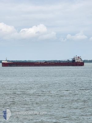
CSL NIAGARA
Self Discharging Bulk Carrier
Current Trip
TWO HARBORS
| Time Travelled | 1 day |
|---|---|
| Remaining Time | --- |
| Distance Travelled | 273.67 nm |
| Remaining Distance | --- |
| AVG Speed | 11.1 Knots |
| MAX Speed | 11.5 Knots |
| AVG Wind | 7.1 knots |
| MAX Wind | 11.9 knots |
| MIN Temp | 4.1°C / 39.38°F |
| MAX Temp | 8.6°C / 47.48°F |
| Draught | 6 m |
| Position Received | 1 d ago |
Current Position
| Longitude | -91.67781° |
|---|---|
| Latitude | 47.00354° |
| Status | Under way using engine |
| Speed | 3.7 Knots |
| Course | 30° |
| Area | Gulf of St-Lawrence |
| Station | T-AIS |
| Position Received | 1 d ago |
Info
Information
The current position of CSL NIAGARA is in Gulf of St-Lawrence with coordinates 47.00354° / -91.67781° as reported on 2024-05-28 18:19 by AIS to our vessel tracker app. The vessel's current speed is 3.7 Knots
The vessel CSL NIAGARA (IMO: 7128423, MMSI: 316029000) is a Self Discharging Bulk Carrier that was built in 1972 ( 52 years old ). It's sailing under the flag of [CA] Canada.
In this page you can find informations about the vessels current position, last detected port calls, and current voyage information. If the vessels is not in coverage by AIS you will find the latest position.
The current position of CSL NIAGARA is detected by our AIS receivers and we are not responsible for the reliability of the data. The last position was recorded while the vessel was in Coverage by the Ais receivers of our vessel tracking app.
The current draught of CSL NIAGARA as reported by AIS is 6 meters
Weather
| Temperature | 4.7°C / 40.46°F |
|---|---|
| Wind Speed | 4 knots |
| Direction | 303° WNW |
| Pressure | 1023.7 hPa |
| Humidity | 86.8 % |
| Cloud Coverage | --- |
Featured Company
Last Port Calls
| Port | Arrival | Departure | Time In Port |
|---|---|---|---|
| 2024-05-28 18:34 | 2024-05-29 06:33 | 11 h | |
| 2024-05-26 13:41 | 2024-05-26 15:20 | 1 h | |
| 2024-05-25 12:07 | 2024-05-25 14:26 | 2 h | |
| 2024-05-24 04:35 | 2024-05-24 13:04 | 8 h | |
| 2024-05-22 04:47 | 2024-05-22 05:49 | 1 h | |
| 2024-05-19 23:13 | 2024-05-20 19:57 | 20 h | |
| 2024-05-17 22:35 | 2024-05-18 00:29 | 1 h | |
| 2024-05-16 20:50 | 2024-05-16 23:28 | 2 h | |
| 2024-05-15 09:18 | 2024-05-15 10:37 | 1 h | |
| 2024-05-14 16:28 | 2024-05-15 06:23 | 13 h |
Most Visited Ports (Last year)
| Port | Arrivals | |
|---|---|---|
| 60 | ||
| 30 | ||
| 30 | ||
| 30 | ||
| 18 | ||
| 9 |
Last Trips
| Origin | Departure | Destination | Arrival | Distance | |
|---|---|---|---|---|---|
| 2024-05-26 11:20 | 2024-05-28 13:34 | 360.52 nm | |||
| 2024-05-25 10:26 | 2024-05-26 09:41 | 236.17 nm | |||
| 2024-05-24 09:04 | 2024-05-25 08:07 | 240.56 nm | |||
| 2024-05-22 01:49 | 2024-05-24 00:35 | 481.56 nm | |||
| 2024-05-20 14:57 | 2024-05-22 00:47 | 346.29 nm | |||
| 2024-05-17 20:29 | 2024-05-19 18:13 | 340.47 nm | |||
| 2024-05-16 19:28 | 2024-05-17 18:35 | 235.92 nm | |||
| 2024-05-15 06:37 | 2024-05-16 16:50 | 285.64 nm | |||
| 2024-05-15 02:23 | 2024-05-15 05:18 | 27.85 nm | |||
| 2024-05-14 09:47 | 2024-05-14 12:28 | 28.24 nm |
Events
| Time | Event | Details | Position / Dest | Info |
|---|---|---|---|---|
| 2024-05-29 06:33 | START Moving | 0.72 nm, South East of TWO HARBORS |
47.00667 / -91.65667
TWO HARBORS
|
Speed: 8 kn Course: -1° |
| 2024-05-29 06:33 | PORT DEPARTURE |
|
47.00667 / -91.65667
TWO HARBORS
|
Speed: 1 kn Course: -1° |
| 2024-05-28 18:39 | STOP Moving |
47.01167 / -91.66833
[US] TWO HARBORS
|
Speed: Course: -1° |
|
| 2024-05-28 18:34 | Status Changed | Default Under way using engine |
47.01235 / -91.66985
[US] TWO HARBORS
|
Speed: 3.7 kn Course: 30° |
| 2024-05-28 18:34 | PORT ARRIVAL |
|
47.01235 / -91.66985
[US] TWO HARBORS
|
Speed: 3.7 kn Course: 30° |
| 2024-05-28 18:19 | OUT of Coverage |
47.00354 / -91.67781
Gulf of St-Lawrence
[US] TWO HARBORS
|
Speed: 3.7 kn Course: 27.7° |
|
| 2024-05-28 18:11 | Status Changed | Under way using engine Default |
46.99251 / -91.68432
TWO HARBORS
|
Speed: 6 kn Course: 19° |
| 2024-05-28 17:57 | Status Changed | Default Under way using engine |
46.96333 / -91.69833
TWO HARBORS
|
Speed: 11.4 kn Course: 49.7° |
| 2024-05-28 15:40 | START Moving | 3.16 nm, North East of DULUTH SUPERIOR |
46.78175 / -92.02298
TWO HARBORS
|
Speed: 5.3 kn Course: 57.3° |
| 2024-05-28 15:08 | Destination Changed | TWO HARBORS DULUTH |
46.77706 / -92.02248
TWO HARBORS
|
Speed: 0.1 kn Course: 314° |