
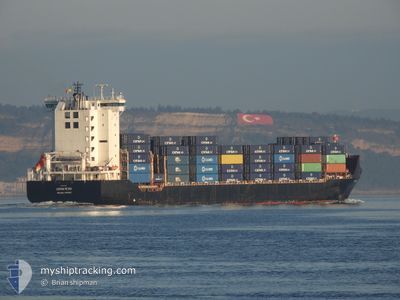
CSTAR PETER
Container Ship
Current Trip
| Time Travelled | 4 h, 57 mins |
|---|---|
| Remaining Time | --- |
| Distance Travelled | 60.70 nm |
| Remaining Distance | --- |
| AVG Speed | 13.7 Knots |
| MAX Speed | 14.4 Knots |
| AVG Wind | 8.4 knots |
| MAX Wind | 9.9 knots |
| MIN Temp | 11.6°C / 52.88°F |
| MAX Temp | 16.2°C / 61.16°F |
| Draught | 9.7 m |
| Position Received | Now |
Current Position
| Longitude | 28.16222° |
|---|---|
| Latitude | 60.15013° |
| Status | Under way using engine |
| Speed | 14 Knots |
| Course | 285.8° |
| Area | Gulf of Finland |
| Station | T-AIS |
| Position Received | Now |
Info
Information
The current position of CSTAR PETER is in Gulf of Finland with coordinates 60.15013° / 28.16222° as reported on 2024-06-01 04:39 by AIS to our vessel tracker app. The vessel's current speed is 14 Knots and is heading at the port of YARIMCA. The estimated time of arrival as calculated by vessel tracking app is 2024-06-14 22:00 LT
The vessel CSTAR PETER (IMO: 9313216, MMSI: 511101288) is a Container Ship that was built in 2005 ( 19 years old ). It's sailing under the flag of [PW] Palau.
In this page you can find informations about the vessels current position, last detected port calls, and current voyage information. If the vessels is not in coverage by AIS you will find the latest position.
The current position of CSTAR PETER is detected by our AIS receivers and we are not responsible for the reliability of the data. The last position was recorded while the vessel was in Coverage by the Ais receivers of our vessel tracking app.
The current draught of CSTAR PETER as reported by AIS is 9.7 meters
Weather
| Temperature | 12.3°C / 54.14°F |
|---|---|
| Wind Speed | 8 knots |
| Direction | 76° ENE |
| Pressure | 1016 hPa |
| Humidity | 93.7 % |
| Cloud Coverage | 37 % |
Featured Company
Last Port Calls
| Port | Arrival | Departure | Time In Port |
|---|---|---|---|
| 2024-05-30 14:15 | 2024-05-31 23:42 | 1 d | |
| 2024-05-15 15:12 | 2024-05-16 11:44 | 20 h | |
| 2024-04-29 03:01 | 2024-04-30 19:54 | 1 d | |
| 2024-04-13 20:23 | 2024-04-15 00:34 | 1 d |
Most Visited Ports (Last year)
| Port | Arrivals | |
|---|---|---|
| 4 | ||
| 4 |
Last Trips
| Origin | Departure | Destination | Arrival | Distance | |
|---|---|---|---|---|---|
| 2024-05-16 14:44 | 2024-05-30 17:15 | 4641.63 nm | |||
| 2024-04-30 22:54 | 2024-05-15 18:12 | 4668.74 nm | |||
| 2024-04-15 03:34 | 2024-04-29 06:01 | 4631.85 nm | |||
| 2024-03-29 22:09 | 2024-04-13 23:23 | 4648.29 nm |
Events
| Time | Event | Details | Position / Dest | Info |
|---|---|---|---|---|
| 2024-06-01 02:52 | Draught Changed | 9.7 6.8 |
60.04398 / 28.94795
RULED>TRYAR
|
Speed: 14.1 kn Course: 273° |
| 2024-06-01 02:52 | Destination Changed | RULED>TRYAR TRYAR=>RULED |
60.04398 / 28.94795
RULED>TRYAR
|
Speed: 14.1 kn Course: 273° |
| 2024-06-01 02:52 | ETA Changed | 2024/06/14 22:00 2024/05/30 12:00 |
60.04398 / 28.94795
RULED>TRYAR
|
Speed: 14.1 kn Course: 273° |
| 2024-06-01 02:00 | IN Coverage |
60.03439 / 29.34606
Gulf of Finland
|
Speed: 12.5 kn Course: 284.9° |
|
| 2024-06-01 00:00 | OUT of Coverage |
59.90722 / 30.07152
Gulf of Finland
|
Speed: 11.5 kn Course: 291.3° |
|
| 2024-05-31 23:42 | PORT DEPARTURE |
|
59.89080 / 30.15223
TRYAR=>RULED
|
Speed: 7.9 kn Course: 292° |
| 2024-05-31 23:36 | IN Coverage |
59.88561 / 30.17725
Gulf of Finland
[RU] ST PETERSBURG
|
Speed: 7.4 kn Course: 298.5° |
|
| 2024-05-30 14:33 | OUT of Coverage |
59.88230 / 30.18905
Gulf of Finland
[RU] ST PETERSBURG
|
Speed: 1.5 kn Course: 77.1° |
|
| 2024-05-30 14:15 | PORT ARRIVAL |
|
59.89002 / 30.15716
[RU] ST PETERSBURG
|
Speed: 6.7 kn Course: 111.2° |
| 2024-05-30 13:25 | IN Coverage |
59.93610 / 29.92880
Gulf of Finland
TRYAR=>RULED
|
Speed: 10.9 kn Course: 112° |