
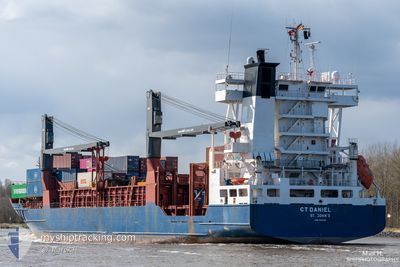
CT DANIEL
Container Ship
Current Trip
| Time Travelled | 17 h, 49 mins |
|---|---|
| Remaining Time | 20 h, 3 mins |
| Distance Travelled | 264.97 nm |
| Remaining Distance | 306.87 nm |
| AVG Speed | 15.1 Knots |
| MAX Speed | 16 Knots |
| AVG Wind | 6 knots |
| MAX Wind | 11.3 knots |
| MIN Temp | 16.8°C / 62.24°F |
| MAX Temp | 19°C / 66.2°F |
| Draught | 8.7 m |
| Position Received | 1 m ago |
Current Position
| Longitude | -9.96562° |
|---|---|
| Latitude | 38.27570° |
| Status | Under way using engine |
| Speed | 15.1 Knots |
| Course | 166° |
| Area | North Atlantic Ocean |
| Station | T-AIS |
| Position Received | 1 m ago |
Info
Information
The current position of CT DANIEL is in North Atlantic Ocean with coordinates 38.27570° / -9.96562° as reported on 2024-06-05 12:22 by AIS to our vessel tracker app. The vessel's current speed is 15.1 Knots and is heading at the port of ALGECIRAS. The estimated time of arrival as calculated by vessel tracking app is 2024-06-06 08:26 LT
The vessel CT DANIEL (IMO: 9326988, MMSI: 255806235) is a Container Ship that was built in 2006 ( 18 years old ). It's sailing under the flag of [PT] Portugal.
In this page you can find informations about the vessels current position, last detected port calls, and current voyage information. If the vessels is not in coverage by AIS you will find the latest position.
The current position of CT DANIEL is detected by our AIS receivers and we are not responsible for the reliability of the data. The last position was recorded while the vessel was in Coverage by the Ais receivers of our vessel tracking app.
The current draught of CT DANIEL as reported by AIS is 8.7 meters
Weather
| Temperature | 17.5°C / 63.5°F |
|---|---|
| Wind Speed | 11 knots |
| Direction | 328° NNW |
| Pressure | 1017.1 hPa |
| Humidity | 76.4 % |
| Cloud Coverage | 100 % |
Featured Company
Last Port Calls
| Port | Arrival | Departure | Time In Port |
|---|---|---|---|
| 2024-06-03 18:48 | 2024-06-04 18:34 | 23 h | |
| 2024-06-03 05:26 | 2024-06-03 16:38 | 11 h | |
| 2024-05-31 16:17 | 2024-06-01 12:19 | 20 h | |
| 2024-05-28 17:05 | 2024-05-31 16:08 | 2 d | |
| 2024-05-26 05:30 | 2024-05-26 23:59 | 18 h | |
| 2024-05-25 15:54 | 2024-05-26 03:19 | 11 h | |
| 2024-05-23 10:51 | 2024-05-24 00:05 | 13 h | |
| 2024-05-20 01:06 | 2024-05-21 00:18 | 23 h | |
| 2024-05-19 16:16 | 2024-05-19 22:50 | 6 h | |
| 2024-05-17 05:01 | 2024-05-17 23:45 | 18 h |
Last Trips
| Origin | Departure | Destination | Arrival | Distance | |
|---|---|---|---|---|---|
| 2024-06-03 18:38 | 2024-06-03 20:48 | 23.30 nm | |||
| 2024-06-01 14:19 | 2024-06-03 07:26 | 548.59 nm | |||
| 2024-05-31 18:08 | 2024-05-31 18:17 | 1.08 nm | |||
| 2024-05-27 01:59 | 2024-05-28 19:05 | 579.85 nm | |||
| 2024-05-26 05:19 | 2024-05-26 07:30 | 22.98 nm | |||
| 2024-05-24 02:05 | 2024-05-25 17:54 | 548.40 nm | |||
| 2024-05-21 02:18 | 2024-05-23 12:51 | 581.53 nm | |||
| 2024-05-20 00:50 | 2024-05-20 03:06 | 22.94 nm | |||
| 2024-05-18 01:45 | 2024-05-19 18:16 | 546.20 nm | |||
| 2024-05-15 07:30 | 2024-05-17 07:01 | 593.90 nm |
Events
| Time | Event | Details | Position / Dest | Info |
|---|---|---|---|---|
| 2024-06-05 11:01 | Status Changed | Under way using engine Default |
38.60598 / -10.06425
ESALG
|
Speed: 15.4 kn Course: 170° |
| 2024-06-05 10:54 | Status Changed | Default Under way using engine |
38.63537 / -10.07077
ESALG
|
Speed: 15.5 kn Course: 170° |
| 2024-06-05 05:43 | Status Changed | Under way using engine Default |
39.84517 / -9.48967
ESALG
|
Speed: 15.1 kn Course: 209° |
| 2024-06-05 05:28 | IN Coverage |
39.84517 / -9.48967
North Atlantic Ocean
ESALG
|
Speed: 15.1 kn Course: 209° |
|
| 2024-06-05 03:25 | Status Changed | Default Under way using engine |
40.38518 / -9.22977
ESALG
|
Speed: 15 kn Course: 189° |
| 2024-06-05 03:19 | OUT of Coverage |
40.41177 / -9.22368
North Atlantic Ocean
ESALG
|
Speed: 15 kn Course: 189° |
|
| 2024-06-05 03:15 | Status Changed | Under way using engine Default |
40.42750 / -9.22000
ESALG
|
Speed: 14.8 kn Course: 194° |
| 2024-06-05 02:59 | IN Coverage |
40.42750 / -9.22000
North Atlantic Ocean
ESALG
|
Speed: 15 kn Course: 190° |
|
| 2024-06-05 02:18 | Status Changed | Default Under way using engine |
40.66182 / -9.17860
ESALG
|
Speed: 15.1 kn Course: 184° |
| 2024-06-05 02:09 | OUT of Coverage |
40.69883 / -9.17600
North Atlantic Ocean
ESALG
|
Speed: 15.1 kn Course: 184° |