
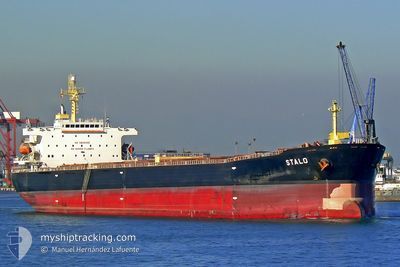
CYMONA STAR
Bulk Carrier
Current Trip
| Time Travelled | 12 days |
|---|---|
| Remaining Time | 3 days |
| Distance Travelled | 3283.83 nm |
| Remaining Distance | 1379.18 nm |
| AVG Speed | 10.4 Knots |
| MAX Speed | 13.9 Knots |
| AVG Wind | 16.1 knots |
| MAX Wind | 26 knots |
| MIN Temp | 16.8°C / 62.24°F |
| MAX Temp | 30°C / 86°F |
| Draught | 14.3 m |
| Position Received | 1 d ago |
Current Position
| Longitude | 135.35167° |
|---|---|
| Latitude | 8.80275° |
| Status | Under way using engine |
| Speed | 11 Knots |
| Course | 322° |
| Area | Philippine Sea |
| Station | T-AIS |
| Position Received | 1 d ago |
Info
Information
The current position of CYMONA STAR is in Philippine Sea with coordinates 8.80275° / 135.35167° as reported on 2024-05-31 21:48 by AIS to our vessel tracker app. The vessel's current speed is 11 Knots and is heading at the port of TAICHUNG. The estimated time of arrival as calculated by vessel tracking app is 2024-06-05 21:16 LT
The vessel CYMONA STAR (IMO: 9309485, MMSI: 209317000) is a Bulk Carrier that was built in 2006 ( 18 years old ). It's sailing under the flag of [CY] Cyprus.
In this page you can find informations about the vessels current position, last detected port calls, and current voyage information. If the vessels is not in coverage by AIS you will find the latest position.
The current position of CYMONA STAR is detected by our AIS receivers and we are not responsible for the reliability of the data. The last position was recorded while the vessel was in Coverage by the Ais receivers of our vessel tracking app.
The current draught of CYMONA STAR as reported by AIS is 14.3 meters
Weather
| Temperature | 28.9°C / 84.02°F |
|---|---|
| Wind Speed | 5 knots |
| Direction | 104° ESE |
| Pressure | 1010.1 hPa |
| Humidity | 68.5 % |
| Cloud Coverage | 99 % |
Featured Company
Events
| Time | Event | Details | Position / Dest | Info |
|---|---|---|---|---|
| 2024-05-31 22:01 | Status Changed | Default Under way using engine |
8.83282 / 135.32759
TWTXG
|
Speed: 11 kn Course: 322° |
| 2024-05-31 21:48 | Status Changed | Under way using engine Default |
8.80275 / 135.35167
TWTXG
|
Speed: 11.2 kn Course: 322° |
| 2024-05-31 21:48 | OUT of Coverage |
8.80275 / 135.35167
Philippine Sea
TWTXG
|
Speed: 11 kn Course: 322° |
|
| 2024-05-31 21:29 | Status Changed | Default Under way using engine |
8.75529 / 135.38731
TWTXG
|
Speed: 11.4 kn Course: 321.6° |
| 2024-05-31 21:18 | Status Changed | Under way using engine Default |
8.72688 / 135.40937
TWTXG
|
Speed: 11.6 kn Course: 322° |
| 2024-05-31 21:09 | Status Changed | Default Under way using engine |
8.70414 / 135.42664
TWTXG
|
Speed: 11.5 kn Course: 323.2° |
| 2024-05-31 20:22 | Status Changed | Under way using engine Default |
8.58100 / 135.51827
TWTXG
|
Speed: 11.6 kn Course: 322° |
| 2024-05-31 20:17 | Status Changed | Default Under way using engine |
8.56837 / 135.52768
TWTXG
|
Speed: 11.6 kn Course: 323.3° |
| 2024-05-31 19:49 | Detected in Sea | Palau part of the Philippine Sea |
8.49612 / 135.58136
Philippine Sea
TWTXG
|
Speed: 11.6 kn Course: 322.6° |
| 2024-05-31 19:49 | Status Changed | Under way using engine Default |
8.49612 / 135.58136
TWTXG
|
Speed: 11.6 kn Course: 322° |