
CZECH
Cargo D
Current Trip
| Time Travelled | 4 days |
|---|---|
| Remaining Time | 6 days |
| Distance Travelled | 1720.13 nm |
| Remaining Distance | 2372.24 nm |
| AVG Speed | 15.1 Knots |
| MAX Speed | 17.8 Knots |
| AVG Wind | 16.1 knots |
| MAX Wind | 29 knots |
| MIN Temp | 12.2°C / 53.96°F |
| MAX Temp | 18.5°C / 65.3°F |
| Draught | 11.8 m |
| Position Received | 1 h, 10 m ago |
Current Position
| Longitude | -31.59644° |
|---|---|
| Latitude | 38.23989° |
| Status | Under way using engine |
| Speed | 16.1 Knots |
| Course | 236.4° |
| Area | North Atlantic Ocean |
| Station | T-AIS |
| Position Received | 1 h, 10 m ago |
Info
Information
The current position of CZECH is in North Atlantic Ocean with coordinates 38.23989° / -31.59644° as reported on 2024-05-17 08:25 by AIS to our vessel tracker app. The vessel's current speed is 16.1 Knots and is heading at the port of BOCA CHIKA. The estimated time of arrival as calculated by vessel tracking app is 2024-05-23 16:23 LT
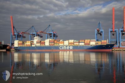
The vessel CZECH (IMO: 9723241, MMSI: 256771000) is a Cargo D It's sailing under the flag of [MT] Malta.
In this page you can find informations about the vessels current position, last detected port calls, and current voyage information. If the vessels is not in coverage by AIS you will find the latest position.
The current position of CZECH is detected by our AIS receivers and we are not responsible for the reliability of the data. The last position was recorded while the vessel was in Coverage by the Ais receivers of our vessel tracking app.
The current draught of CZECH as reported by AIS is 11.8 meters
Weather
| Temperature | 18.3°C / 64.94°F |
|---|---|
| Wind Speed | 8 knots |
| Direction | 62° ENE |
| Pressure | 1026 hPa |
| Humidity | 67.9 % |
| Cloud Coverage | 87 % |
Featured Company
Last Port Calls
| Port | Arrival | Departure | Time In Port |
|---|---|---|---|
| 2024-05-12 03:11 | 2024-05-12 18:02 | 14 h | |
| 2024-05-08 18:49 | 2024-05-09 17:31 | 22 h | |
| 2024-05-05 21:33 | 2024-05-07 09:51 | 1 d | |
| 2024-05-02 23:43 | 2024-05-03 23:12 | 23 h | |
| 2024-04-30 11:34 | 2024-05-02 11:20 | 1 d | |
| 2024-04-19 19:24 | 2024-04-21 04:09 | 1 d | |
| 2024-04-17 09:34 | 2024-04-18 08:39 | 23 h | |
| 2024-04-16 01:04 | 2024-04-16 14:45 | 13 h | |
| 2024-04-10 04:06 | 2024-04-10 20:50 | 16 h | |
| 2024-04-02 19:21 | 2024-04-07 00:29 | 4 d |
Most Visited Ports (Last year)
| Port | Arrivals | |
|---|---|---|
| 6 | ||
| 6 | ||
| 4 | ||
| 4 | ||
| 4 | ||
| 4 |
Last Trips
| Origin | Departure | Destination | Arrival | Distance | |
|---|---|---|---|---|---|
| 2024-05-09 19:31 | 2024-05-12 05:11 | 335.35 nm | |||
| 2024-05-07 11:51 | 2024-05-08 20:49 | 403.59 nm | |||
| 2024-05-04 00:12 | 2024-05-05 23:33 | 445.38 nm | |||
| 2024-05-02 13:20 | 2024-05-03 00:43 | 149.37 nm | |||
| 2024-04-21 00:09 | 2024-04-30 13:34 | 4047.54 nm | |||
| 2024-04-18 03:39 | 2024-04-19 15:24 | 641.55 nm | |||
| 2024-04-16 09:45 | 2024-04-17 04:34 | 287.07 nm | |||
| 2024-04-10 15:50 | 2024-04-15 20:04 | 1499.87 nm | |||
| 2024-04-06 21:29 | 2024-04-09 23:06 | 1351.60 nm | |||
| 2024-03-29 19:49 | 2024-04-02 16:21 | 1343.98 nm |
Events
| Time | Event | Details | Position / Dest | Info |
|---|---|---|---|---|
| 2024-05-17 08:28 | Status Changed | Default Under way using engine |
38.23000 / -31.61167
DOCAU
|
Speed: 16.1 kn Course: 236.4° |
| 2024-05-17 08:25 | Status Changed | Under way using engine Default |
38.23989 / -31.59644
DOCAU
|
Speed: 16 kn Course: 237° |
| 2024-05-17 08:25 | OUT of Coverage |
38.23989 / -31.59644
North Atlantic Ocean
DOCAU
|
Speed: 16.1 kn Course: 236.4° |
|
| 2024-05-17 08:10 | IN Coverage |
38.23989 / -31.59644
North Atlantic Ocean
DOCAU
|
Speed: 16.1 kn Course: 236.4° |
|
| 2024-05-17 05:47 | Status Changed | Default Under way using engine |
38.61132 / -30.82948
DOCAU
|
Speed: 16 kn Course: 240.6° |
| 2024-05-17 05:44 | OUT of Coverage |
38.61754 / -30.81559
North Atlantic Ocean
DOCAU
|
Speed: 16 kn Course: 240.6° |
|
| 2024-05-17 05:35 | Status Changed | Under way using engine Default |
38.63604 / -30.77403
DOCAU
|
Speed: 16 kn Course: 240° |
| 2024-05-17 05:32 | Status Changed | Default Under way using engine |
38.64360 / -30.75717
DOCAU
|
Speed: 16 kn Course: 239.7° |
| 2024-05-16 18:58 | Change Sea Area | Portuguese (Azores) part of the North Atlantic Ocean French part of the Celtic Sea |
39.65923 / -27.45126
North Atlantic Ocean
DOCAU
|
Speed: 15.9 kn Course: 251.7° |
| 2024-05-16 18:58 | Status Changed | Under way using engine Default |
39.65923 / -27.45126
DOCAU
|
Speed: 16 kn Course: 253° |