
DAFERNYA
Cargo
Current Trip
Current Position
| Longitude | 5.61585° |
|---|---|
| Latitude | 52.97414° |
| Status | Moored |
| Speed | |
| Course | --- |
| Area | North Sea |
| Station | T-AIS |
| Position Received | Now |
Info
Information
The current position of DAFERNYA is in North Sea with coordinates 52.97414° / 5.61585° as reported on 2024-06-01 03:30 by AIS to our vessel tracker app. The vessel's current speed is 0 Knots and is currently inside the port of HEEG.
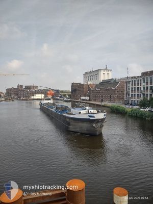
The vessel DAFERNYA (MMSI: 244287360) is a Cargo It's sailing under the flag of [NL] Netherlands.
In this page you can find informations about the vessels current position, last detected port calls, and current voyage information. If the vessels is not in coverage by AIS you will find the latest position.
The current position of DAFERNYA is detected by our AIS receivers and we are not responsible for the reliability of the data. The last position was recorded while the vessel was in Coverage by the Ais receivers of our vessel tracking app.
The current draught of DAFERNYA as reported by AIS is 0.1 meters
Weather
| Temperature | 14.2°C / 57.56°F |
|---|---|
| Wind Speed | 12 knots |
| Direction | 1° N |
| Pressure | 1014.5 hPa |
| Humidity | 93 % |
| Cloud Coverage | 100 % |
Featured Company
Last Port Calls
| Port | Arrival | Departure | Time In Port |
|---|---|---|---|
| 2024-05-30 13:52 | |||
| 2024-05-28 12:27 | 2024-05-28 15:55 | 3 h | |
| 2024-05-28 11:27 | 2024-05-28 12:01 | 34 m | |
| 2024-05-27 14:26 | 2024-05-27 20:35 | 6 h | |
| 2024-05-27 13:14 | 2024-05-27 13:54 | 39 m | |
| 2024-05-24 06:36 | 2024-05-26 15:06 | 2 d | |
| 2024-05-22 18:29 | 2024-05-23 12:43 | 18 h | |
| 2024-05-21 17:43 | 2024-05-22 12:34 | 18 h | |
| 2024-05-20 13:54 | 2024-05-21 12:25 | 22 h | |
| 2024-05-17 04:48 | 2024-05-20 09:37 | 3 d |
Last Trips
| Origin | Departure | Destination | Arrival | Distance | |
|---|---|---|---|---|---|
| 2024-05-28 17:55 | 2024-05-30 15:52 | 122.30 nm | |||
| 2024-05-28 14:01 | 2024-05-28 14:27 | 3.59 nm | |||
| 2024-05-27 22:35 | 2024-05-28 13:27 | 51.86 nm | |||
| 2024-05-27 15:54 | 2024-05-27 16:26 | 3.63 nm | |||
| 2024-05-26 17:06 | 2024-05-27 15:14 | 52.57 nm | |||
| 2024-05-23 14:43 | 2024-05-24 08:36 | 34.98 nm | |||
| 2024-05-22 14:34 | 2024-05-22 20:29 | 25.95 nm | |||
| 2024-05-21 14:25 | 2024-05-21 19:43 | 28.71 nm | |||
| 2024-05-20 11:37 | 2024-05-20 15:54 | 28.70 nm | |||
| 2024-05-16 17:19 | 2024-05-17 06:48 | 30.51 nm |
Events
| Time | Event | Details | Position / Dest | Info |
|---|---|---|---|---|
| 2024-05-31 08:00 | Status Changed | Moored Default |
52.97415 / 5.61582
[NL] HEEG
|
Speed: Course: -1° |
| 2024-05-31 07:52 | Status Changed | Default Moored |
52.97414 / 5.61583
[NL] HEEG
|
Speed: Course: 511° |
| 2024-05-30 14:12 | Status Changed | Moored Under way using engine |
52.97396 / 5.61590
[NL] HEEG
|
Speed: Course: 511° |
| 2024-05-30 13:52 | STOP Moving |
52.97400 / 5.61595
[NL] HEEG
|
Speed: 0.1 kn Course: 511° |
|
| 2024-05-30 13:52 | PORT ARRIVAL |
|
52.97400 / 5.61595
[NL] HEEG
|
Speed: 0.6 kn Course: 511° |
| 2024-05-30 11:47 | START Moving | 0.88 nm, North West of LEMMER |
52.85445 / 5.67816
SNEEK
|
Speed: 4.6 kn Course: 17.1° |
| 2024-05-30 11:33 | STOP Moving | 0.88 nm, West of LEMMER |
52.85195 / 5.67676
SNEEK
|
Speed: 0.1 kn Course: 511° |
| 2024-05-30 09:07 | Status Changed | Under way using engine Default |
52.72773 / 5.42045
SNEEK
|
Speed: 1.3 kn Course: -1° |
| 2024-05-30 09:07 | START Moving | 4.83 nm, East of ENKHUIZEN |
52.72773 / 5.42045
SNEEK
|
Speed: 5.7 kn Course: 75.4° |
| 2024-05-30 08:49 | IN Coverage |
52.72773 / 5.42045
North Sea
|
Speed: 5.7 kn Course: 75.4° |