
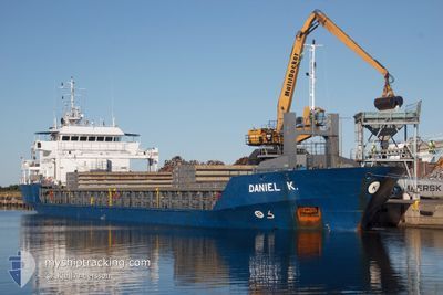
DANIEL K
General Cargo
Current Trip
| Time Travelled | 23 h, 6 mins |
|---|---|
| Remaining Time | 18 h, 19 mins |
| Distance Travelled | 242.89 nm |
| Remaining Distance | 186.60 nm |
| AVG Speed | 10.7 Knots |
| MAX Speed | 13.3 Knots |
| AVG Wind | 6.1 knots |
| MAX Wind | 13 knots |
| MIN Temp | 17.9°C / 64.22°F |
| MAX Temp | 28.5°C / 83.3°F |
| Draught | 4 m |
| Position Received | 1 m ago |
Current Position
| Longitude | -9.57846° |
|---|---|
| Latitude | 37.82825° |
| Status | Under way using engine |
| Speed | 9.4 Knots |
| Course | 343.9° |
| Area | North Atlantic Ocean |
| Station | T-AIS |
| Position Received | 1 m ago |
Info
Information
The current position of DANIEL K is in North Atlantic Ocean with coordinates 37.82825° / -9.57846° as reported on 2024-06-28 10:59 by AIS to our vessel tracker app. The vessel's current speed is 9.4 Knots and is heading at the port of AVEIRO. The estimated time of arrival as calculated by vessel tracking app is 2024-06-29 05:19 LT
The vessel DANIEL K (IMO: 9198654, MMSI: 244336000) is a General Cargo that was built in 2002 ( 22 years old ). It's sailing under the flag of [NL] Netherlands.
In this page you can find informations about the vessels current position, last detected port calls, and current voyage information. If the vessels is not in coverage by AIS you will find the latest position.
The current position of DANIEL K is detected by our AIS receivers and we are not responsible for the reliability of the data. The last position was recorded while the vessel was in Coverage by the Ais receivers of our vessel tracking app.
The current draught of DANIEL K as reported by AIS is 4 meters
Weather
| Temperature | 17.9°C / 64.22°F |
|---|---|
| Wind Speed | 8 knots |
| Direction | 337° NNW |
| Pressure | 1015.3 hPa |
| Humidity | 93.9 % |
| Cloud Coverage | 100 % |
Featured Company
Last Port Calls
| Port | Arrival | Departure | Time In Port |
|---|---|---|---|
| 2024-06-25 06:40 | 2024-06-27 11:54 | 2 d | |
| 2024-06-19 23:03 | 2024-06-20 16:44 | 17 h | |
| 2024-06-16 14:12 | 2024-06-18 13:58 | 1 d | |
| 2024-06-10 17:21 | 2024-06-12 19:04 | 2 d | |
| 2024-06-04 12:25 | 2024-06-07 03:56 | 2 d | |
| 2024-05-31 14:08 | 2024-06-01 14:28 | 1 d | |
| 2024-05-28 06:36 | 2024-05-29 12:37 | 1 d | |
| 2024-05-20 06:26 | 2024-05-22 09:44 | 2 d | |
| 2024-05-12 10:26 | 2024-05-13 19:58 | 1 d | |
| 2024-05-03 18:18 | 2024-05-08 21:54 | 5 d |
Last Trips
| Origin | Departure | Destination | Arrival | Distance | |
|---|---|---|---|---|---|
| 2024-06-20 18:44 | 2024-06-25 08:40 | 1016.02 nm | |||
| 2024-06-18 15:58 | 2024-06-20 01:03 | 358.90 nm | |||
| 2024-06-12 21:04 | 2024-06-16 16:12 | 790.36 nm | |||
| 2024-06-07 05:56 | 2024-06-10 19:21 | 324.23 nm | |||
| 2024-06-01 16:28 | 2024-06-04 14:25 | 309.33 nm | |||
| 2024-05-29 13:37 | 2024-05-31 16:08 | 304.33 nm | |||
| 2024-05-22 11:44 | 2024-05-28 07:36 | 796.86 nm | |||
| 2024-05-13 21:58 | 2024-05-20 08:26 | 1404.03 nm | |||
| 2024-05-08 22:54 | 2024-05-12 12:26 | 832.86 nm | |||
| 2024-04-25 22:13 | 2024-05-03 19:18 | 1397.64 nm |
Events
| Time | Event | Details | Position / Dest | Info |
|---|---|---|---|---|
| 2024-06-28 09:38 | Status Changed | Under way using engine Default |
37.61431 / -9.49674
PT AVE
|
Speed: 10.3 kn Course: 358° |
| 2024-06-28 09:24 | IN Coverage |
37.61431 / -9.49674
North Atlantic Ocean
PT AVE
|
Speed: 10 kn Course: 350.9° |
|
| 2024-06-28 02:48 | Status Changed | Default Under way using engine |
36.72196 / -8.78942
PT AVE
|
Speed: 10.5 kn Course: 270.5° |
| 2024-06-28 02:41 | Status Changed | Under way using engine Default |
36.72226 / -8.76390
PT AVE
|
Speed: 10.6 kn Course: 270° |
| 2024-06-28 02:41 | OUT of Coverage |
36.72226 / -8.76390
North Atlantic Ocean
PT AVE
|
Speed: 10.5 kn Course: 270.5° |
|
| 2024-06-28 02:16 | Status Changed | Default Under way using engine |
36.72159 / -8.67223
PT AVE
|
Speed: 10.6 kn Course: 269.4° |
| 2024-06-28 02:10 | Status Changed | Under way using engine Default |
36.72175 / -8.65234
PT AVE
|
Speed: 10.5 kn Course: 270° |
| 2024-06-28 02:08 | Status Changed | Default Under way using engine |
36.72182 / -8.64312
PT AVE
|
Speed: 10.6 kn Course: 269° |
| 2024-06-28 01:53 | Status Changed | Under way using engine Default |
36.72257 / -8.58933
PT AVE
|
Speed: 10.6 kn Course: 269° |
| 2024-06-28 01:43 | Status Changed | Default Under way using engine |
36.72311 / -8.55127
PT AVE
|
Speed: 10.6 kn Course: 270.6° |