
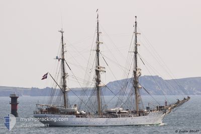
DANMARK
Sailing Vessel
Current Trip
| Time Travelled | 25 days |
|---|---|
| Remaining Time | --- |
| Distance Travelled | 1140.61 nm |
| Remaining Distance | --- |
| AVG Speed | 5.2 Knots |
| MAX Speed | 8.5 Knots |
| AVG Wind | 7.5 knots |
| MAX Wind | 23.8 knots |
| MIN Temp | 14.8°C / 58.64°F |
| MAX Temp | 19.3°C / 66.74°F |
| Draught | 5 m |
| Position Received | 9 d ago |
Current Position
| Longitude | -26.41511° |
|---|---|
| Latitude | 38.53218° |
| Status | Under way using engine |
| Speed | 5.3 Knots |
| Course | 338.2° |
| Area | North Atlantic Ocean |
| Station | T-AIS |
| Position Received | 9 d ago |
Info
Information
The current position of DANMARK is in North Atlantic Ocean with coordinates 38.53218° / -26.41511° as reported on 2024-05-09 06:43 by AIS to our vessel tracker app. The vessel's current speed is 5.3 Knots
The vessel DANMARK (IMO: 5086279, MMSI: 219500000) is a Sailing Vessel that was built in 1933 ( 91 years old ). It's sailing under the flag of [DK] Denmark.
In this page you can find informations about the vessels current position, last detected port calls, and current voyage information. If the vessels is not in coverage by AIS you will find the latest position.
The current position of DANMARK is detected by our AIS receivers and we are not responsible for the reliability of the data. The last position was recorded while the vessel was in Coverage by the Ais receivers of our vessel tracking app.
The current draught of DANMARK as reported by AIS is 5 meters
Weather
| Temperature | 16.9°C / 62.42°F |
|---|---|
| Wind Speed | 11 knots |
| Direction | 316° NW |
| Pressure | 1017 hPa |
| Humidity | 81.1 % |
| Cloud Coverage | 67 % |
Featured Company
Most Visited Ports (Last year)
| Port | Arrivals | |
|---|---|---|
| 2 | ||
| 1 | ||
| 1 | ||
| 1 | ||
| 1 | ||
| 1 |
Events
| Time | Event | Details | Position / Dest | Info |
|---|---|---|---|---|
| 2024-05-09 06:43 | OUT of Coverage |
38.53218 / -26.41511
North Atlantic Ocean
BANTRY BAY
|
Speed: 5.3 kn Course: 338.2° |
|
| 2024-05-09 06:43 | IN Coverage |
38.53218 / -26.41511
North Atlantic Ocean
BANTRY BAY
|
Speed: 5.3 kn Course: 338.2° |