
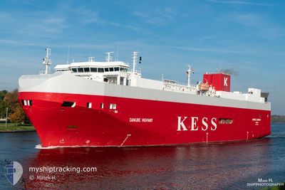
DANUBE HIGHWAY
Vehicles Carrier
Current Trip
| Time Travelled | 2 days |
|---|---|
| Remaining Time | 14 h, 51 mins |
| Distance Travelled | 793.15 nm |
| Remaining Distance | 230.34 nm |
| AVG Speed | 15.8 Knots |
| MAX Speed | 19.7 Knots |
| AVG Wind | 14 knots |
| MAX Wind | 23.7 knots |
| MIN Temp | 11°C / 51.8°F |
| MAX Temp | 14.8°C / 58.64°F |
| Draught | 7.4 m |
| Position Received | Now |
Current Position
| Longitude | 8.31689° |
|---|---|
| Latitude | 57.12823° |
| Status | Under way using engine |
| Speed | 15 Knots |
| Course | 209.3° |
| Area | North Sea |
| Station | T-AIS |
| Position Received | Now |
Info
Information
The current position of DANUBE HIGHWAY is in North Sea with coordinates 57.12823° / 8.31689° as reported on 2024-06-16 11:02 by AIS to our vessel tracker app. The vessel's current speed is 15 Knots and is heading at the port of CUXHAVEN. The estimated time of arrival as calculated by vessel tracking app is 2024-06-17 01:54 LT
The vessel DANUBE HIGHWAY (IMO: 9316309, MMSI: 308803000) is a Vehicles Carrier that was built in 2006 ( 18 years old ). It's sailing under the flag of [BS] Bahamas.
In this page you can find informations about the vessels current position, last detected port calls, and current voyage information. If the vessels is not in coverage by AIS you will find the latest position.
The current position of DANUBE HIGHWAY is detected by our AIS receivers and we are not responsible for the reliability of the data. The last position was recorded while the vessel was in Coverage by the Ais receivers of our vessel tracking app.
The current draught of DANUBE HIGHWAY as reported by AIS is 7.4 meters
Weather
| Temperature | 13.8°C / 56.84°F |
|---|---|
| Wind Speed | 13 knots |
| Direction | 179° S |
| Pressure | 1004.7 hPa |
| Humidity | 80.9 % |
| Cloud Coverage | 78 % |
Featured Company
Last Port Calls
| Port | Arrival | Departure | Time In Port |
|---|---|---|---|
| 2024-06-13 10:21 | 2024-06-14 10:04 | 23 h | |
| 2024-06-12 07:22 | 2024-06-12 20:14 | 12 h | |
| 2024-06-11 23:47 | 2024-06-12 04:06 | 4 h | |
| 2024-06-10 02:50 | 2024-06-10 17:20 | 14 h | |
| 2024-06-06 19:31 | 2024-06-08 14:31 | 1 d | |
| 2024-06-06 04:21 | 2024-06-06 12:04 | 7 h | |
| 2024-06-04 05:16 | 2024-06-04 20:57 | 15 h | |
| 2024-06-03 09:30 | 2024-06-03 21:36 | 12 h | |
| 2024-05-30 10:50 | 2024-05-31 09:45 | 22 h | |
| 2024-05-29 09:10 | 2024-05-29 20:42 | 11 h |
Last Trips
| Origin | Departure | Destination | Arrival | Distance | |
|---|---|---|---|---|---|
| 2024-06-12 23:14 | 2024-06-13 13:21 | 233.56 nm | |||
| 2024-06-12 07:06 | 2024-06-12 10:22 | 46.37 nm | |||
| 2024-06-10 19:20 | 2024-06-12 02:47 | 511.16 nm | |||
| 2024-06-08 16:31 | 2024-06-10 04:50 | 669.92 nm | |||
| 2024-06-06 13:04 | 2024-06-06 21:31 | 99.23 nm | |||
| 2024-06-04 22:57 | 2024-06-06 05:21 | 312.21 nm | |||
| 2024-06-03 23:36 | 2024-06-04 07:16 | 123.10 nm | |||
| 2024-05-31 12:45 | 2024-06-03 11:30 | 1035.28 nm | |||
| 2024-05-29 23:42 | 2024-05-30 13:50 | 233.12 nm | |||
| 2024-05-29 09:23 | 2024-05-29 12:10 | 46.26 nm |
Events
| Time | Event | Details | Position / Dest | Info |
|---|---|---|---|---|
| 2024-06-16 10:35 | Change Sea Area | Danish part of the North Sea Danish part of the Skaggerak |
57.20619 / 8.46006
North Sea
CUXHAVEN
|
Speed: 15 kn Course: 236.5° |
| 2024-06-16 04:44 | Change Sea Area | Danish part of the Skaggerak Danish part of the Kattegat |
57.79732 / 10.92333
Skaggerak
CUXHAVEN
|
Speed: 17.8 kn Course: 318.5° |
| 2024-06-16 03:53 | Change Sea Area | Danish part of the Kattegat Swedish part of the Kattegat |
57.61614 / 11.23555
Kattegat
CUXHAVEN
|
Speed: 17.5 kn Course: 315.1° |
| 2024-06-15 20:32 | Change Sea Area | Swedish part of the Kattegat Danish part of the Kattegat |
55.81441 / 12.72437
Kattegat
CUXHAVEN
|
Speed: 17.3 kn Course: 15.4° |
| 2024-06-15 19:01 | Change Sea Area | Danish part of the Kattegat Swedish part of the Kattegat |
55.49388 / 12.71075
Kattegat
CUXHAVEN
|
Speed: 15.6 kn Course: 7.7° |
| 2024-06-15 18:25 | Change Sea Area | Swedish part of the Kattegat Swedish part of the Baltic Sea |
55.33831 / 12.66259
Kattegat
CUXHAVEN
|
Speed: 15.7 kn Course: 9.3° |
| 2024-06-15 13:34 | Change Sea Area | Swedish part of the Baltic Sea Danish part of the Kattegat |
55.47545 / 14.70308
Baltic Sea
CUXHAVEN
|
Speed: 16.4 kn Course: 237.6° |
| 2024-06-15 12:18 | Change Sea Area | Danish part of the Kattegat Swedish part of the Baltic Sea |
55.64676 / 15.23255
Kattegat
CUXHAVEN
|
Speed: 16.2 kn Course: 240.2° |
| 2024-06-15 06:31 | Status Changed | Under way using engine Default |
56.73382 / 17.11596
CUXHAVEN
|
Speed: 16.4 kn Course: 202° |
| 2024-06-15 06:29 | Status Changed | Default Under way using engine |
56.74185 / 17.12186
CUXHAVEN
|
Speed: 16.4 kn Course: 201.6° |