
DARLEAKAY
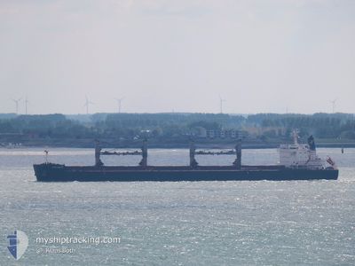
Bulk Carrier
Current Trip
TOLU COLOMBIA
| Time Travelled | 2 days |
|---|---|
| Remaining Time | --- |
| Distance Travelled | 518.85 nm |
| Remaining Distance | --- |
| AVG Speed | 11.3 Knots |
| MAX Speed | 14.9 Knots |
| AVG Wind | 9.8 knots |
| MAX Wind | 15 knots |
| MIN Temp | 25.8°C / 78.44°F |
| MAX Temp | 29.3°C / 84.74°F |
| Draught | 12.7 m |
| Position Received | 1 d ago |
Current Position
| Longitude | -88.51377° |
|---|---|
| Latitude | 27.78723° |
| Status | Under way using engine |
| Speed | 10.3 Knots |
| Course | 141.8° |
| Area | Gulf of Mexico |
| Station | T-AIS |
| Position Received | 1 d ago |
Info
Information
The current position of DARLEAKAY is in Gulf of Mexico with coordinates 27.78723° / -88.51377° as reported on 2024-05-27 14:04 by AIS to our vessel tracker app. The vessel's current speed is 10.3 Knots
The vessel DARLEAKAY (IMO: 9623647, MMSI: 538005724) is a Bulk Carrier that was built in 2012 ( 12 years old ). It's sailing under the flag of [MH] Marshall Is.
In this page you can find informations about the vessels current position, last detected port calls, and current voyage information. If the vessels is not in coverage by AIS you will find the latest position.
The current position of DARLEAKAY is detected by our AIS receivers and we are not responsible for the reliability of the data. The last position was recorded while the vessel was in Coverage by the Ais receivers of our vessel tracking app.
The current draught of DARLEAKAY as reported by AIS is 12.7 meters
Weather
| Temperature | 28.9°C / 84.02°F |
|---|---|
| Wind Speed | 4 knots |
| Direction | 35° NE |
| Pressure | 1015.3 hPa |
| Humidity | 69.1 % |
| Cloud Coverage | --- |
Featured Company
Last Port Calls
| Port | Arrival | Departure | Time In Port |
|---|---|---|---|
| 2024-05-15 13:12 | 2024-05-26 23:43 | 11 d | |
| 2024-05-10 03:44 | 2024-05-13 03:17 | 2 d | |
| 2024-05-06 18:06 | 2024-05-09 10:57 | 2 d | |
| 2024-04-27 02:57 | 2024-04-27 23:45 | 20 h | |
| 2024-04-22 23:07 | 2024-04-26 06:21 | 3 d | |
| 2024-03-18 15:44 | 2024-03-25 16:13 | 7 d | |
| 2024-03-10 01:24 |
Most Visited Ports (Last year)
| Port | Arrivals | |
|---|---|---|
| 4 | ||
| 2 | ||
| 2 | ||
| 2 | ||
| 1 | ||
| 1 |
Last Trips
| Origin | Departure | Destination | Arrival | Distance | |
|---|---|---|---|---|---|
| 2024-05-12 23:17 | 2024-05-15 08:12 | 502.63 nm | |||
| 2024-05-09 06:57 | 2024-05-09 23:44 | 75.63 nm | |||
| 2024-04-27 19:45 | 2024-05-06 14:06 | 617.19 nm | |||
| 2024-04-26 02:21 | 2024-04-26 22:57 | 53.13 nm | |||
| 2024-03-25 19:13 | 2024-04-22 19:07 | 6057.86 nm | |||
| 2024-03-10 03:24 | 2024-03-18 18:44 | 1006.45 nm |
Events
| Time | Event | Details | Position / Dest | Info |
|---|---|---|---|---|
| 2024-05-27 14:11 | Status Changed | Default Under way using engine |
27.77294 / -88.50051
TOLU COLOMBIA
|
Speed: 10.3 kn Course: 141.8° |
| 2024-05-27 14:04 | OUT of Coverage |
27.78723 / -88.51377
Gulf of Mexico
TOLU COLOMBIA
|
Speed: 10.3 kn Course: 141.8° |
|
| 2024-05-27 14:01 | Status Changed | Under way using engine Default |
27.79400 / -88.51979
TOLU COLOMBIA
|
Speed: 10.3 kn Course: 150° |
| 2024-05-27 13:47 | IN Coverage |
27.79400 / -88.51979
Gulf of Mexico
TOLU COLOMBIA
|
Speed: 10.3 kn Course: 142.8° |
|
| 2024-05-27 10:03 | Status Changed | Default Under way using engine |
28.34090 / -88.98486
TOLU COLOMBIA
|
Speed: 10.1 kn Course: 132.1° |
| 2024-05-27 09:57 | Status Changed | Under way using engine Default |
28.35160 / -88.99816
TOLU COLOMBIA
|
Speed: 10.1 kn Course: 133° |
| 2024-05-27 09:57 | OUT of Coverage |
28.35160 / -88.99816
Gulf of Mexico
TOLU COLOMBIA
|
Speed: 10.1 kn Course: 132.1° |
|
| 2024-05-27 09:35 | Status Changed | Default Under way using engine |
28.39397 / -89.04997
TOLU COLOMBIA
|
Speed: 9.9 kn Course: 134.9° |
| 2024-05-27 09:29 | Status Changed | Under way using engine Default |
28.40619 / -89.06407
TOLU COLOMBIA
|
Speed: 9.9 kn Course: 135° |
| 2024-05-27 09:15 | Status Changed | Default Under way using engine |
28.43343 / -89.09317
TOLU COLOMBIA
|
Speed: 9.5 kn Course: 143.6° |