
DAYA
Cargo
Current Trip
| Time Travelled | 8 days |
|---|---|
| Remaining Time | --- |
| Distance Travelled | 336.86 nm |
| Remaining Distance | --- |
| AVG Speed | 9.8 Knots |
| MAX Speed | 15.8 Knots |
| AVG Wind | 6.3 knots |
| MAX Wind | 11.8 knots |
| MIN Temp | 11.2°C / 52.16°F |
| MAX Temp | 19.4°C / 66.92°F |
| Draught | 1.8 m |
| Position Received | 3 h, 38 m ago |
Current Position
| Longitude | 5.68806° |
|---|---|
| Latitude | 50.79356° |
| Status | Under way using engine |
| Speed | 8.2 Knots |
| Course | 342.2° |
| Area | North Sea |
| Station | T-AIS |
| Position Received | 3 h, 38 m ago |
Info
Information
The current position of DAYA is in North Sea with coordinates 50.79356° / 5.68806° as reported on 2024-06-06 12:50 by AIS to our vessel tracker app. The vessel's current speed is 8.2 Knots
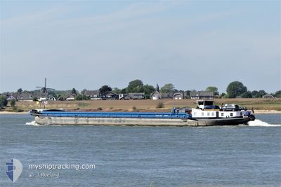
The vessel DAYA (MMSI: 205430290) is a Cargo It's sailing under the flag of [BE] Belgium.
In this page you can find informations about the vessels current position, last detected port calls, and current voyage information. If the vessels is not in coverage by AIS you will find the latest position.
The current position of DAYA is detected by our AIS receivers and we are not responsible for the reliability of the data. The last position was recorded while the vessel was in Coverage by the Ais receivers of our vessel tracking app.
The current draught of DAYA as reported by AIS is 1.8 meters
Weather
| Temperature | 16.5°C / 61.7°F |
|---|---|
| Wind Speed | 10 knots |
| Direction | 258° WSW |
| Pressure | 1017.3 hPa |
| Humidity | 54.6 % |
| Cloud Coverage | 51 % |
Featured Company
Last Port Calls
| Port | Arrival | Departure | Time In Port |
|---|---|---|---|
| 2024-05-28 09:47 | 2024-05-29 10:34 | 1 d | |
| 2024-05-22 08:17 | 2024-05-23 07:20 | 23 h | |
| 2024-05-22 04:12 | |||
| 2024-05-15 08:15 | 2024-05-18 03:33 | 2 d | |
| 2024-05-09 07:43 | 2024-05-11 09:25 | 2 d | |
| 2024-05-06 17:51 | 2024-05-07 09:17 | 15 h | |
| 2024-05-05 16:18 | 2024-05-06 03:57 | 11 h | |
| 2024-05-03 04:58 | 2024-05-03 05:38 | 40 m | |
| 2024-05-02 09:33 | 2024-05-02 10:03 | 29 m | |
| 2024-04-30 10:47 | 2024-04-30 12:18 | 1 h |
Last Trips
| Origin | Departure | Destination | Arrival | Distance | |
|---|---|---|---|---|---|
| 2024-05-23 09:20 | 2024-05-28 11:47 | 298.93 nm | |||
| 2024-05-22 06:12 | 2024-05-22 10:17 | 0.94 nm | |||
| 2024-05-11 11:25 | 2024-05-15 10:15 | 3.78 nm | |||
| 2024-05-07 11:17 | 2024-05-09 09:43 | 129.80 nm | |||
| 2024-05-06 05:57 | 2024-05-06 19:51 | 113.18 nm | |||
| 2024-05-03 07:38 | 2024-05-05 18:18 | 222.56 nm | |||
| 2024-05-02 12:03 | 2024-05-03 06:58 | 34.87 nm | |||
| 2024-04-30 14:18 | 2024-05-02 11:33 | 5.19 nm | |||
| 2024-04-29 15:48 | 2024-04-30 12:47 | 35.04 nm | |||
| 2024-04-26 05:02 | 2024-04-29 15:20 | 215.57 nm |
Events
| Time | Event | Details | Position / Dest | Info |
|---|---|---|---|---|
| 2024-06-06 12:50 | Destination Changed | HASSELT MARCINELLE |
50.79356 / 5.68806
HASSELT
|
Speed: 8.2 kn Course: 342.2° |
| 2024-06-06 12:50 | ETA Changed | 2024/06/07 09:32 2024/06/03 13:27 |
50.79356 / 5.68806
HASSELT
|
Speed: 8.2 kn Course: 342.2° |
| 2024-06-06 12:50 | OUT of Coverage |
50.79356 / 5.68806
North Sea
HASSELT
|
Speed: 8.2 kn Course: 342.2° |
|
| 2024-06-06 12:49 | IN Coverage |
50.79356 / 5.68806
North Sea
HASSELT
|
Speed: 8.2 kn Course: 342.2° |
|
| 2024-06-01 05:00 | OUT of Coverage |
50.78970 / 5.69039
North Sea
MARCINELLE
|
Speed: 7.1 kn Course: 189.9° |
|
| 2024-06-01 04:59 | START Moving | 0.51 nm, South West of WAOLENWIERT |
50.79240 / 5.69099
MARCINELLE
|
Speed: 4.4 kn Course: 185.7° |
| 2024-06-01 04:48 | STOP Moving | 0.45 nm, South West of WAOLENWIERT |
50.79426 / 5.69116
MARCINELLE
|
Speed: Course: 511° |
| 2024-06-01 02:19 | START Moving | 4.66 nm, South West of BARGE TERMINAL BORN |
50.98857 / 5.76662
MARCINELLE
|
Speed: 3.3 kn Course: 206.4° |
| 2024-06-01 02:17 | Status Changed | Under way using engine Moored |
50.98971 / 5.76788
MARCINELLE
|
Speed: 0.1 kn Course: 511° |
| 2024-06-01 01:31 | Status Changed | Moored Under way using engine |
50.98994 / 5.76830
MARCINELLE
|
Speed: 0.1 kn Course: 511° |