
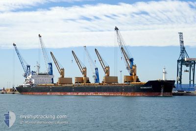
DAYANG ORIENT
Bulk Carrier
Current Trip
OBI ISLAND
| Time Travelled | 20 days |
|---|---|
| Remaining Time | --- |
| Distance Travelled | 4908.15 nm |
| Remaining Distance | --- |
| AVG Speed | 9.7 Knots |
| MAX Speed | 12.8 Knots |
| AVG Wind | 8.9 knots |
| MAX Wind | 27.9 knots |
| MIN Temp | 27.5°C / 81.5°F |
| MAX Temp | 34.2°C / 93.56°F |
| Draught | 12.9 m |
| Position Received | 4 d ago |
Current Position
| Longitude | 104.21899° |
|---|---|
| Latitude | 1.26623° |
| Status | Under way using engine |
| Speed | 10.4 Knots |
| Course | 85.9° |
| Area | Singapore Strait |
| Station | T-AIS |
| Position Received | 4 d ago |
Info
Information
The current position of DAYANG ORIENT is in Singapore Strait with coordinates 1.26623° / 104.21899° as reported on 2024-06-12 17:56 by AIS to our vessel tracker app. The vessel's current speed is 10.4 Knots
The vessel DAYANG ORIENT (IMO: 9491252, MMSI: 636015850) is a Bulk Carrier that was built in 2011 ( 13 years old ). It's sailing under the flag of [LR] Liberia.
In this page you can find informations about the vessels current position, last detected port calls, and current voyage information. If the vessels is not in coverage by AIS you will find the latest position.
The current position of DAYANG ORIENT is detected by our AIS receivers and we are not responsible for the reliability of the data. The last position was recorded while the vessel was in Coverage by the Ais receivers of our vessel tracking app.
The current draught of DAYANG ORIENT as reported by AIS is 12.9 meters
Weather
| Temperature | 27.6°C / 81.68°F |
|---|---|
| Wind Speed | 20 knots |
| Direction | 104° ESE |
| Pressure | 1012 hPa |
| Humidity | 79.1 % |
| Cloud Coverage | 91 % |
Featured Company
Most Visited Ports (Last year)
| Port | Arrivals | |
|---|---|---|
| 2 | ||
| 2 | ||
| 2 | ||
| 2 | ||
| 1 | ||
| 1 |
Events
| Time | Event | Details | Position / Dest | Info |
|---|---|---|---|---|
| 2024-06-12 18:01 | Status Changed | Default Under way using engine |
1.26835 / 104.23341
OBI ISLAND
|
Speed: 10.4 kn Course: 85.9° |
| 2024-06-12 17:56 | OUT of Coverage |
1.26623 / 104.21899
Singapore Strait
OBI ISLAND
|
Speed: 10.4 kn Course: 85.9° |
|
| 2024-06-12 17:50 | Status Changed | Under way using engine Default |
1.26412 / 104.20105
OBI ISLAND
|
Speed: 10.4 kn Course: 85° |
| 2024-06-12 17:45 | Status Changed | Default Under way using engine |
1.26256 / 104.18754
OBI ISLAND
|
Speed: 10.6 kn Course: 83° |
| 2024-06-12 17:35 | Change Sea Area | Malaysian part of the Singapore Strait Indonesian part of the Singapore Strait |
1.25912 / 104.15727
Singapore Strait
OBI ISLAND
|
Speed: 10.5 kn Course: 83.9° |
| 2024-06-12 14:44 | Status Changed | Under way using engine Default |
1.10576 / 103.74332
OBI ISLAND
|
Speed: 8.9 kn Course: 38° |
| 2024-06-12 14:03 | Status Changed | Default Under way using engine |
1.04892 / 103.65307
OBI ISLAND
|
Speed: 9.7 kn Course: 108.9° |
| 2024-06-12 13:34 | Change Sea Area | Indonesian part of the Singapore Strait Indian part of the Laccadive Sea |
1.07777 / 103.58172
Singapore Strait
OBI ISLAND
|
Speed: 9.9 kn Course: 121.6° |
| 2024-06-12 13:33 | Status Changed | Under way using engine Default |
1.07973 / 103.57852
OBI ISLAND
|
Speed: 9.9 kn Course: 122° |
| 2024-06-12 13:17 | IN Coverage |
1.07777 / 103.58172
Singapore Strait
OBI ISLAND
|
Speed: 9.9 kn Course: 121.6° |