
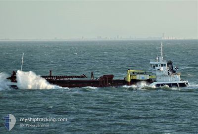
DC BRUGGE
General Cargo
Aktuelle Reise
| Bisherige Reisezeit | 3 Tage |
|---|---|
| Verbleibende Reisezeit | 15 Minuten |
| Zurückgelegte Distanz | 355.04 nm |
| Verbleibende Distanz | 6.02 nm |
| Durchschnittliche Geschwindigkeit | 8.9 Knoten |
| Maximale Geschwindigkeit | 13.7 Knoten |
| Durchschnittliche Windgeschwindigkeit | 19.4 Knoten |
| Maximale Windgeschwindigkeit | 36.9 Knoten |
| Minimale Temperatur | 12.1°C / 53.78°F |
| Maximale Temperatur | 19.4°C / 66.92°F |
| Tiefgang | 6.5 m |
| Position erhalten | 5 m alt |
Aktuelle Position
| Länge | 3.41769° |
|---|---|
| Breite | 51.47798° |
| Zustand | Under way using engine |
| Geschwindigkeit | 10.9 Knoten |
| Kurs | 326.9° |
| Gebiet | North Sea |
| Station | T-AIS |
| Position erhalten | 5 m alt |
Schiffsdetails
Information
Die DC BRUGGE befindet sich derzeit in North Sea mit den Koordinaten 51.47798° / 3.41769°, Diese Position wurde am 2024-09-27 14:44 von unserer Schiffsverfolgungs-App über AIS erfasst. Das Schiff fährt momentan mit einer Geschwindigkeit von 10.9 Knoten und fahrt in den Hafen von BRESKENS. Die geschatzte Ankunftszeit, berechnet von der -App zur Schiffsverfolgung, ist 2024-09-27 15:05 LT
Das Schiff DC BRUGGE (IMO: 7365851, MMSI: 245239000) ist General Cargo das wurde im Jahr 1974 ( 50 Jahre alt ) gebaut. und fährt unter der Flagge von [NL] Netherlands.
Auf dieser Seite erhalten Sie Informationen zur aktuellen Position des Schiffes, zu den letzten bekannten Hafenanläufen und zu den aktuellen Reiseinformationen. Sollte das Schiff nicht durch AIS abgedeckt sein, wird die zuletzt erfasste Position angezeigt.
Die DC BRUGGE wird durch unsere AIS-Empfänger ermittelt. Wir übernehmen keine Gewähr für die Richtigkeit der Daten. Die letzte Position wurde von unseren AIS-Empfängern aufgezeichnet, während das Schiff in Reichweite war.
Der aktuelle Entwurf von DC BRUGGE, wie von AIS gemeldet, betragt 6.5 meter
Wetter
| Temperatur | 13.5°C / 56.3°F |
|---|---|
| Windgeschwindigkeit | 13 Knoten |
| Windrichtung | 350° N |
| Luftdruck | 997.7 hPa |
| Luftfeuchtigkeit | 87.6 % |
| Wolken | 100 % |
Featured Company
Letzte Hafenanläufe
| Hafen | Ankunft | Abfahrt | Time In Port |
|---|---|---|---|
| 2024-09-24 00:03 | 2024-09-24 09:59 | 9 h | |
| 2024-09-19 23:30 | 2024-09-20 00:42 | 1 h | |
| 2024-09-19 22:28 | 2024-09-19 22:44 | 16 m | |
| 2024-09-19 10:28 | 2024-09-19 11:43 | 1 h | |
| 2024-09-17 01:57 | 2024-09-17 09:10 | 7 h | |
| 2024-09-10 08:32 | 2024-09-10 14:35 | 6 h | |
| 2024-09-08 03:12 | 2024-09-08 03:50 | 37 m | |
| 2024-09-07 13:14 | 2024-09-07 13:29 | 14 m | |
| 2024-09-07 10:23 | 2024-09-07 12:39 | 2 h | |
| 2024-09-03 04:35 | 2024-09-03 11:49 | 7 h |
Meistbesuchte Häfen (Letztes Jahr)
| Hafen | Ankünfte | |
|---|---|---|
| 34 | ||
| 33 | ||
| 16 | ||
| 12 | ||
| 10 | ||
| 5 |
Letzte Reisen
| Herkunft | Abfahrt | Ziel | Ankunft | Distanz | |
|---|---|---|---|---|---|
| 2024-09-20 02:42 | 2024-09-24 02:03 | 585.42 nm | |||
| 2024-09-20 00:44 | 2024-09-20 01:30 | 0.96 nm | |||
| 2024-09-19 13:43 | 2024-09-20 00:28 | 1.78 nm | |||
| 2024-09-17 11:10 | 2024-09-19 12:28 | 269.03 nm | |||
| 2024-09-10 16:35 | 2024-09-17 03:57 | 604.46 nm | |||
| 2024-09-08 05:50 | 2024-09-10 10:32 | 234.92 nm | |||
| 2024-09-07 15:29 | 2024-09-08 05:12 | 6.12 nm | |||
| 2024-09-07 14:39 | 2024-09-07 15:14 | 1.68 nm | |||
| 2024-09-03 13:49 | 2024-09-07 12:23 | 461.60 nm | |||
| 2024-08-31 13:00 | 2024-09-03 06:35 | 273.37 nm |
Events
| Zeit | Ereignis | Details | Position / Ziel | Information |
|---|---|---|---|---|
| 2024-09-27 14:20 | geänderte voraussichtliche Ankunftszeit | 2024/09/27 23:00 2024/09/27 08:00 |
51.42722 / 3.50842
DREDGE AREA - NLBRS
|
Geschwindigkeit: 12.4 kn Kurs: 298.9° |
| 2024-09-27 14:20 | geänderter Status | Under way using engine At anchor |
51.42722 / 3.50842
DREDGE AREA - NLBRS
|
Geschwindigkeit: 12.3 kn Kurs: 299° |
| 2024-09-27 13:53 | START Bewegung | 2.5 nm, East of BRESKENS |
51.38708 / 3.63171
DREDGE AREA - NLBRS
|
Geschwindigkeit: 7.4 kn Kurs: 280.2° |
| 2024-09-27 12:50 | geänderter Status | At anchor Default |
51.38687 / 3.63475
DREDGE AREA - NLBRS
|
Geschwindigkeit: 0.1 kn Kurs: 114° |
| 2024-09-27 12:47 | geänderter Status | Default At anchor |
51.38686 / 3.63473
DREDGE AREA - NLBRS
|
Geschwindigkeit: 0.1 kn Kurs: 114° |
| 2024-09-27 11:38 | STOP Bewegung | 2.62 nm, East of BRESKENS |
51.38694 / 3.63483
DREDGE AREA - NLBRS
|
Geschwindigkeit: 0.2 kn Kurs: 124° |
| 2024-09-27 11:29 | START Bewegung | 2.32 nm, East of BRESKENS |
51.38782 / 3.62704
DREDGE AREA - NLBRS
|
Geschwindigkeit: 4.5 kn Kurs: 88° |
| 2024-09-27 06:10 | geändertes Ziel | DREDGE AREA - NLBRS DREDGE AREA - BEOST |
51.38760 / 3.62504
DREDGE AREA - NLBRS
|
Geschwindigkeit: 0.1 kn Kurs: 249° |
| 2024-09-27 06:10 | geänderte voraussichtliche Ankunftszeit | 2024/09/27 08:00 2024/09/24 03:00 |
51.38760 / 3.62504
DREDGE AREA - NLBRS
|
Geschwindigkeit: 0.1 kn Kurs: 249° |
| 2024-09-27 06:09 | geänderter Status | At anchor Under way using engine |
51.38760 / 3.62504
DREDGE AREA - BEOST
|
Geschwindigkeit: 0.1 kn Kurs: 250° |