
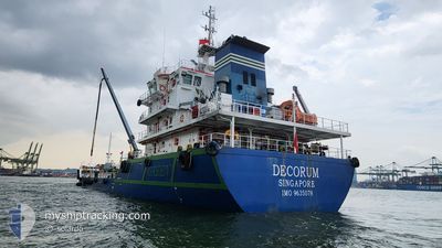
DECORUM
Bunkering Tanker
Current Trip
| Time Travelled | 2 days |
|---|---|
| Remaining Time | 3 mins |
| Distance Travelled | 130.81 nm |
| Remaining Distance | 3.42 nm |
| AVG Speed | 7.3 Knots |
| MAX Speed | 10.7 Knots |
| AVG Wind | 5.6 knots |
| MAX Wind | 14.2 knots |
| MIN Temp | 25°C / 77°F |
| MAX Temp | 31°C / 87.8°F |
| Draught | 7.5 m |
| Position Received | Now |
Current Position
| Longitude | 103.88612° |
|---|---|
| Latitude | 1.23449° |
| Status | Under way using engine |
| Speed | 8.5 Knots |
| Course | 39.5° |
| Area | Singapore Strait |
| Station | T-AIS |
| Position Received | Now |
Info
Information
The current position of DECORUM is in Singapore Strait with coordinates 1.23449° / 103.88612° as reported on 2024-05-04 06:40 by AIS to our vessel tracker app. The vessel's current speed is 8.5 Knots and is heading at the port of SINGAPORE. The estimated time of arrival as calculated by vessel tracking app is 2024-05-04 06:43 LT
The vessel DECORUM (IMO: 9635078, MMSI: 566449000) is a Bunkering Tanker that was built in 2012 ( 12 years old ). It's sailing under the flag of [SG] Singapore.
In this page you can find informations about the vessels current position, last detected port calls, and current voyage information. If the vessels is not in coverage by AIS you will find the latest position.
The current position of DECORUM is detected by our AIS receivers and we are not responsible for the reliability of the data. The last position was recorded while the vessel was in Coverage by the Ais receivers of our vessel tracking app.
The current draught of DECORUM as reported by AIS is 7.5 meters
Weather
| Temperature | 25.6°C / 78.08°F |
|---|---|
| Wind Speed | 15 knots |
| Direction | 270° W |
| Pressure | 1008.9 hPa |
| Humidity | 90.6 % |
| Cloud Coverage | 100 % |
Featured Company
Last Port Calls
| Port | Arrival | Departure | Time In Port |
|---|---|---|---|
| 2024-04-30 10:39 | 2024-05-01 07:14 | 20 h | |
| 2024-04-27 18:39 | 2024-04-28 13:34 | 18 h | |
| 2024-04-24 09:28 | 2024-04-24 22:32 | 13 h | |
| 2024-04-23 08:44 | 2024-04-23 20:31 | 11 h | |
| 2024-04-19 14:04 | 2024-04-20 04:28 | 14 h | |
| 2024-04-16 07:47 | 2024-04-16 22:39 | 14 h | |
| 2024-04-15 12:34 | 2024-04-15 22:12 | 9 h | |
| 2024-04-14 14:21 | 2024-04-15 03:56 | 13 h | |
| 2024-04-13 15:55 | 2024-04-14 03:40 | 11 h | |
| 2024-03-25 18:37 | 2024-03-26 06:20 | 11 h |
Most Visited Ports (Last year)
| Port | Arrivals | |
|---|---|---|
| 114 | ||
| 52 | ||
| 8 | ||
| 1 |
Last Trips
| Origin | Departure | Destination | Arrival | Distance | |
|---|---|---|---|---|---|
| 2024-04-28 21:34 | 2024-04-30 18:39 | 51.47 nm | |||
| 2024-04-25 06:32 | 2024-04-28 02:39 | 44.42 nm | |||
| 2024-04-24 04:31 | 2024-04-24 17:28 | 27.67 nm | |||
| 2024-04-20 12:28 | 2024-04-23 16:44 | 61.92 nm | |||
| 2024-04-17 06:39 | 2024-04-19 22:04 | 79.33 nm | |||
| 2024-04-16 06:12 | 2024-04-16 15:47 | 20.27 nm | |||
| 2024-04-15 11:56 | 2024-04-15 20:34 | 22.27 nm | |||
| 2024-04-14 11:40 | 2024-04-14 22:21 | 26.51 nm | |||
| 2024-03-26 14:20 | 2024-04-13 23:55 | 348.31 nm | |||
| 2024-03-25 00:10 | 2024-03-26 02:37 | 39.27 nm |
Events
| Time | Event | Details | Position / Dest | Info |
|---|---|---|---|---|
| 2024-05-04 05:06 | Destination Changed | AEPB TG.PELEPAS |
1.20789 / 103.66952
AEPB
|
Speed: 10.1 kn Course: 78.1° |
| 2024-05-04 05:06 | ETA Changed | 2024/05/04 17:00 2024/05/04 02:00 |
1.20789 / 103.66952
AEPB
|
Speed: 10.1 kn Course: 78.1° |
| 2024-05-04 04:51 | Change Sea Area | Singaporean part of the Singapore Strait Indonesian part of the Singapore Strait |
1.20667 / 103.62953
Singapore Strait
TG.PELEPAS
|
Speed: 9.1 kn Course: 98.4° |
| 2024-05-04 04:49 | Change Sea Area | Indonesian part of the Singapore Strait Malaysian part of the Singapore Strait |
1.20756 / 103.62456
Singapore Strait
TG.PELEPAS
|
Speed: 9.1 kn Course: 104.1° |
| 2024-05-04 04:49 | IN Coverage |
1.20756 / 103.62456
Singapore Strait
TG.PELEPAS
|
Speed: 9.1 kn Course: 104.1° |
|
| 2024-05-04 04:48 | Status Changed | Under way using engine Default |
1.20806 / 103.62252
TG.PELEPAS
|
Speed: 9.2 kn Course: 108° |
| 2024-05-04 03:28 | START Moving | 6.97 nm, South West of TANJUNG PELEPAS |
1.26750 / 103.46023
TG.PELEPAS
|
Speed: 3.2 kn Course: 127° |
| 2024-05-03 17:44 | STOP Moving | 7.3 nm, South West of TANJUNG PELEPAS |
1.26601 / 103.45416
TG.PELEPAS
|
Speed: 0.3 kn Course: 101° |
| 2024-05-03 17:00 | Status Changed | Default Under way using engine |
1.23023 / 103.50922
TG.PELEPAS
|
Speed: 8.6 kn Course: 281.9° |
| 2024-05-03 16:55 | OUT of Coverage |
1.22773 / 103.52081
Singapore Strait
TG.PELEPAS
|
Speed: 8.6 kn Course: 281.9° |