
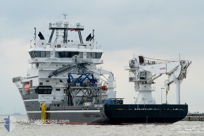
DEEP CYGNUS
Offshore Supply Ship
Current Trip
| Trip Time | 2 days |
|---|---|
| Trip Distance | 276.83 nm |
| AVG Speed | 11.1 Knots |
| MAX Speed | 14.9 Knots |
| Draught | 5.4 m |
| AVG Wind | 10.2 knots |
| MAX Wind | 23 knots |
| MIN Temp | 9.4°C / 48.92°F |
| MAX Temp | 12.8°C / 55.04°F |
| Position Received | 11 m ago |
Current Position
| Longitude | 5.58919° |
|---|---|
| Latitude | 58.92825° |
| Status | Moored |
| Speed | |
| Course | 89° |
| Area | North Sea |
| Station | T-AIS |
| Position Received | 11 m ago |
Info
Information
The current position of DEEP CYGNUS is in North Sea with coordinates 58.92825° / 5.58919° as reported on 2024-06-20 12:07 by AIS to our vessel tracker app. The vessel's current speed is 0 Knots and is currently inside the port of TANANGER.
The vessel DEEP CYGNUS (IMO: 9479541, MMSI: 257205000) is a Offshore Supply Ship that was built in 2009 ( 15 years old ). It's sailing under the flag of [NO] Norway.
In this page you can find informations about the vessels current position, last detected port calls, and current voyage information. If the vessels is not in coverage by AIS you will find the latest position.
The current position of DEEP CYGNUS is detected by our AIS receivers and we are not responsible for the reliability of the data. The last position was recorded while the vessel was in Coverage by the Ais receivers of our vessel tracking app.
The current draught of DEEP CYGNUS as reported by AIS is 5.4 meters
Weather
| Temperature | 12°C / 53.6°F |
|---|---|
| Wind Speed | 11 knots |
| Direction | 309° NW |
| Pressure | 1018.6 hPa |
| Humidity | 77.1 % |
| Cloud Coverage | 65 % |
Featured Company
Last Port Calls
| Port | Arrival | Departure | Time In Port |
|---|---|---|---|
| 2024-06-20 01:58 | |||
| 2024-06-17 08:20 | 2024-06-18 01:19 | 16 h | |
| 2024-06-08 15:20 |
Most Visited Ports (Last year)
| Port | Arrivals | |
|---|---|---|
| 15 | ||
| 5 | ||
| 2 | ||
| 2 | ||
| 2 | ||
| 1 |
Last Trips
| Origin | Departure | Destination | Arrival | Distance | |
|---|---|---|---|---|---|
| 2024-06-18 03:19 | 2024-06-20 03:58 | 276.83 nm | |||
| 2024-06-08 17:20 | 2024-06-17 10:20 | 171.99 nm |
Events
| Time | Event | Details | Position / Dest | Info |
|---|---|---|---|---|
| 2024-06-20 02:59 | Status Changed | Moored Under way using engine |
58.92825 / 5.58919
[NO] TANANGER
|
Speed: Course: 89° |
| 2024-06-20 02:12 | STOP Moving |
58.92792 / 5.58859
[NO] TANANGER
|
Speed: 0.3 kn Course: 69° |
|
| 2024-06-20 01:58 | PORT ARRIVAL |
|
58.93011 / 5.57237
[NO] TANANGER
|
Speed: 10.1 kn Course: 123.2° |
| 2024-06-19 22:19 | ETA Changed | 2024/06/19 03:00 2024/06/19 04:00 |
59.27351 / 4.67964
NOTAE
|
Speed: 12.1 kn Course: 178.2° |
| 2024-06-19 16:12 | Destination Changed | NOTAE TESTING |
60.43737 / 4.77724
NOTAE
|
Speed: 11.5 kn Course: 176° |
| 2024-06-19 16:12 | ETA Changed | 2024/06/19 04:00 2024/06/19 17:00 |
60.43737 / 4.77724
NOTAE
|
Speed: 11.5 kn Course: 176° |
| 2024-06-19 16:12 | Status Changed | Under way using engine Restricted manoeuverability |
60.43737 / 4.77724
TESTING
|
Speed: 11.7 kn Course: 176.7° |
| 2024-06-19 15:57 | START Moving | 5.49 nm, South West of KOLLSNES |
60.47971 / 4.77488
TESTING
|
Speed: 4.5 kn Course: 207° |
| 2024-06-19 11:49 | Status Changed | Restricted manoeuverability Under way using engine |
60.48035 / 4.77729
TESTING
|
Speed: 0.2 kn Course: 315° |
| 2024-06-19 11:49 | Destination Changed | TESTING TANANGER NOSLA |
60.48034 / 4.77730
TESTING
|
Speed: 0.2 kn Course: 315° |