
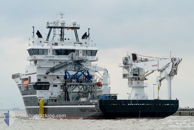
DEEP CYGNUS
Offshore Supply Ship
Current Trip
SEATRIALS
| Time Travelled | 3 days |
|---|---|
| Remaining Time | --- |
| Distance Travelled | 73.00 nm |
| Remaining Distance | --- |
| AVG Speed | 5.3 Knots |
| MAX Speed | 14.5 Knots |
| AVG Wind | 9.2 knots |
| MAX Wind | 18.8 knots |
| MIN Temp | 4.1°C / 39.38°F |
| MAX Temp | 11.1°C / 51.98°F |
| Draught | 5.4 m |
| Position Received | Now |
Current Position
| Longitude | 6.29952° |
|---|---|
| Latitude | 62.39358° |
| Status | Restricted manoeuverability |
| Speed | 0.1 Knots |
| Course | 250° |
| Area | Norwegian Sea |
| Station | T-AIS |
| Position Received | Now |
Info
Information
The current position of DEEP CYGNUS is in Norwegian Sea with coordinates 62.39358° / 6.29952° as reported on 2024-06-12 07:02 by AIS to our vessel tracker app. The vessel's current speed is 0.1 Knots
The vessel DEEP CYGNUS (IMO: 9479541, MMSI: 257205000) is a Offshore Supply Ship that was built in 2009 ( 15 years old ). It's sailing under the flag of [NO] Norway.
In this page you can find informations about the vessels current position, last detected port calls, and current voyage information. If the vessels is not in coverage by AIS you will find the latest position.
The current position of DEEP CYGNUS is detected by our AIS receivers and we are not responsible for the reliability of the data. The last position was recorded while the vessel was in Coverage by the Ais receivers of our vessel tracking app.
The current draught of DEEP CYGNUS as reported by AIS is 5.4 meters
Weather
| Temperature | 8.5°C / 47.3°F |
|---|---|
| Wind Speed | 8 knots |
| Direction | 24° NNE |
| Pressure | 1010.8 hPa |
| Humidity | 71.2 % |
| Cloud Coverage | 96 % |
Featured Company
Last Port Calls
| Port | Arrival | Departure | Time In Port |
|---|---|---|---|
| 2024-06-08 15:20 |
Most Visited Ports (Last year)
| Port | Arrivals | |
|---|---|---|
| 15 | ||
| 5 | ||
| 2 | ||
| 2 | ||
| 2 | ||
| 1 |
Last Trips
| Origin | Departure | Destination | Arrival | Distance |
|---|
Events
| Time | Event | Details | Position / Dest | Info |
|---|---|---|---|---|
| 2024-06-11 22:24 | STOP Moving | 2.04 nm, West of FESTOYA |
62.38575 / 6.26227
SEATRIALS
|
Speed: 0.3 kn Course: 261° |
| 2024-06-11 21:45 | START Moving | 1.48 nm, South East of SULESUND |
62.37554 / 6.20011
SEATRIALS
|
Speed: 4.6 kn Course: 62° |
| 2024-06-11 20:48 | STOP Moving | 1.47 nm, South East of SULESUND |
62.37791 / 6.20563
SEATRIALS
|
Speed: 0.2 kn Course: 87° |
| 2024-06-11 20:21 | START Moving | 1.41 nm, South East of SULESUND |
62.37703 / 6.20027
SEATRIALS
|
Speed: 3.4 kn Course: 322° |
| 2024-06-11 18:04 | STOP Moving | 1.92 nm, West of FESTOYA |
62.38279 / 6.26492
SEATRIALS
|
Speed: 0.3 kn Course: 87° |
| 2024-06-11 17:52 | START Moving | 2.29 nm, South East of SULESUND |
62.37895 / 6.24200
SEATRIALS
|
Speed: 3.2 kn Course: 77° |
| 2024-06-11 16:21 | STOP Moving | 1.75 nm, North West of FESTOYA |
62.38978 / 6.27674
SEATRIALS
|
Speed: 0.3 kn Course: 17° |
| 2024-06-11 15:49 | START Moving | 1.37 nm, South East of SULESUND |
62.37611 / 6.19504
SEATRIALS
|
Speed: 3.2 kn Course: 74° |
| 2024-06-11 11:56 | STOP Moving | 2.11 nm, West of FESTOYA |
62.38121 / 6.25726
SEATRIALS
|
Speed: 0.3 kn Course: 84° |
| 2024-06-11 11:39 | START Moving | 2.05 nm, East of SULESUND |
62.38201 / 6.23535
SEATRIALS
|
Speed: 4.3 kn Course: 68° |