
DEEP ENERGY
Pipe Layer
Current Position
| Longitude | -4.27610° |
|---|---|
| Latitude | 57.66479° |
| Status | At anchor |
| Speed | 0.1 Knots |
| Course | 92° |
| Area | North Sea |
| Station | T-AIS |
| Position Received | 1 h, 42 m ago |
Info
Information
The current position of DEEP ENERGY is in North Sea with coordinates 57.66479° / -4.27610° as reported on 2024-06-26 01:59 by AIS to our vessel tracker app. The vessel's current speed is 0.1 Knots and is currently inside the port of EVANTON.
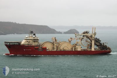
The vessel DEEP ENERGY (IMO: 9481154, MMSI: 311036900) is a Pipe Layer that was built in 2013 ( 11 years old ). It's sailing under the flag of [BS] Bahamas.
In this page you can find informations about the vessels current position, last detected port calls, and current voyage information. If the vessels is not in coverage by AIS you will find the latest position.
The current position of DEEP ENERGY is detected by our AIS receivers and we are not responsible for the reliability of the data. The last position was recorded while the vessel was in Coverage by the Ais receivers of our vessel tracking app.
The current draught of DEEP ENERGY as reported by AIS is 8.7 meters
Weather
| Temperature | 9.1°C / 48.38°F |
|---|---|
| Wind Speed | 1 knots |
| Direction | 81° E |
| Pressure | 1019 hPa |
| Humidity | 97 % |
| Cloud Coverage | 91 % |
Featured Company
Last Port Calls
| Port | Arrival | Departure | Time In Port |
|---|---|---|---|
| 2024-06-13 07:36 | |||
| 2024-06-07 03:27 | 2024-06-08 17:35 | 1 d | |
| 2024-05-29 00:29 | 2024-05-30 18:45 | 1 d | |
| 2024-05-17 21:34 | |||
| 2024-05-12 19:02 | 2024-05-13 13:56 | 18 h | |
| 2024-04-26 10:43 | 2024-05-02 13:46 | 6 d | |
| 2024-04-01 17:11 |
Most Visited Ports (Last year)
| Port | Arrivals | |
|---|---|---|
| 7 | ||
| 3 | ||
| 2 | ||
| 2 |
Last Trips
| Origin | Departure | Destination | Arrival | Distance | |
|---|---|---|---|---|---|
| 2024-05-30 19:45 | 2024-06-07 04:27 | 467.67 nm | |||
| 2024-05-17 22:34 | 2024-05-29 01:29 | 784.10 nm | |||
| 2024-05-02 15:46 | 2024-05-12 20:02 | 969.59 nm | |||
| 2024-04-01 19:11 | 2024-04-26 12:43 | 998.74 nm |
Events
| Time | Event | Details | Position / Dest | Info |
|---|---|---|---|---|
| 2024-06-26 01:59 | OUT of Coverage |
57.66479 / -4.27610
North Sea
[GB] EVANTON
|
Speed: 0.1 kn Course: 208° |
|
| 2024-06-26 01:29 | IN Coverage |
57.66478 / -4.27610
North Sea
[GB] EVANTON
|
Speed: Course: 162° |
|
| 2024-06-26 00:26 | OUT of Coverage |
57.66479 / -4.27610
North Sea
[GB] EVANTON
|
Speed: Course: 324° |
|
| 2024-06-26 00:23 | IN Coverage |
57.66479 / -4.27610
North Sea
[GB] EVANTON
|
Speed: Course: 295° |
|
| 2024-06-18 23:32 | OUT of Coverage |
57.67500 / -4.24664
North Sea
|
Speed: 0.1 kn Course: 304° |
|
| 2024-06-18 23:31 | IN Coverage |
57.67500 / -4.24664
North Sea
|
Speed: 0.1 kn Course: 304° |
|
| 2024-06-18 20:06 | OUT of Coverage |
57.68097 / -4.20947
North Sea
|
Speed: 5.3 kn Course: 267° |
|
| 2024-06-18 13:19 | Destination Changed | CROMARTY FIRTH AFFLECK FIELD |
57.54229 / -1.23986
CROMARTY FIRTH
|
Speed: 16.7 kn Course: 299° |
| 2024-06-18 13:19 | ETA Changed | 2024/06/18 00:30 2024/06/14 01:00 |
57.54229 / -1.23986
CROMARTY FIRTH
|
Speed: 16.7 kn Course: 299° |
| 2024-06-18 12:32 | IN Coverage |
57.43996 / -.88895
North Sea
|
Speed: 16.8 kn Course: 298° |