
DEEP ENERGY
Pipe Layer
Current Trip
JUDY PLATFORM
| Time Travelled | 6 days |
|---|---|
| Remaining Time | --- |
| Distance Travelled | 246.45 nm |
| Remaining Distance | --- |
| AVG Speed | 12.2 Knots |
| MAX Speed | 15.4 Knots |
| AVG Wind | 5.5 knots |
| MAX Wind | 15.3 knots |
| MIN Temp | 9.5°C / 49.1°F |
| MAX Temp | 12.3°C / 54.14°F |
| Draught | 9 m |
| Position Received | 2 d ago |
Current Position
| Longitude | 2.47099° |
|---|---|
| Latitude | 56.58384° |
| Status | Restricted manoeuverability |
| Speed | |
| Course | 328° |
| Area | North Sea |
| Station | T-AIS |
| Position Received | 2 d ago |
Info
Information
The current position of DEEP ENERGY is in North Sea with coordinates 56.58384° / 2.47099° as reported on 2024-05-20 23:28 by AIS to our vessel tracker app. The vessel's current speed is 0 Knots
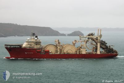
The vessel DEEP ENERGY (IMO: 9481154, MMSI: 311036900) is a Pipe Layer that was built in 2013 ( 11 years old ). It's sailing under the flag of [BS] Bahamas.
In this page you can find informations about the vessels current position, last detected port calls, and current voyage information. If the vessels is not in coverage by AIS you will find the latest position.
The current position of DEEP ENERGY is detected by our AIS receivers and we are not responsible for the reliability of the data. The last position was recorded while the vessel was in Coverage by the Ais receivers of our vessel tracking app.
The current draught of DEEP ENERGY as reported by AIS is 9 meters
Weather
| Temperature | 12.4°C / 54.32°F |
|---|---|
| Wind Speed | 10 knots |
| Direction | 48° NE |
| Pressure | 1015.1 hPa |
| Humidity | 86.8 % |
| Cloud Coverage | --- |
Featured Company
Last Port Calls
| Port | Arrival | Departure | Time In Port |
|---|---|---|---|
| 2024-05-17 21:34 | |||
| 2024-05-12 19:02 | 2024-05-13 13:56 | 18 h | |
| 2024-04-26 10:43 | 2024-05-02 13:46 | 6 d | |
| 2024-03-22 14:10 | 2024-04-01 17:11 | 10 d | |
| 2024-03-06 16:23 | 2024-03-09 01:32 | 2 d |
Most Visited Ports (Last year)
| Port | Arrivals | |
|---|---|---|
| 8 | ||
| 2 | ||
| 1 | ||
| 1 | ||
| 1 |
Last Trips
| Origin | Departure | Destination | Arrival | Distance | |
|---|---|---|---|---|---|
| 2024-05-02 15:46 | 2024-05-12 20:02 | 969.59 nm | |||
| 2024-04-01 19:11 | 2024-04-26 12:43 | 998.74 nm | |||
| 2024-03-08 19:32 | 2024-03-22 15:10 | 4953.39 nm | |||
| 2024-02-28 17:34 | 2024-03-06 10:23 | 16.89 nm |
Events
| Time | Event | Details | Position / Dest | Info |
|---|---|---|---|---|
| 2024-05-20 23:28 | OUT of Coverage |
56.58384 / 2.47099
North Sea
|
Speed: Course: 244° |
|
| 2024-05-20 13:52 | IN Coverage |
56.57879 / 2.47849
North Sea
|
Speed: 0.1 kn Course: 238° |
|
| 2024-05-20 12:16 | OUT of Coverage |
56.57879 / 2.47850
North Sea
|
Speed: 0.1 kn Course: 91° |
|
| 2024-05-20 10:48 | STOP Moving |
56.57880 / 2.47846
JUDY PLATFORM
|
Speed: Course: 359° |
|
| 2024-05-20 09:39 | IN Coverage |
56.60018 / 2.44265
North Sea
|
Speed: 5.6 kn Course: 151° |
|
| 2024-05-20 06:59 | OUT of Coverage |
56.62702 / 2.42015
North Sea
|
Speed: 0.5 kn Course: 320° |
|
| 2024-05-20 06:51 | IN Coverage |
56.62613 / 2.42133
North Sea
|
Speed: 0.5 kn Course: 322° |
|
| 2024-05-20 01:47 | OUT of Coverage |
56.59155 / 2.46271
North Sea
|
Speed: 0.5 kn Course: 329° |
|
| 2024-05-20 01:15 | IN Coverage |
56.58782 / 2.46694
North Sea
|
Speed: 0.5 kn Course: 334° |
|
| 2024-05-20 00:12 | OUT of Coverage |
56.58104 / 2.47479
North Sea
|
Speed: 0.5 kn Course: 323° |