
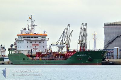
DEFNE BAYRAK
Tanker
Current Trip
| Time Travelled | 12 days |
|---|---|
| Remaining Time | 10 h, 50 mins |
| Distance Travelled | 619.54 nm |
| Remaining Distance | 136.45 nm |
| AVG Speed | 11.7 Knots |
| MAX Speed | 15.3 Knots |
| AVG Wind | 11 knots |
| MAX Wind | 26.8 knots |
| MIN Temp | 6.9°C / 44.42°F |
| MAX Temp | 14.2°C / 57.56°F |
| Draught | 5.3 m |
| Position Received | 1 m ago |
Current Position
| Longitude | 1.81858° |
|---|---|
| Latitude | 51.14720° |
| Status | Under way using engine |
| Speed | 11.5 Knots |
| Course | 58° |
| Area | North Sea |
| Station | T-AIS |
| Position Received | 1 m ago |
Info
Information
The current position of DEFNE BAYRAK is in North Sea with coordinates 51.14720° / 1.81858° as reported on 2024-05-04 01:49 by AIS to our vessel tracker app. The vessel's current speed is 11.5 Knots and is heading at the port of MOERDIJK. The estimated time of arrival as calculated by vessel tracking app is 2024-05-04 12:41 LT
The vessel DEFNE BAYRAK (IMO: 9835032, MMSI: 215086000) is a Tanker It's sailing under the flag of [MT] Malta.
In this page you can find informations about the vessels current position, last detected port calls, and current voyage information. If the vessels is not in coverage by AIS you will find the latest position.
The current position of DEFNE BAYRAK is detected by our AIS receivers and we are not responsible for the reliability of the data. The last position was recorded while the vessel was in Coverage by the Ais receivers of our vessel tracking app.
The current draught of DEFNE BAYRAK as reported by AIS is 5.3 meters
Weather
| Temperature | 11.3°C / 52.34°F |
|---|---|
| Wind Speed | 8 knots |
| Direction | 210° SSW |
| Pressure | 1012.8 hPa |
| Humidity | 85.8 % |
| Cloud Coverage | 13 % |
Featured Company
Last Port Calls
| Port | Arrival | Departure | Time In Port |
|---|---|---|---|
| 2024-04-21 10:03 | 2024-04-22 01:14 | 15 h | |
| 2024-04-17 15:05 | 2024-04-18 16:09 | 1 d | |
| 2024-04-12 14:05 | 2024-04-16 17:47 | 4 d | |
| 2024-04-04 08:26 | 2024-04-05 08:13 | 23 h | |
| 2024-03-29 20:44 | 2024-03-30 22:55 | 1 d | |
| 2024-03-28 03:48 | 2024-03-29 20:08 | 1 d | |
| 2024-03-26 09:41 | 2024-03-27 14:01 | 1 d | |
| 2024-03-23 08:02 | 2024-03-24 05:51 | 21 h | |
| 2024-03-21 06:27 | 2024-03-22 23:16 | 1 d | |
| 2024-03-16 18:08 | 2024-03-17 07:04 | 12 h |
Last Trips
| Origin | Departure | Destination | Arrival | Distance | |
|---|---|---|---|---|---|
| 2024-04-18 18:09 | 2024-04-21 11:03 | 648.96 nm | |||
| 2024-04-16 19:47 | 2024-04-17 17:05 | 97.72 nm | |||
| 2024-04-05 09:13 | 2024-04-12 16:05 | 1425.17 nm | |||
| 2024-03-30 23:55 | 2024-04-04 09:26 | 1175.95 nm | |||
| 2024-03-29 21:08 | 2024-03-29 21:44 | 3.58 nm | |||
| 2024-03-27 15:01 | 2024-03-28 04:48 | 8.96 nm | |||
| 2024-03-24 06:51 | 2024-03-26 10:41 | 322.33 nm | |||
| 2024-03-23 00:16 | 2024-03-23 09:02 | 90.32 nm | |||
| 2024-03-17 08:04 | 2024-03-21 07:27 | 1004.74 nm | |||
| 2024-03-15 17:59 | 2024-03-16 19:08 | 139.35 nm |
Events
| Time | Event | Details | Position / Dest | Info |
|---|---|---|---|---|
| 2024-05-04 01:41 | Change Sea Area | French part of the North Sea United Kingdom part of the North Sea |
51.13232 / 1.78453
North Sea
FRLEH>NLMOE
|
Speed: 11.7 kn Course: 54° |
| 2024-05-04 01:23 | Change Sea Area | United Kingdom part of the North Sea French part of the North Sea |
51.09626 / 1.70889
North Sea
FRLEH>NLMOE
|
Speed: 11.8 kn Course: 51.6° |
| 2024-05-04 00:58 | Change Sea Area | French part of the North Sea French part of the English Channel |
51.03268 / 1.62297
North Sea
FRLEH>NLMOE
|
Speed: 12.6 kn Course: 40.4° |
| 2024-05-04 00:58 | Status Changed | Under way using engine Default |
51.03268 / 1.62297
FRLEH>NLMOE
|
Speed: 12.6 kn Course: 41° |
| 2024-05-04 00:56 | Status Changed | Default Under way using engine |
51.02873 / 1.61761
FRLEH>NLMOE
|
Speed: 12.6 kn Course: 41.1° |
| 2024-05-03 23:15 | ETA Changed | 2024/05/04 12:00 2024/05/04 13:00 |
50.71063 / 1.38090
FRLEH>NLMOE
|
Speed: 12.5 kn Course: 28° |
| 2024-05-03 22:55 | Status Changed | Under way using engine Default |
50.65987 / 1.31016
FRLEH>NLMOE
|
Speed: 12.6 kn Course: 50° |
| 2024-05-03 22:52 | Status Changed | Default Under way using engine |
50.65472 / 1.30036
FRLEH>NLMOE
|
Speed: 12.6 kn Course: 49.8° |
| 2024-05-03 22:52 | Status Changed | Under way using engine Default |
50.65428 / 1.29951
FRLEH>NLMOE
|
Speed: 12.4 kn Course: 50° |
| 2024-05-03 22:48 | Status Changed | Default Under way using engine |
50.64576 / 1.28357
FRLEH>NLMOE
|
Speed: 12.4 kn Course: 49.6° |