
DEJA VU
Sailing
Current Trip
Unknown
| Time Travelled | 5 days |
|---|---|
| Remaining Time | --- |
| Distance Travelled | 213.61 nm |
| Remaining Distance | --- |
| AVG Speed | 3.8 Knots |
| MAX Speed | 6.1 Knots |
| AVG Wind | 9.3 knots |
| MAX Wind | 23.9 knots |
| MIN Temp | 24°C / 75.2°F |
| MAX Temp | 29.4°C / 84.92°F |
| Draught | --- |
| Position Received | 2 d ago |
Current Position
| Longitude | 28.80769° |
|---|---|
| Latitude | 35.38109° |
| Status | Default |
| Speed | 5.5 Knots |
| Course | 105.8° |
| Area | Mediterranean Sea - Eastern Basin |
| Station | T-AIS |
| Position Received | 2 d ago |
Info
Information
The current position of DEJA VU is in Mediterranean Sea - Eastern Basin with coordinates 35.38109° / 28.80769° as reported on 2024-06-27 05:50 by AIS to our vessel tracker app. The vessel's current speed is 5.5 Knots
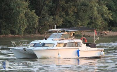
The vessel DEJA VU (MMSI: 232024708) is a Sailing It's sailing under the flag of [GB] United Kingdom.
In this page you can find informations about the vessels current position, last detected port calls, and current voyage information. If the vessels is not in coverage by AIS you will find the latest position.
The current position of DEJA VU is detected by our AIS receivers and we are not responsible for the reliability of the data. The last position was recorded while the vessel was in Coverage by the Ais receivers of our vessel tracking app.
Weather
| Temperature | 26°C / 78.8°F |
|---|---|
| Wind Speed | 9 knots |
| Direction | 296° WNW |
| Pressure | 1005.2 hPa |
| Humidity | 79 % |
| Cloud Coverage | --- |
Featured Company
Most Visited Ports (Last year)
| Port | Arrivals | |
|---|---|---|
| 1 | ||
| 1 | ||
| 1 | ||
| 1 |
Events
| Time | Event | Details | Position / Dest | Info |
|---|---|---|---|---|
| 2024-06-27 05:50 | OUT of Coverage |
35.38109 / 28.80769
Mediterranean Sea - Eastern Basin
|
Speed: 5.5 kn Course: 105.8° |
|
| 2024-06-27 05:50 | IN Coverage |
35.38109 / 28.80769
Mediterranean Sea - Eastern Basin
|
Speed: 5.5 kn Course: 105.8° |
|
| 2024-06-26 23:49 | OUT of Coverage |
35.47486 / 28.53255
Mediterranean Sea - Eastern Basin
|
Speed: 2.8 kn Course: 102.7° |
|
| 2024-06-26 12:00 | IN Coverage |
35.92716 / 27.85697
Mediterranean Sea - Eastern Basin
|
Speed: 3.1 kn Course: 206.2° |
|
| 2024-06-26 06:02 | OUT of Coverage |
35.89501 / 27.81268
Mediterranean Sea - Eastern Basin
|
Speed: 3.3 kn Course: 61.4° |
|
| 2024-06-26 05:07 | Change Sea Area | Greek part of the Mediterranean Sea - Eastern Basin Greek part of the Aegean Sea |
35.86703 / 27.74345
Mediterranean Sea - Eastern Basin
|
Speed: 3.9 kn Course: 75.6° |
| 2024-06-26 02:51 | IN Coverage |
35.89179 / 27.54821
Aegean Sea
|
Speed: 4.5 kn Course: 118.8° |
|
| 2024-06-26 00:57 | OUT of Coverage |
35.93208 / 27.37734
Aegean Sea
|
Speed: 5.9 kn Course: 98.2° |
|
| 2024-06-26 00:57 | IN Coverage |
35.93208 / 27.37734
Aegean Sea
|
Speed: 5.9 kn Course: 98.2° |
|
| 2024-06-24 20:12 | OUT of Coverage |
36.61490 / 25.65245
Aegean Sea
|
Speed: 3.1 kn Course: 148° |