
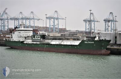
DELTAGAS
Tanker
Current Trip
| Time Travelled | 44 days |
|---|---|
| Remaining Time | 1 day |
| Distance Travelled | 12952.22 nm |
| Remaining Distance | 588.18 nm |
| AVG Speed | 12.3 Knots |
| MAX Speed | 16.3 Knots |
| AVG Wind | 13.6 knots |
| MAX Wind | 30.8 knots |
| MIN Temp | 13.3°C / 55.94°F |
| MAX Temp | 29.9°C / 85.82°F |
| Draught | 7.2 m |
| Position Received | 22 h, 16 m ago |
Current Position
| Longitude | -9.65287° |
|---|---|
| Latitude | 43.65772° |
| Status | Under way using engine |
| Speed | 11.7 Knots |
| Course | 30.1° |
| Area | North Atlantic Ocean |
| Station | T-AIS |
| Position Received | 22 h, 16 m ago |
Info
Information
The current position of DELTAGAS is in North Atlantic Ocean with coordinates 43.65772° / -9.65287° as reported on 2024-05-24 07:35 by AIS to our vessel tracker app. The vessel's current speed is 11.7 Knots and is heading at the port of ANTWERP. The estimated time of arrival as calculated by vessel tracking app is 2024-05-26 20:57 LT
The vessel DELTAGAS (IMO: 9540003, MMSI: 229399000) is a Tanker It's sailing under the flag of [MT] Malta.
In this page you can find informations about the vessels current position, last detected port calls, and current voyage information. If the vessels is not in coverage by AIS you will find the latest position.
The current position of DELTAGAS is detected by our AIS receivers and we are not responsible for the reliability of the data. The last position was recorded while the vessel was in Coverage by the Ais receivers of our vessel tracking app.
The current draught of DELTAGAS as reported by AIS is 7.2 meters
Weather
| Temperature | 14.2°C / 57.56°F |
|---|---|
| Wind Speed | 16 knots |
| Direction | 138° SE |
| Pressure | 1014.6 hPa |
| Humidity | 80.3 % |
| Cloud Coverage | 100 % |
Featured Company
Most Visited Ports (Last year)
| Port | Arrivals | |
|---|---|---|
| 2 | ||
| 2 | ||
| 1 | ||
| 1 | ||
| 1 | ||
| 1 |
Events
| Time | Event | Details | Position / Dest | Info |
|---|---|---|---|---|
| 2024-05-24 07:48 | Status Changed | Default Under way using engine |
43.69373 / -9.62536
SG SIN>BE ANR
|
Speed: 11.7 kn Course: 30.1° |
| 2024-05-24 07:35 | OUT of Coverage |
43.65772 / -9.65287
North Atlantic Ocean
SG SIN>BE ANR
|
Speed: 11.7 kn Course: 30.1° |
|
| 2024-05-24 06:57 | Status Changed | Under way using engine Default |
43.55377 / -9.73382
SG SIN>BE ANR
|
Speed: 11.6 kn Course: 29° |
| 2024-05-24 06:46 | Status Changed | Default Under way using engine |
43.52082 / -9.75805
SG SIN>BE ANR
|
Speed: 11.2 kn Course: 28° |
| 2024-05-24 06:43 | Status Changed | Under way using engine Default |
43.51337 / -9.76342
SG SIN>BE ANR
|
Speed: 11.8 kn Course: 25° |
| 2024-05-24 06:24 | Status Changed | Default Under way using engine |
43.45932 / -9.80162
SG SIN>BE ANR
|
Speed: 11.7 kn Course: 24.7° |
| 2024-05-24 05:20 | Status Changed | Under way using engine Default |
43.27410 / -9.93441
SG SIN>BE ANR
|
Speed: 11.8 kn Course: 28° |
| 2024-05-24 05:14 | Status Changed | Default Under way using engine |
43.25701 / -9.94725
SG SIN>BE ANR
|
Speed: 11.7 kn Course: 0.6° |
| 2024-05-24 04:49 | Change Sea Area | Spanish part of the North Atlantic Ocean Portuguese part of the North Atlantic Ocean |
43.17831 / -9.95707
North Atlantic Ocean
SG SIN>BE ANR
|
Speed: 11.7 kn Course: 0° |
| 2024-05-24 04:48 | Status Changed | Under way using engine Default |
43.17502 / -9.95699
SG SIN>BE ANR
|
Speed: 11.8 kn Course: 358° |