
DENIZ AKAY
General Cargo
Current Trip
| Time Travelled | 1 day |
|---|---|
| Remaining Time | 18 h, 5 mins |
| Distance Travelled | 296.78 nm |
| Remaining Distance | 191.20 nm |
| AVG Speed | 11.3 Knots |
| MAX Speed | 12.2 Knots |
| AVG Wind | 5.5 knots |
| MAX Wind | 19.5 knots |
| MIN Temp | 24.1°C / 75.38°F |
| MAX Temp | 31.6°C / 88.88°F |
| Draught | 5.4 m |
| Position Received | 1 m ago |
Current Position
| Longitude | 23.93285° |
|---|---|
| Latitude | 36.45280° |
| Status | Under way using engine |
| Speed | 10.6 Knots |
| Course | 83.6° |
| Area | Aegean Sea |
| Station | T-AIS |
| Position Received | 1 m ago |
Info
Information
The current position of DENIZ AKAY is in Aegean Sea with coordinates 36.45280° / 23.93285° as reported on 2024-06-26 13:45 by AIS to our vessel tracker app. The vessel's current speed is 10.6 Knots and is heading at the port of GULLUK. The estimated time of arrival as calculated by vessel tracking app is 2024-06-27 07:52 LT
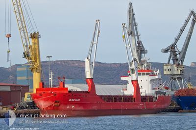
The vessel DENIZ AKAY (IMO: 9349447, MMSI: 370097000) is a General Cargo that was built in 2010 ( 14 years old ). It's sailing under the flag of [PA] Panama.
In this page you can find informations about the vessels current position, last detected port calls, and current voyage information. If the vessels is not in coverage by AIS you will find the latest position.
The current position of DENIZ AKAY is detected by our AIS receivers and we are not responsible for the reliability of the data. The last position was recorded while the vessel was in Coverage by the Ais receivers of our vessel tracking app.
The current draught of DENIZ AKAY as reported by AIS is 5.4 meters
Weather
| Temperature | 24.7°C / 76.46°F |
|---|---|
| Wind Speed | 16 knots |
| Direction | 17° NNE |
| Pressure | 1011.4 hPa |
| Humidity | 76.8 % |
| Cloud Coverage | --- |
Featured Company
Last Port Calls
| Port | Arrival | Departure | Time In Port |
|---|---|---|---|
| 2024-06-24 14:46 | 2024-06-25 11:08 | 20 h | |
| 2024-06-18 05:13 | 2024-06-20 09:28 | 2 d | |
| 2024-06-15 12:48 | 2024-06-15 17:33 | 4 h | |
| 2024-06-09 12:51 | 2024-06-13 16:07 | 4 d | |
| 2024-05-27 14:29 | 2024-05-31 14:36 | 4 d | |
| 2024-05-21 05:59 | 2024-05-24 04:41 | 2 d | |
| 2024-05-07 07:34 | 2024-05-14 14:27 | 7 d | |
| 2024-05-05 00:47 | 2024-05-05 09:00 | 8 h | |
| 2024-04-29 06:49 | 2024-04-30 05:43 | 22 h | |
| 2024-04-25 06:36 | 2024-04-27 06:12 | 1 d |
Last Trips
| Origin | Departure | Destination | Arrival | Distance | |
|---|---|---|---|---|---|
| 2024-06-20 11:28 | 2024-06-24 17:46 | 977.76 nm | |||
| 2024-06-15 19:33 | 2024-06-18 07:13 | 704.94 nm | |||
| 2024-06-13 18:07 | 2024-06-15 14:48 | 198.69 nm | |||
| 2024-05-31 17:36 | 2024-06-09 14:51 | 1463.45 nm | |||
| 2024-05-24 05:41 | 2024-05-27 17:29 | 838.21 nm | |||
| 2024-05-14 15:27 | 2024-05-21 06:59 | 1420.78 nm | |||
| 2024-05-05 11:00 | 2024-05-07 08:34 | 449.94 nm | |||
| 2024-04-30 06:43 | 2024-05-05 02:47 | 1098.54 nm | |||
| 2024-04-27 07:12 | 2024-04-29 07:49 | 91.85 nm | |||
| 2024-04-22 00:43 | 2024-04-25 07:36 | 851.53 nm |
Events
| Time | Event | Details | Position / Dest | Info |
|---|---|---|---|---|
| 2024-06-26 12:14 | Status Changed | Under way using engine Default |
36.42724 / 23.60639
TR GUL
|
Speed: 10.5 kn Course: 83° |
| 2024-06-26 11:43 | Status Changed | Default Under way using engine |
36.41437 / 23.49303
TR GUL
|
Speed: 10.6 kn Course: 84° |
| 2024-06-26 10:22 | Change Sea Area | Greek part of the Aegean Sea Greek part of the Mediterranean Sea - Eastern Basin |
36.40190 / 23.19837
Aegean Sea
TR GUL
|
Speed: 10.1 kn Course: 94.7° |
| 2024-06-26 10:21 | Status Changed | Under way using engine Default |
36.40211 / 23.19499
TR GUL
|
Speed: 10.3 kn Course: 94° |
| 2024-06-26 09:33 | Status Changed | Default Under way using engine |
36.40522 / 23.02447
TR GUL
|
Speed: 10.7 kn Course: 94.2° |
| 2024-06-26 06:55 | Change Sea Area | Greek part of the Mediterranean Sea - Eastern Basin Greek part of the Ionian Sea |
36.37746 / 22.43432
Mediterranean Sea - Eastern Basin
TR GUL
|
Speed: 11.3 kn Course: 118.6° |
| 2024-06-26 06:55 | Status Changed | Under way using engine Default |
36.37746 / 22.43432
TR GUL
|
Speed: 11.7 kn Course: 122° |
| 2024-06-26 06:55 | IN Coverage |
36.37746 / 22.43432
Mediterranean Sea - Eastern Basin
TR GUL
|
Speed: 11.3 kn Course: 118.6° |
|
| 2024-06-26 04:56 | Status Changed | Default Under way using engine |
36.56156 / 22.00991
TR GUL
|
Speed: 11.7 kn Course: 117.8° |
| 2024-06-26 04:45 | OUT of Coverage |
36.57821 / 21.96981
Ionian Sea
TR GUL
|
Speed: 11.7 kn Course: 117.8° |