
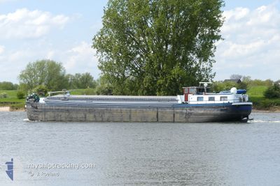
DESTINY
Cargo
Current Trip
NIJKERK
| Time Travelled | 3 days |
|---|---|
| Remaining Time | --- |
| Distance Travelled | 21.91 nm |
| Remaining Distance | --- |
| AVG Speed | 5.1 Knots |
| MAX Speed | 5.6 Knots |
| AVG Wind | 13.8 knots |
| MAX Wind | 15 knots |
| MIN Temp | 15.2°C / 59.36°F |
| MAX Temp | 16.5°C / 61.7°F |
| Draught | 2.6 m |
| Position Received | 2 d ago |
Current Position
| Longitude | 2.32078° |
|---|---|
| Latitude | 48.86275° |
| Status | Under way using engine |
| Speed | 4.4 Knots |
| Course | 109.8° |
| Area | North Sea |
| Station | T-AIS |
| Position Received | 2 d ago |
Info
Information
The current position of DESTINY is in North Sea with coordinates 48.86275° / 2.32078° as reported on 2024-06-15 16:29 by AIS to our vessel tracker app. The vessel's current speed is 4.4 Knots
The vessel DESTINY (MMSI: 244700900) is a Cargo It's sailing under the flag of [NL] Netherlands.
In this page you can find informations about the vessels current position, last detected port calls, and current voyage information. If the vessels is not in coverage by AIS you will find the latest position.
The current position of DESTINY is detected by our AIS receivers and we are not responsible for the reliability of the data. The last position was recorded while the vessel was in Coverage by the Ais receivers of our vessel tracking app.
The current draught of DESTINY as reported by AIS is 2.6 meters
Weather
| Temperature | 16.6°C / 61.88°F |
|---|---|
| Wind Speed | 13 knots |
| Direction | 224° SW |
| Pressure | 1007.7 hPa |
| Humidity | 65.4 % |
| Cloud Coverage | 100 % |
Featured Company
Last Port Calls
| Port | Arrival | Departure | Time In Port |
|---|---|---|---|
| 2024-06-15 11:12 | 2024-06-15 11:23 | 10 m | |
| 2024-06-10 17:22 | 2024-06-11 04:24 | 11 h | |
| 2024-06-10 11:54 | 2024-06-10 15:00 | 3 h | |
| 2024-06-09 07:00 | 2024-06-09 07:35 | 34 m | |
| 2024-06-07 14:32 | 2024-06-08 10:25 | 19 h | |
| 2024-06-07 09:55 | 2024-06-07 11:22 | 1 h | |
| 2024-06-07 08:38 | 2024-06-07 09:21 | 43 m | |
| 2024-06-06 08:57 | 2024-06-07 08:26 | 23 h | |
| 2024-05-31 09:03 | 2024-06-06 06:25 | 5 d | |
| 2024-05-30 17:47 | 2024-05-31 04:38 | 10 h |
Most Visited Ports (Last year)
| Port | Arrivals | |
|---|---|---|
| 18 | ||
| 14 | ||
| 12 | ||
| 9 | ||
| 7 | ||
| 6 |
Last Trips
| Origin | Departure | Destination | Arrival | Distance | |
|---|---|---|---|---|---|
| 2024-06-11 06:24 | 2024-06-15 13:12 | 171.10 nm | |||
| 2024-06-10 17:00 | 2024-06-10 19:22 | 13.55 nm | |||
| 2024-06-09 09:35 | 2024-06-10 13:54 | 98.17 nm | |||
| 2024-06-08 12:25 | 2024-06-09 09:00 | 27.02 nm | |||
| 2024-06-07 13:22 | 2024-06-07 16:32 | 19.00 nm | |||
| 2024-06-07 11:21 | 2024-06-07 11:55 | 3.26 nm | |||
| 2024-06-07 10:26 | 2024-06-07 10:38 | 0.58 nm | |||
| 2024-06-06 08:25 | 2024-06-06 10:57 | 10.58 nm | |||
| 2024-05-31 06:38 | 2024-05-31 11:03 | 26.43 nm | |||
| 2024-05-30 16:12 | 2024-05-30 19:47 | 21.93 nm |
Events
| Time | Event | Details | Position / Dest | Info |
|---|---|---|---|---|
| 2024-06-15 16:29 | OUT of Coverage |
48.86275 / 2.32078
North Sea
|
Speed: 4.4 kn Course: 109.8° |
|
| 2024-06-15 11:23 | PORT DEPARTURE |
|
48.86810 / 2.13681
NIJKERK
|
Speed: 5.4 kn Course: 105.4° |
| 2024-06-15 11:20 | START Moving |
48.86975 / 2.13082
[FR] PORT MARLY
|
Speed: 4.4 kn Course: 131.6° |
|
| 2024-06-15 11:12 | STOP Moving |
48.87121 / 2.12849
[FR] PORT MARLY
|
Speed: 0.1 kn Course: 511° |
|
| 2024-06-15 11:12 | PORT ARRIVAL |
|
48.87121 / 2.12849
[FR] PORT MARLY
|
Speed: 4.3 kn Course: 139.9° |
| 2024-06-15 09:28 | IN Coverage |
48.98425 / 2.16405
North Sea
|
Speed: 5.1 kn Course: 119.8° |
|
| 2024-06-15 06:58 | OUT of Coverage |
49.06668 / 2.14981
North Sea
|
Speed: 6.3 kn Course: 285.5° |
|
| 2024-06-15 06:58 | IN Coverage |
49.06668 / 2.14981
North Sea
|
Speed: 6.3 kn Course: 285.5° |
|
| 2024-06-11 14:12 | OUT of Coverage |
50.79667 / 3.51743
North Sea
|
Speed: 4.1 kn Course: 215.2° |
|
| 2024-06-11 13:05 | START Moving | 8.45 nm, North East of AVELGEM |
50.85006 / 3.61835
NIJKERK
|
Speed: 3.1 kn Course: 218.1° |