
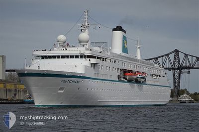
DEUTSCHLAND
Passengers Ship
Current Trip
| Time Travelled | 10 h, 11 mins |
|---|---|
| Remaining Time | --- |
| Distance Travelled | 151.07 nm |
| Remaining Distance | --- |
| AVG Speed | 12.5 Knots |
| MAX Speed | 16 Knots |
| AVG Wind | 4.1 knots |
| MAX Wind | 7.1 knots |
| MIN Temp | 10.6°C / 51.08°F |
| MAX Temp | 12.1°C / 53.78°F |
| Draught | 6 m |
| Position Received | 8 h, 39 m ago |
Current Position
| Longitude | -2.90217° |
|---|---|
| Latitude | 59.18979° |
| Status | Under way using engine |
| Speed | 12.5 Knots |
| Course | 295.5° |
| Area | North Atlantic Ocean |
| Station | T-AIS |
| Position Received | 8 h, 39 m ago |
Info
Information
The current position of DEUTSCHLAND is in North Atlantic Ocean with coordinates 59.18979° / -2.90217° as reported on 2024-05-19 17:38 by AIS to our vessel tracker app. The vessel's current speed is 12.5 Knots and is heading at the port of VESTMANNAEYJAR. The estimated time of arrival as calculated by vessel tracking app is 2024-05-21 08:30 LT
The vessel DEUTSCHLAND (IMO: 9141807, MMSI: 311000410) is a Passengers Ship that was built in 1998 ( 26 years old ). It's sailing under the flag of [BS] Bahamas.
In this page you can find informations about the vessels current position, last detected port calls, and current voyage information. If the vessels is not in coverage by AIS you will find the latest position.
The current position of DEUTSCHLAND is detected by our AIS receivers and we are not responsible for the reliability of the data. The last position was recorded while the vessel was in Coverage by the Ais receivers of our vessel tracking app.
The current draught of DEUTSCHLAND as reported by AIS is 6 meters
Weather
| Temperature | 10.9°C / 51.62°F |
|---|---|
| Wind Speed | 7 knots |
| Direction | 168° SSE |
| Pressure | 1017.5 hPa |
| Humidity | 82.7 % |
| Cloud Coverage | 66 % |
Featured Company
Last Port Calls
| Port | Arrival | Departure | Time In Port |
|---|---|---|---|
| 2024-05-19 06:46 | 2024-05-19 16:06 | 9 h | |
| 2024-05-17 05:24 | 2024-05-17 17:26 | 12 h | |
| 2024-05-15 06:50 | 2024-05-15 19:10 | 12 h | |
| 2024-05-14 06:34 | 2024-05-14 12:34 | 5 h | |
| 2024-05-12 06:02 | 2024-05-12 12:14 | 6 h | |
| 2024-05-11 06:00 | 2024-05-11 19:29 | 13 h | |
| 2024-05-10 06:27 | 2024-05-10 21:10 | 14 h | |
| 2024-05-08 06:34 | 2024-05-08 17:13 | 10 h | |
| 2024-05-07 06:26 | 2024-05-07 18:12 | 11 h | |
| 2024-04-20 04:25 | 2024-05-05 17:12 | 15 d |
Most Visited Ports (Last year)
| Port | Arrivals | |
|---|---|---|
| 11 | ||
| 3 | ||
| 3 | ||
| 3 | ||
| 3 | ||
| 2 |
Last Trips
| Origin | Departure | Destination | Arrival | Distance | |
|---|---|---|---|---|---|
| 2024-05-17 19:26 | 2024-05-19 07:46 | 515.52 nm | |||
| 2024-05-15 20:10 | 2024-05-17 07:24 | 452.92 nm | |||
| 2024-05-14 13:34 | 2024-05-15 07:50 | 234.95 nm | |||
| 2024-05-12 13:14 | 2024-05-14 07:34 | 431.97 nm | |||
| 2024-05-11 20:29 | 2024-05-12 07:02 | 110.12 nm | |||
| 2024-05-10 22:10 | 2024-05-11 07:00 | 121.85 nm | |||
| 2024-05-08 18:13 | 2024-05-10 07:27 | 344.44 nm | |||
| 2024-05-07 19:12 | 2024-05-08 07:34 | 179.42 nm | |||
| 2024-05-05 19:12 | 2024-05-07 07:26 | 455.51 nm | |||
| 2024-04-13 20:21 | 2024-04-20 06:25 | 1222.70 nm |
Events
| Time | Event | Details | Position / Dest | Info |
|---|---|---|---|---|
| 2024-05-19 17:42 | Status Changed | Default Under way using engine |
59.19762 / -2.93114
IS VES
|
Speed: 12.5 kn Course: 295.5° |
| 2024-05-19 17:38 | OUT of Coverage |
59.18979 / -2.90217
North Atlantic Ocean
IS VES
|
Speed: 12.5 kn Course: 295.5° |
|
| 2024-05-19 17:32 | Change Sea Area | United Kingdom part of the North Atlantic Ocean United Kingdom part of the North Sea |
59.17554 / -2.87619
North Atlantic Ocean
IS VES
|
Speed: 11.7 kn Course: 331.6° |
| 2024-05-19 16:25 | Destination Changed | IS VES GB KWL |
59.01044 / -2.86060
IS VES
|
Speed: 14.2 kn Course: 100.5° |
| 2024-05-19 16:25 | ETA Changed | 2024/05/21 08:30 2024/05/19 06:00 |
59.01044 / -2.86060
IS VES
|
Speed: 14.2 kn Course: 100.5° |
| 2024-05-19 16:21 | Status Changed | Under way using engine Default |
59.01342 / -2.89067
GB KWL
|
Speed: 8.9 kn Course: 106° |
| 2024-05-19 16:15 | Status Changed | Default Under way using engine |
59.01954 / -2.92115
GB KWL
|
Speed: 9 kn Course: 65.3° |
| 2024-05-19 16:09 | Status Changed | Under way using engine Default |
59.02118 / -2.94934
GB KWL
|
Speed: 9 kn Course: 23° |
| 2024-05-19 16:07 | Status Changed | Default Under way using engine |
59.01689 / -2.95564
GB KWL
|
Speed: 3.3 kn Course: 50° |
| 2024-05-19 16:06 | PORT DEPARTURE |
|
59.01689 / -2.95564
GB KWL
|
Speed: 3.3 kn Course: 50° |